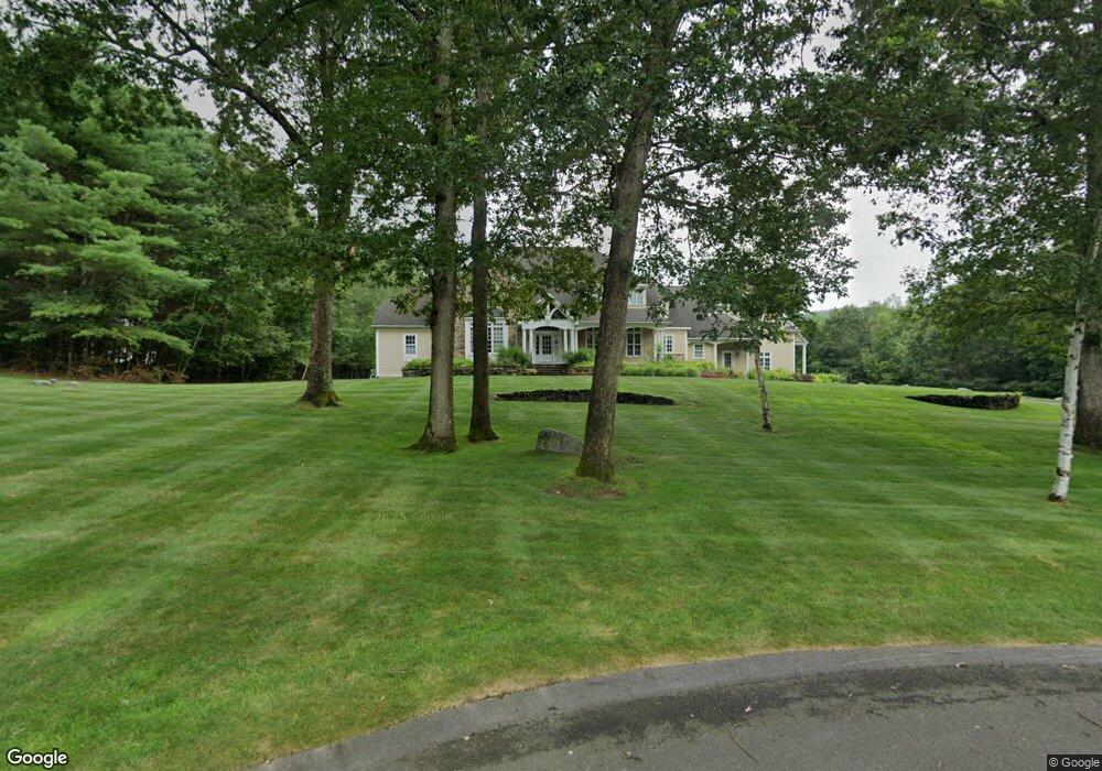
6 Autumn Rd Wilbraham, MA 01095
Estimated Value: $998,366 - $1,279,000
4
Beds
5
Baths
5,300
Sq Ft
$219/Sq Ft
Est. Value
About This Home
This home is located at 6 Autumn Rd, Wilbraham, MA 01095 and is currently estimated at $1,158,789, approximately $218 per square foot. 6 Autumn Rd is a home located in Hampden County with nearby schools including Minnechaug Regional High School.
Ownership History
Date
Name
Owned For
Owner Type
Purchase Details
Closed on
Dec 23, 2008
Sold by
Aaron Fred
Bought by
Wright Gail L and Wright Timothy C
Current Estimated Value
Purchase Details
Closed on
Jun 26, 2006
Sold by
Coons Amy B and Coons Gregory A
Bought by
Aaron Fred
Home Financials for this Owner
Home Financials are based on the most recent Mortgage that was taken out on this home.
Original Mortgage
$797,120
Interest Rate
6.59%
Mortgage Type
Purchase Money Mortgage
Create a Home Valuation Report for This Property
The Home Valuation Report is an in-depth analysis detailing your home's value as well as a comparison with similar homes in the area
Home Values in the Area
Average Home Value in this Area
Purchase History
| Date | Buyer | Sale Price | Title Company |
|---|---|---|---|
| Wright Gail L | $200,000 | -- | |
| Wright Gail L | $890,354 | -- | |
| Aaron Fred | $630,000 | -- |
Source: Public Records
Mortgage History
| Date | Status | Borrower | Loan Amount |
|---|---|---|---|
| Previous Owner | Aaron Fred | $797,120 |
Source: Public Records
Tax History Compared to Growth
Tax History
| Year | Tax Paid | Tax Assessment Tax Assessment Total Assessment is a certain percentage of the fair market value that is determined by local assessors to be the total taxable value of land and additions on the property. | Land | Improvement |
|---|---|---|---|---|
| 2025 | $18,168 | $1,016,100 | $216,700 | $799,400 |
| 2024 | $17,775 | $960,800 | $209,200 | $751,600 |
| 2023 | $17,031 | $948,900 | $176,200 | $772,700 |
| 2022 | $17,031 | $831,200 | $146,200 | $685,000 |
| 2021 | $17,966 | $782,500 | $155,300 | $627,200 |
| 2020 | $17,512 | $782,500 | $155,300 | $627,200 |
| 2019 | $17,059 | $782,500 | $155,300 | $627,200 |
| 2018 | $16,869 | $745,100 | $155,300 | $589,800 |
| 2017 | $16,392 | $745,100 | $155,300 | $589,800 |
| 2016 | $16,036 | $742,400 | $169,300 | $573,100 |
| 2015 | $15,501 | $742,400 | $169,300 | $573,100 |
Source: Public Records
Map
Nearby Homes
- 603 Glendale Rd
- 60 Lakeshore Dr
- 733 Monson Rd
- 474-480 Mountain Rd
- 474 Mountain Rd
- 6 Hilltop Park
- 72 Beebe Rd
- 20 Old Orchard Rd
- 17 Peak Rd
- 182 Mountain Rd
- 68 Monson Rd
- 2 Bayberry Dr Unit 51
- 254 Ames Rd
- 2 Vista Rd
- 79 High Pine Cir
- 69 High Pine Cir
- 28 Decorie Dr
- 8 Patriot Ridge Ln
- 54 High Pine Cir
- 187 Hovey Rd
- 14 Red Gap Rd
- 12 Red Gap Rd
- 10 Red Gap Rd
- 4 Falcon Heights
- 1 Autumn Rd
- 5 Autumn Rd
- 5 Autumn Rd Unit 1
- 5 Autumn Rd Unit 5
- 16 Red Gap Rd
- 5v Red Gap Rd
- 8 Red Gap Rd
- 11 Red Gap Rd
- 9 Red Gap Rd
- 15 Red Gap Rd
- 3 Falcon Heights
- 18 Red Gap Rd
- 6 Falcon Heights
- Lot 6 Falcon Heights Rd
- Lot 4 Falcon Heights Rd
- 6 Red Gap Rd