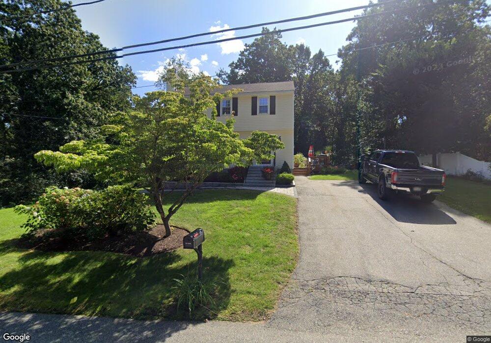
6 Bates Ave Wilmington, MA 01887
Estimated Value: $710,000 - $873,000
3
Beds
2
Baths
1,470
Sq Ft
$515/Sq Ft
Est. Value
About This Home
This home is located at 6 Bates Ave, Wilmington, MA 01887 and is currently estimated at $757,511, approximately $515 per square foot. 6 Bates Ave is a home with nearby schools including Wilmington Middle School, Wilmington High School, and N Reading Knowledge Beginnings.
Ownership History
Date
Name
Owned For
Owner Type
Purchase Details
Closed on
Apr 16, 1993
Sold by
Conserva Mark C
Bought by
Mcgillvray Paul
Current Estimated Value
Home Financials for this Owner
Home Financials are based on the most recent Mortgage that was taken out on this home.
Original Mortgage
$147,100
Interest Rate
7.39%
Mortgage Type
Purchase Money Mortgage
Create a Home Valuation Report for This Property
The Home Valuation Report is an in-depth analysis detailing your home's value as well as a comparison with similar homes in the area
Home Values in the Area
Average Home Value in this Area
Purchase History
| Date | Buyer | Sale Price | Title Company |
|---|---|---|---|
| Mcgillvray Paul | $154,900 | -- |
Source: Public Records
Mortgage History
| Date | Status | Borrower | Loan Amount |
|---|---|---|---|
| Open | Mcgillvray Paul | $165,000 | |
| Closed | Mcgillvray Paul | $147,100 |
Source: Public Records
Tax History Compared to Growth
Tax History
| Year | Tax Paid | Tax Assessment Tax Assessment Total Assessment is a certain percentage of the fair market value that is determined by local assessors to be the total taxable value of land and additions on the property. | Land | Improvement |
|---|---|---|---|---|
| 2025 | $6,968 | $608,600 | $260,200 | $348,400 |
| 2024 | $6,836 | $598,100 | $260,200 | $337,900 |
| 2023 | $6,433 | $538,800 | $236,500 | $302,300 |
| 2022 | $6,049 | $464,200 | $197,100 | $267,100 |
| 2021 | $5,965 | $431,000 | $179,100 | $251,900 |
| 2020 | $5,676 | $418,000 | $179,100 | $238,900 |
| 2019 | $5,485 | $398,900 | $170,600 | $228,300 |
| 2018 | $5,382 | $373,500 | $162,500 | $211,000 |
| 2017 | $5,247 | $363,100 | $156,700 | $206,400 |
| 2016 | $4,908 | $335,500 | $149,300 | $186,200 |
| 2015 | $4,732 | $329,300 | $149,300 | $180,000 |
| 2014 | $4,493 | $315,500 | $142,200 | $173,300 |
Source: Public Records
Map
Nearby Homes
- 12 Parkview Terrace
- 9 Flash Rd
- 11 Cogswell Rd
- 10 Hillside Rd
- 300 Martins Landing Unit 107
- 18 Burroughs Rd
- 260 Martins Landing Unit 508
- 260 Martins Landing Unit 103
- 200 Martins Landing Unit 102
- 220 Martins Landing Unit 309
- 320 Martins Landing Unit 108
- 320 Martins Landing Unit 109
- 320 Martins Landing Unit 110
- 320 Martins Landing Unit 303
- 320 Martins Landing Unit 102
- 320 Martins Landing Unit 103
- 320 Martins Landing Unit 2410
- 320 Martins Landing Unit 403
- 320 Martins Landing Unit 2201
- 320 Martins Landing Unit 112