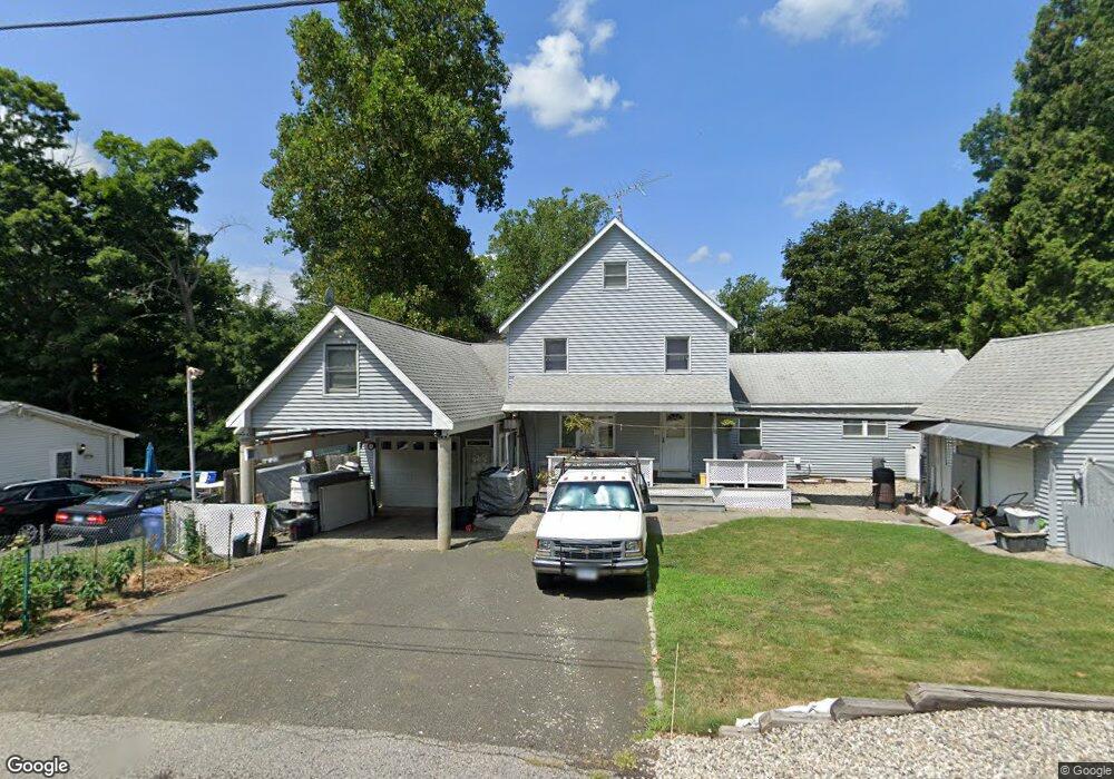
6 Bryant Rd East Hampton, CT 06424
Estimated Value: $250,000 - $408,000
3
Beds
2
Baths
1,692
Sq Ft
$208/Sq Ft
Est. Value
About This Home
This home is located at 6 Bryant Rd, East Hampton, CT 06424 and is currently estimated at $351,758, approximately $207 per square foot. 6 Bryant Rd is a home located in Middlesex County with nearby schools including Memorial School, Center Elementary School, and East Hampton Middle School.
Ownership History
Date
Name
Owned For
Owner Type
Purchase Details
Closed on
May 12, 1989
Sold by
Macdonald William J
Bought by
Macdonald Douglas J
Current Estimated Value
Create a Home Valuation Report for This Property
The Home Valuation Report is an in-depth analysis detailing your home's value as well as a comparison with similar homes in the area
Home Values in the Area
Average Home Value in this Area
Purchase History
We collect this data history from publicly available records. To have your information removed, we recommend requesting removal directly through your county’s website.
| Date | Buyer | Sale Price | Title Company |
|---|---|---|---|
| Macdonald Douglas J | $102,500 | -- |
Source: Public Records
Mortgage History
We collect this data history from publicly available records. To have your information removed, we recommend requesting removal directly through your county’s website.
| Date | Status | Borrower | Loan Amount |
|---|---|---|---|
| Open | Macdonald Douglas J | $50,000 | |
| Open | Macdonald Douglas J | $127,949 | |
| Closed | Macdonald Douglas J | $131,500 | |
| Closed | Macdonald Douglas J | $103,000 |
Source: Public Records
Tax History
| Year | Tax Paid | Tax Assessment Tax Assessment Total Assessment is a certain percentage of the fair market value that is determined by local assessors to be the total taxable value of land and additions on the property. | Land | Improvement |
|---|---|---|---|---|
| 2025 | $6,461 | $162,710 | $50,450 | $112,260 |
| 2024 | $6,189 | $162,710 | $50,450 | $112,260 |
| 2023 | $5,867 | $162,710 | $50,450 | $112,260 |
| 2022 | $5,640 | $162,710 | $50,450 | $112,260 |
| 2021 | $5,486 | $158,870 | $50,450 | $108,420 |
| 2020 | $4,621 | $139,450 | $34,760 | $104,690 |
| 2019 | $4,440 | $133,980 | $39,240 | $94,740 |
| 2018 | $4,196 | $133,980 | $39,240 | $94,740 |
| 2017 | $4,196 | $133,980 | $39,240 | $94,740 |
| 2016 | $3,944 | $133,980 | $39,240 | $94,740 |
| 2015 | $4,086 | $147,100 | $46,170 | $100,930 |
| 2014 | $3,555 | $147,100 | $46,170 | $100,930 |
Source: Public Records
Map
Nearby Homes
- 141 E High St
- 306 Lake Vista Dr Unit 306
- 711 Lake Vista Dr Unit 711
- 3 Brook Trail
- 6 North Hollow
- 10 Mountain Trail
- 18 Brook Trail
- 29 Namonee Trail
- 74 Spellman Point Rd
- 5 Seminole Trail
- 18 Lake Blvd
- 114 Lake Dr
- 26 Lake Blvd
- 2 Town Line Dr
- 15 Beechcrest Dr
- 85 N Main St Unit 86
- 14 Mountainview Rd
- 6 Candlewood Dr
- 55 Mountainview Rd
- 22 W High St
Your Personal Tour Guide
Ask me questions while you tour the home.