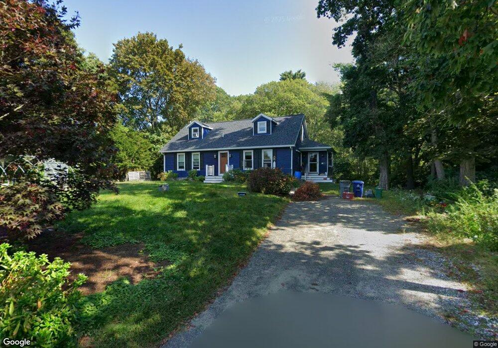
6 Burns Way Gloucester, MA 01930
Estimated Value: $882,406 - $1,152,000
4
Beds
3
Baths
2,051
Sq Ft
$480/Sq Ft
Est. Value
About This Home
This home is located at 6 Burns Way, Gloucester, MA 01930 and is currently estimated at $985,102, approximately $480 per square foot. 6 Burns Way is a home located in Essex County with nearby schools including Plum Cove School, Ralph B O'maley Middle School, and Gloucester High School.
Ownership History
Date
Name
Owned For
Owner Type
Purchase Details
Closed on
Dec 1, 2004
Sold by
Dimond Melissa A and Putnam Gretchen J
Bought by
Dimond Melissa A
Current Estimated Value
Purchase Details
Closed on
May 13, 2004
Sold by
Gillespie Maria Paterno and Gillespie Steven A
Bought by
Dimond Melissa A and Putnam Gretchen J
Purchase Details
Closed on
Jul 15, 1992
Sold by
Burns William E and Burns Marilyn
Bought by
Gillespie Steven A
Create a Home Valuation Report for This Property
The Home Valuation Report is an in-depth analysis detailing your home's value as well as a comparison with similar homes in the area
Purchase History
| Date | Buyer | Sale Price | Title Company |
|---|---|---|---|
| Dimond Melissa A | -- | -- | |
| Dimond Melissa A | $485,000 | -- | |
| Gillespie Steven A | $167,000 | -- |
Source: Public Records
Mortgage History
| Date | Status | Borrower | Loan Amount |
|---|---|---|---|
| Open | Gillespie Steven A | $246,050 | |
| Closed | Gillespie Steven A | $250,461 |
Source: Public Records
Tax History
| Year | Tax Paid | Tax Assessment Tax Assessment Total Assessment is a certain percentage of the fair market value that is determined by local assessors to be the total taxable value of land and additions on the property. | Land | Improvement |
|---|---|---|---|---|
| 2025 | $7,078 | $728,200 | $187,400 | $540,800 |
| 2024 | $7,218 | $741,800 | $178,400 | $563,400 |
| 2023 | $7,003 | $661,300 | $159,300 | $502,000 |
| 2022 | $6,208 | $529,200 | $138,600 | $390,600 |
| 2021 | $6,269 | $503,900 | $126,000 | $377,900 |
| 2020 | $6,052 | $490,800 | $126,000 | $364,800 |
| 2019 | $6,007 | $473,400 | $126,000 | $347,400 |
| 2018 | $5,883 | $455,000 | $126,000 | $329,000 |
| 2017 | $5,643 | $427,800 | $120,000 | $307,800 |
| 2016 | $5,569 | $409,200 | $125,200 | $284,000 |
| 2015 | $5,292 | $387,700 | $125,200 | $262,500 |
Source: Public Records
Map
Nearby Homes
- 672 Washington St
- 136 Leonard St
- 4 Ciaramitaro Ct
- 2 Breezy Point Rd
- 226 Atlantic St
- 178 Atlantic St
- 167 Atlantic St
- 3 Deacon Farm Ln
- 13 Honeysuckle Rd
- 9 Hickory St
- 1030 Washington St
- 31 Echo Ave
- 43 High St Unit B
- 10 Emerald St
- 13 Mystic Ave
- 8 Mystic Ave
- 3 Rockland St
- 33 Quarry Ridge Ln Unit 33
- 177 Main St
- 98 Maplewood Ave
- 4 Burns Way
- 7 Bittersweet Rd
- 5 Bittersweet Rd
- 8 Bittersweet Rd
- 14 Butternut Ln
- 12 Butternut Ln
- 3 Bittersweet Rd
- 16 Butternut Ln
- 18 Youngs Rd
- 4 Bittersweet Rd
- 7 Butternut Ln
- 1 Bittersweet Rd
- 8 Butternut Ln
- 19 Youngs Rd
- 9 Butternut Ln
- 14 Youngs Rd
- 709 Washington St
- 731 Washington St
- 717 Washington St
- 4 Butternut Ln
Your Personal Tour Guide
Ask me questions while you tour the home.