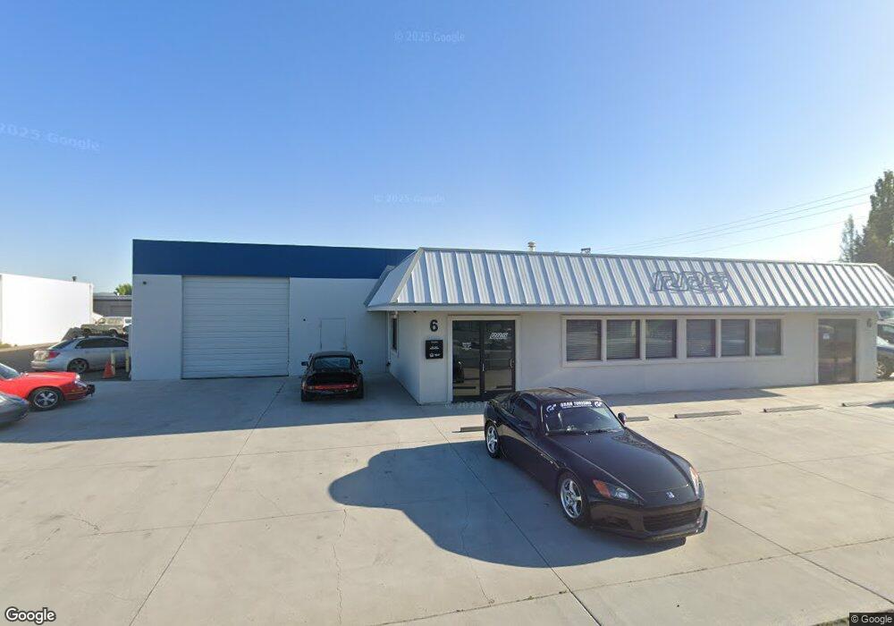
6 Cal Ln Sparks, NV 89431
Estimated Value: $1,762,609
Studio
--
Bath
5,500
Sq Ft
$320/Sq Ft
Est. Value
About This Home
This home is located at 6 Cal Ln, Sparks, NV 89431 and is currently estimated at $1,762,609, approximately $320 per square foot. 6 Cal Ln is a home located in Washoe County with nearby schools including Roger Corbett Elementary School, Vaughn Middle School, and Earl Wooster High School.
Ownership History
Date
Name
Owned For
Owner Type
Purchase Details
Closed on
Sep 10, 2021
Sold by
Jamin Du Llc
Bought by
Reno Rs Holdings Llc
Current Estimated Value
Purchase Details
Closed on
Jul 7, 2006
Sold by
Uhart John and Douglass Angeline
Bought by
John Uhart 2000 Revocable Trust and Patrick & Angeline Douglass 2000 Trust
Purchase Details
Closed on
May 2, 2006
Sold by
Uhart John
Bought by
Jamin Du Llc
Purchase Details
Closed on
May 19, 1994
Sold by
Uhart Jean and Uhart Jeannette
Bought by
Uhart Jean Baptiste and Uhart Jeannette Uhalde
Create a Home Valuation Report for This Property
The Home Valuation Report is an in-depth analysis detailing your home's value as well as a comparison with similar homes in the area
Purchase History
| Date | Buyer | Sale Price | Title Company |
|---|---|---|---|
| Reno Rs Holdings Llc | $1,700,000 | First American Title Reno | |
| John Uhart 2000 Revocable Trust | -- | None Available | |
| Jamin Du Llc | -- | None Available | |
| Jamin Du Llc | -- | None Available | |
| Uhart Jean Baptiste | -- | -- |
Source: Public Records
Tax History
| Year | Tax Paid | Tax Assessment Tax Assessment Total Assessment is a certain percentage of the fair market value that is determined by local assessors to be the total taxable value of land and additions on the property. | Land | Improvement |
|---|---|---|---|---|
| 2026 | -- | $179,536 | $102,239 | $77,298 |
| 2024 | $5,068 | $159,655 | $83,982 | $75,674 |
| 2023 | $5,068 | $149,056 | $76,679 | $72,377 |
| 2022 | $4,692 | $128,070 | $65,725 | $62,346 |
| 2021 | $4,420 | $120,625 | $56,596 | $64,029 |
| 2020 | $4,551 | $124,286 | $56,596 | $67,690 |
| 2019 | $4,334 | $119,048 | $52,945 | $66,103 |
| 2018 | $4,136 | $113,348 | $45,642 | $67,706 |
| 2017 | $3,970 | $108,365 | $38,339 | $70,026 |
| 2016 | $3,916 | $111,185 | $38,339 | $72,846 |
| 2015 | $2,933 | $107,181 | $32,863 | $74,318 |
| 2014 | $3,788 | $103,390 | $32,862 | $70,528 |
| 2013 | -- | $102,879 | $32,863 | $70,016 |
Source: Public Records
Map
Nearby Homes
- 560 Nichols Blvd
- 483 Beacon Hill Ct Unit 16-D
- 601 Oakwood Dr Unit 4
- 501 7th St
- 2295 S Rock Blvd
- 1224 F St
- 953 7th St
- 675 Parlanti Ln Unit 52
- 675 Parlanti Ln Unit 124
- 675 Parlanti Ln Unit 38
- 675 Parlanti Ln Unit 11
- 675 Parlanti Ln Unit 42
- 675 Parlanti Ln
- 675 Parlanti Ln Unit 9
- 675 Parlanti Ln Unit 88
- 675 Parlanti Ln Unit 63
- 801 Woodglen Dr Unit 2
- 11 E J St
- 828 Woodglen Dr Unit 2
- 959 Mesa Ridge Dr Unit 2
- 6 Cal Ln Unit 6B
- 6 Cal Ln Unit B
- 3 E Freeport Blvd
- 9 E Freeport Blvd
- 27 E Freeport Blvd
- 33 E Freeport Blvd
- 62 E Freeport Blvd
- 95 E Glendale Ave
- 105 Greg St
- 870 Steneri Way Unit 101
- 870 Steneri Way
- 350 Greg St
- 399 Greg St
- 930 Bergin Way
- 1540 Linda Way
- 1565 S Stanford Way
- 210 Coney Island Dr
- 245 Coney Island Dr
- 3152 Linda Way
- 125 Coney Island Dr
Your Personal Tour Guide
Ask me questions while you tour the home.