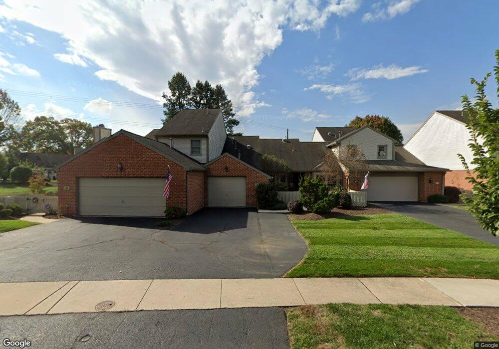
6 Cambridge Dr Hershey, PA 17033
Estimated Value: $292,054 - $431,000
2
Beds
2
Baths
1,410
Sq Ft
$240/Sq Ft
Est. Value
About This Home
This home is located at 6 Cambridge Dr, Hershey, PA 17033 and is currently estimated at $338,264, approximately $239 per square foot. 6 Cambridge Dr is a home located in Dauphin County with nearby schools including Hershey Elementary School, Hershey Primary Elementary School, and Hershey Middle School.
Ownership History
Date
Name
Owned For
Owner Type
Purchase Details
Closed on
Apr 25, 2014
Sold by
Lenard Otto S
Bought by
Morrow R Scott
Current Estimated Value
Home Financials for this Owner
Home Financials are based on the most recent Mortgage that was taken out on this home.
Original Mortgage
$170,400
Outstanding Balance
$129,816
Interest Rate
4.32%
Mortgage Type
New Conventional
Estimated Equity
$208,448
Purchase Details
Closed on
Jul 31, 2006
Sold by
Steinbrenner Conrad
Bought by
Lenard Otto S
Create a Home Valuation Report for This Property
The Home Valuation Report is an in-depth analysis detailing your home's value as well as a comparison with similar homes in the area
Home Values in the Area
Average Home Value in this Area
Purchase History
| Date | Buyer | Sale Price | Title Company |
|---|---|---|---|
| Morrow R Scott | $213,000 | -- | |
| Lenard Otto S | $187,000 | -- |
Source: Public Records
Mortgage History
| Date | Status | Borrower | Loan Amount |
|---|---|---|---|
| Open | Morrow R Scott | $170,400 |
Source: Public Records
Tax History
| Year | Tax Paid | Tax Assessment Tax Assessment Total Assessment is a certain percentage of the fair market value that is determined by local assessors to be the total taxable value of land and additions on the property. | Land | Improvement |
|---|---|---|---|---|
| 2025 | $3,750 | $120,000 | $20,800 | $99,200 |
| 2024 | $3,525 | $120,000 | $20,800 | $99,200 |
| 2023 | $3,462 | $120,000 | $20,800 | $99,200 |
| 2022 | $3,385 | $120,000 | $20,800 | $99,200 |
| 2021 | $3,385 | $120,000 | $20,800 | $99,200 |
| 2020 | $3,385 | $120,000 | $20,800 | $99,200 |
| 2019 | $3,324 | $120,000 | $20,800 | $99,200 |
| 2018 | $3,236 | $120,000 | $20,800 | $99,200 |
| 2017 | $3,236 | $120,000 | $20,800 | $99,200 |
| 2016 | $0 | $120,000 | $20,800 | $99,200 |
| 2015 | -- | $120,000 | $20,800 | $99,200 |
| 2014 | -- | $120,000 | $20,800 | $99,200 |
Source: Public Records
Map
Nearby Homes
- 1343 Church Rd
- 33 Sterling Ct
- 24 Glasgow Ct
- 0 Stauffers Church Rd Unit PADA2052308
- 214 William Dr
- 222 Robin Rd
- 81 Cambridge Dr
- 104 Cambridge Dr
- 2 Plymouth Cir
- 29 Almond Dr
- 46 W Governor Rd
- 15 W Governor Rd
- 0 Hill Church Rd
- 81 Locust Ave
- 251 Maple Ave
- 115 S Hills Dr
- 420 Cedar Ave
- 555 Hilltop Rd
- 147 Elm Ave
- 118 Elm Ave
- 4 Cambridge Dr
- 8 Cambridge Dr
- 10 Cambridge Dr
- 14 Cambridge Dr
- 353 E Glenn Rd
- 16 Cambridge Dr
- 5 Cambridge Dr
- 110 Somerset Dr
- 18 Cambridge Dr
- 7 Cambridge Dr
- 120 Somerset Dr
- 21 Cambridge Dr
- 20 Cambridge Dr
- 19 Cambridge Dr
- 105 Somerset Dr
- 130 Somerset Dr
- 17 Cambridge Dr
- 15 Cambridge Dr
- 368 E Glenn Rd
- 13 Cambridge Dr
Your Personal Tour Guide
Ask me questions while you tour the home.