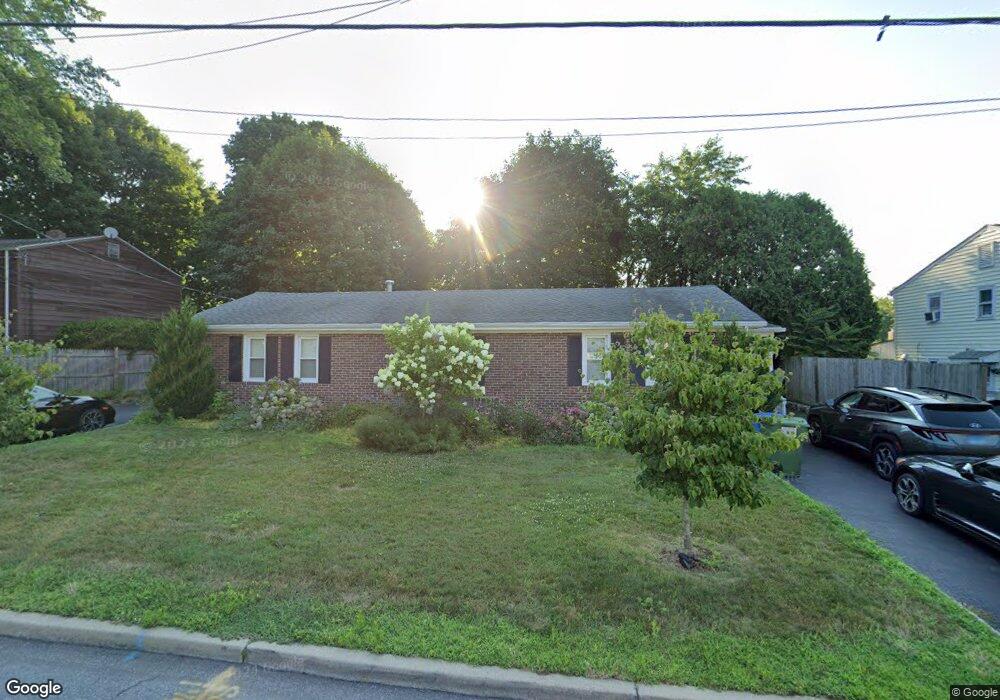
6 Campfield Dr Fairfield, CT 06825
Tunxis Hill NeighborhoodEstimated Value: $556,000 - $706,000
2
Beds
1
Bath
900
Sq Ft
$672/Sq Ft
Est. Value
About This Home
This home is located at 6 Campfield Dr, Fairfield, CT 06825 and is currently estimated at $604,825, approximately $672 per square foot. 6 Campfield Dr is a home located in Fairfield County with nearby schools including Mckinley Elementary School, Tomlinson Middle School, and Fairfield Warde High School.
Ownership History
Date
Name
Owned For
Owner Type
Purchase Details
Closed on
Dec 12, 2018
Sold by
Parlakkilic Turgut and Parlakkilic Nuran
Bought by
Sherwood Christopher W and Sherwood Jacqueline
Current Estimated Value
Home Financials for this Owner
Home Financials are based on the most recent Mortgage that was taken out on this home.
Original Mortgage
$331,500
Outstanding Balance
$288,741
Interest Rate
4.25%
Mortgage Type
Purchase Money Mortgage
Estimated Equity
$316,084
Purchase Details
Closed on
Nov 14, 2007
Sold by
Strieble Kimberly C and Randall Donna M
Bought by
Parlakkilic Nuran and Parlakkilic Turqut
Home Financials for this Owner
Home Financials are based on the most recent Mortgage that was taken out on this home.
Original Mortgage
$171,000
Interest Rate
6.41%
Create a Home Valuation Report for This Property
The Home Valuation Report is an in-depth analysis detailing your home's value as well as a comparison with similar homes in the area
Home Values in the Area
Average Home Value in this Area
Purchase History
| Date | Buyer | Sale Price | Title Company |
|---|---|---|---|
| Sherwood Christopher W | $390,000 | -- | |
| Sherwood Christopher W | $390,000 | -- | |
| Parlakkilic Nuran | $321,000 | -- | |
| Parlakkilic Nuran | $321,000 | -- |
Source: Public Records
Mortgage History
| Date | Status | Borrower | Loan Amount |
|---|---|---|---|
| Open | Sherwood Christopher W | $331,500 | |
| Closed | Sherwood Christopher W | $331,500 | |
| Previous Owner | Parlakkilic Nuran | $225,000 | |
| Previous Owner | Parlakkilic Nuran | $171,000 |
Source: Public Records
Tax History Compared to Growth
Tax History
| Year | Tax Paid | Tax Assessment Tax Assessment Total Assessment is a certain percentage of the fair market value that is determined by local assessors to be the total taxable value of land and additions on the property. | Land | Improvement |
|---|---|---|---|---|
| 2025 | $7,085 | $249,550 | $177,590 | $71,960 |
| 2024 | $6,962 | $249,550 | $177,590 | $71,960 |
| 2023 | $6,865 | $249,550 | $177,590 | $71,960 |
| 2022 | $6,798 | $249,550 | $177,590 | $71,960 |
| 2021 | $6,733 | $249,550 | $177,590 | $71,960 |
| 2020 | $5,545 | $206,990 | $147,980 | $59,010 |
| 2019 | $5,545 | $206,990 | $147,980 | $59,010 |
| 2018 | $5,456 | $206,990 | $147,980 | $59,010 |
| 2017 | $5,344 | $206,990 | $147,980 | $59,010 |
| 2016 | $5,268 | $206,990 | $147,980 | $59,010 |
| 2015 | $5,185 | $209,160 | $154,350 | $54,810 |
| 2014 | $5,104 | $209,160 | $154,350 | $54,810 |
Source: Public Records
Map
Nearby Homes
- 279 Knapps Hwy
- 376 Knapps Hwy
- 67 Campfield Dr
- 333 Lenox Rd
- 42 Fairway Green
- 197 Vesper St
- 183 Vesper St
- 709 Tunxis Hill Rd
- 140 Tunxis Hill Cut Off
- 90 White Oak Rd
- 108 Roseville St
- 62 Soundview Ave
- 101 Soundview Ave
- 90 2nd St
- 180 Oakwood Dr
- 89 Grace St
- 309 Hunyadi Ave
- 299 Villa Ave
- 303 Villa Ave
- 92 Westwood Rd
- 10 Campfield Dr
- 12 Campfield Dr
- 7 Campfield Dr
- 14 Campfield Dr
- 6 Knapps Park Dr
- 2 Campfield Dr
- 5 Campfield Dr
- 3 Campfield Dr
- 1 Campfield Dr
- 2 Knapps Park Dr
- 16 Campfield Dr
- 13 Campfield Dr
- 15 Campfield Dr
- 18 Campfield Dr
- 280 Knapps Hwy
- 10 Knapps Park Dr
- 20 Campfield Dr
- 12 Knapps Park Dr
- 11 Knapps Park Dr
- 6 Berrylane Ct