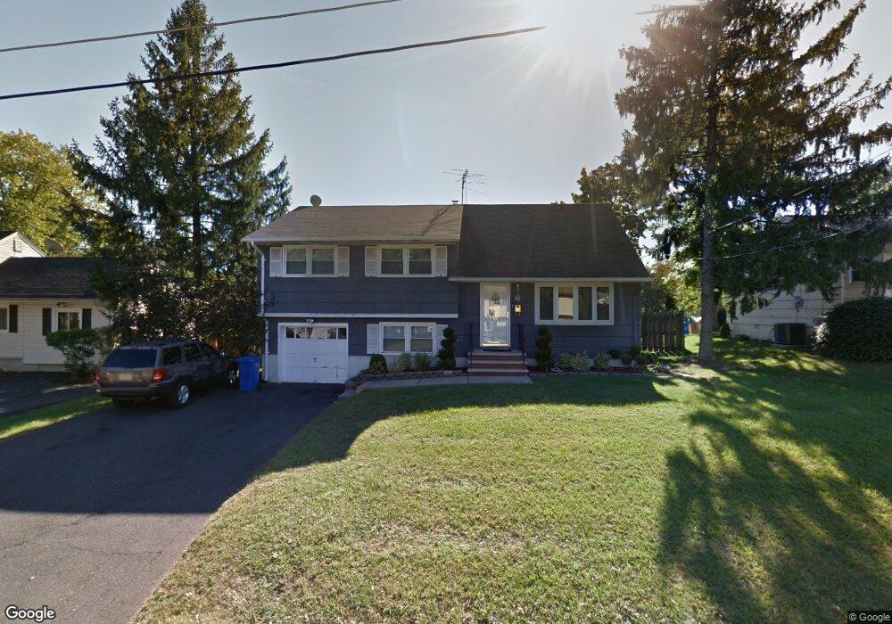
6 Carol Ct Somerset, NJ 08873
Estimated Value: $458,000
--
Bed
--
Bath
1,559
Sq Ft
$294/Sq Ft
Est. Value
About This Home
This home is located at 6 Carol Ct, Somerset, NJ 08873 and is currently estimated at $458,000, approximately $293 per square foot. 6 Carol Ct is a home located in Somerset County with nearby schools including Franklin High School.
Ownership History
Date
Name
Owned For
Owner Type
Purchase Details
Closed on
Aug 16, 2005
Sold by
Poveda Yomar
Bought by
Robinson Eric and Robinson Imani
Current Estimated Value
Home Financials for this Owner
Home Financials are based on the most recent Mortgage that was taken out on this home.
Original Mortgage
$270,400
Outstanding Balance
$142,045
Interest Rate
5.66%
Estimated Equity
$315,955
Create a Home Valuation Report for This Property
The Home Valuation Report is an in-depth analysis detailing your home's value as well as a comparison with similar homes in the area
Home Values in the Area
Average Home Value in this Area
Purchase History
| Date | Buyer | Sale Price | Title Company |
|---|---|---|---|
| Robinson Eric | $338,000 | -- |
Source: Public Records
Mortgage History
| Date | Status | Borrower | Loan Amount |
|---|---|---|---|
| Open | Robinson Eric | $270,400 |
Source: Public Records
Tax History Compared to Growth
Tax History
| Year | Tax Paid | Tax Assessment Tax Assessment Total Assessment is a certain percentage of the fair market value that is determined by local assessors to be the total taxable value of land and additions on the property. | Land | Improvement |
|---|---|---|---|---|
| 2025 | $7,217 | $455,100 | $268,300 | $186,800 |
| 2024 | $7,217 | $396,100 | $268,300 | $127,800 |
| 2023 | $7,021 | $361,900 | $234,100 | $127,800 |
| 2022 | $7,002 | $341,900 | $214,100 | $127,800 |
| 2021 | $6,729 | $301,900 | $174,100 | $127,800 |
| 2020 | $6,333 | $276,900 | $149,100 | $127,800 |
| 2019 | $6,187 | $266,900 | $139,100 | $127,800 |
| 2018 | $5,782 | $246,900 | $119,100 | $127,800 |
| 2017 | $5,570 | $236,900 | $109,100 | $127,800 |
| 2016 | $5,546 | $233,900 | $106,100 | $127,800 |
| 2015 | $5,532 | $234,900 | $107,100 | $127,800 |
| 2014 | $5,473 | $235,900 | $108,100 | $127,800 |
Source: Public Records
Map
Nearby Homes