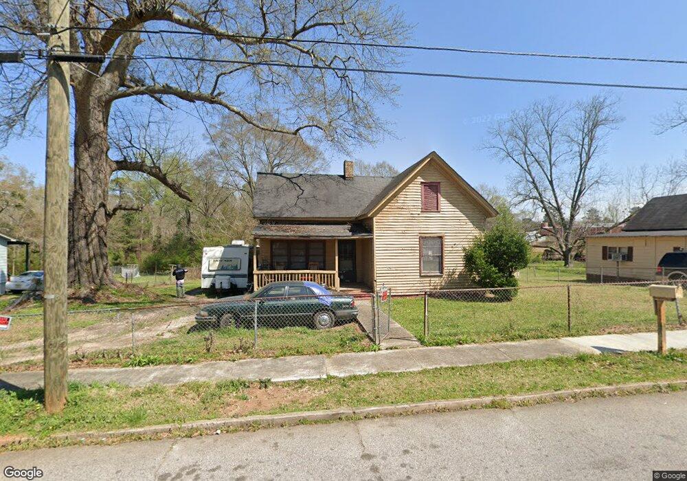
6 Cary St Lagrange, GA 30241
Estimated Value: $67,000 - $130,000
2
Beds
1
Bath
1,200
Sq Ft
$83/Sq Ft
Est. Value
About This Home
This home is located at 6 Cary St, Lagrange, GA 30241 and is currently estimated at $100,065, approximately $83 per square foot. 6 Cary St is a home located in Troup County with nearby schools including Franklin Forest Elementary School, Hollis Hand Elementary School, and Ethel W. Kight Elementary School.
Ownership History
Date
Name
Owned For
Owner Type
Purchase Details
Closed on
Sep 2, 2008
Sold by
Kissun Rudra Roger
Bought by
Ogletree Brenda
Current Estimated Value
Purchase Details
Closed on
Jul 29, 1996
Sold by
Rawlins R Kissun
Bought by
Rudra Roger Kissun
Purchase Details
Closed on
Nov 26, 1986
Sold by
Hubert A Posey
Bought by
Rawlins R Kissun
Purchase Details
Closed on
Jul 9, 1981
Sold by
Wilma Jean Posey Costley
Bought by
Hubert A Posey
Purchase Details
Closed on
Jan 1, 1973
Sold by
David Costley
Bought by
Wilma Jean Posey Costley
Purchase Details
Closed on
Oct 1, 1968
Sold by
Eunice Jeff and Eunice Costley
Bought by
David Costley
Create a Home Valuation Report for This Property
The Home Valuation Report is an in-depth analysis detailing your home's value as well as a comparison with similar homes in the area
Purchase History
| Date | Buyer | Sale Price | Title Company |
|---|---|---|---|
| Ogletree Brenda | $885 | -- | |
| Rudra Roger Kissun | -- | -- | |
| Rawlins R Kissun | $13,000 | -- | |
| Hubert A Posey | -- | -- | |
| Wilma Jean Posey Costley | -- | -- | |
| David Costley | -- | -- |
Source: Public Records
Tax History
| Year | Tax Paid | Tax Assessment Tax Assessment Total Assessment is a certain percentage of the fair market value that is determined by local assessors to be the total taxable value of land and additions on the property. | Land | Improvement |
|---|---|---|---|---|
| 2025 | $563 | $22,360 | $5,360 | $17,000 |
| 2024 | $563 | $20,640 | $5,360 | $15,280 |
| 2023 | $513 | $18,800 | $5,360 | $13,440 |
| 2022 | $501 | $17,960 | $5,360 | $12,600 |
| 2021 | $368 | $12,200 | $3,040 | $9,160 |
| 2020 | $368 | $12,200 | $3,040 | $9,160 |
| 2019 | $337 | $11,160 | $3,040 | $8,120 |
| 2018 | $337 | $11,160 | $3,040 | $8,120 |
| 2017 | $336 | $11,146 | $3,026 | $8,120 |
| 2016 | $335 | $11,096 | $3,026 | $8,070 |
| 2015 | $335 | $11,098 | $3,028 | $8,070 |
| 2014 | $323 | $10,674 | $3,028 | $7,646 |
| 2013 | -- | $14,182 | $3,028 | $11,154 |
Source: Public Records
Map
Nearby Homes
- 4 1/2 Barnard Ave
- 15 Fulton St
- 5 Curran Ave
- 3 Gulfstream Dr
- 5 Gulfstream Dr
- 204 Cleveland Dr
- 2 Louise St
- 212 Cleveland Dr
- Coleman Plan at Crossvine Village
- Beckman Plan at Crossvine Village
- Fairfield Plan at Crossvine Village
- Broadmoor Plan at Crossvine Village
- Dover Plan at Crossvine Village
- 130 Clara Jean Ct
- 87 Youngs Mill Rd
- 0 N Barnard Ave
- 115 Clara Jean Ct
- 107 N Barnard Ave
- 110 Lenox Cir
- 124 Shenandoah Ln
Your Personal Tour Guide
Ask me questions while you tour the home.