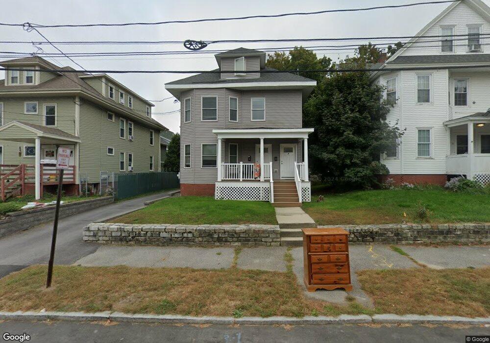
6 Clinton St Portland, ME 04103
Deering Center NeighborhoodEstimated Value: $897,000 - $1,066,906
5
Beds
3
Baths
2,918
Sq Ft
$328/Sq Ft
Est. Value
About This Home
This home is located at 6 Clinton St, Portland, ME 04103 and is currently estimated at $955,977, approximately $327 per square foot. 6 Clinton St is a home located in Cumberland County with nearby schools including Longfellow School-Portland, Lincoln Middle School, and Baxter Academy for Tech & Sciences.
Ownership History
Date
Name
Owned For
Owner Type
Purchase Details
Closed on
Dec 19, 2019
Sold by
Bell Caleb C
Bought by
Bellre Clinton Llc
Current Estimated Value
Home Financials for this Owner
Home Financials are based on the most recent Mortgage that was taken out on this home.
Original Mortgage
$464,800
Outstanding Balance
$409,788
Interest Rate
3.6%
Mortgage Type
New Conventional
Estimated Equity
$546,189
Create a Home Valuation Report for This Property
The Home Valuation Report is an in-depth analysis detailing your home's value as well as a comparison with similar homes in the area
Home Values in the Area
Average Home Value in this Area
Purchase History
| Date | Buyer | Sale Price | Title Company |
|---|---|---|---|
| Bellre Clinton Llc | -- | None Available |
Source: Public Records
Mortgage History
| Date | Status | Borrower | Loan Amount |
|---|---|---|---|
| Open | Bellre Clinton Llc | $464,800 |
Source: Public Records
Tax History Compared to Growth
Tax History
| Year | Tax Paid | Tax Assessment Tax Assessment Total Assessment is a certain percentage of the fair market value that is determined by local assessors to be the total taxable value of land and additions on the property. | Land | Improvement |
|---|---|---|---|---|
| 2024 | $9,203 | $613,100 | $92,700 | $520,400 |
| 2023 | $8,835 | $613,100 | $92,700 | $520,400 |
| 2022 | $8,344 | $613,100 | $92,700 | $520,400 |
| 2021 | $7,964 | $613,100 | $92,700 | $520,400 |
| 2020 | $6,807 | $292,000 | $87,200 | $204,800 |
| 2019 | $6,807 | $292,000 | $87,200 | $204,800 |
| 2018 | $6,322 | $292,000 | $87,200 | $204,800 |
| 2017 | $6,322 | $292,000 | $87,200 | $204,800 |
| 2016 | $6,164 | $292,000 | $87,200 | $204,800 |
| 2015 | $5,838 | $283,000 | $87,200 | $195,800 |
| 2014 | $5,660 | $283,000 | $87,200 | $195,800 |
Source: Public Records
Map
Nearby Homes
- 25 Pleasant Ave
- 736 Forest Ave
- 44 Pleasant Ave
- 42 Sawyer St
- 33 Mayland St
- 89 Clinton St
- 44 Hersey St
- 33 Bay View Dr
- 147 Pleasant Ave Unit 2
- 930 Forest Ave
- 37 Tremont St
- 45 George St
- 65 Mcauley Way Unit 506
- 37 Wellington Rd
- 75 Mcauley Way Unit 307
- 75 Mcauley Way Unit 206
- 75 Mcauley Way Unit 401
- 75 Mcauley Way Unit 207
- 75 Mcauley Way Unit 502
- 75 Mcauley Way Unit 304
- 6 Clinton St
- 2 Clinton St
- 10 Clinton St
- 14 Clinton St
- 774 Forest Ave Unit 2
- 756 Forest Ave
- 18 Clinton St
- 15 Clinton St
- 757 Forest Ave
- 780 Forest Ave
- 767 Forest Ave
- 778 Forest Ave
- 15 Pleasant Ave
- 3 Pleasant Ave Unit Clark Lofts on Pleasant
- 3 Pleasant Ave
- 19 Pleasant Ave
- 25 Pleasant Ave
- 29 Pleasant Ave
- 19 Pleasant Ave
- 777 Forest Ave