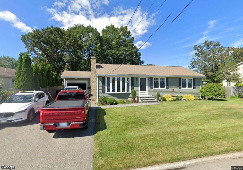
6 Commack Rd East Providence, RI 02914
Kent Heights NeighborhoodEstimated Value: $461,342 - $537,000
3
Beds
2
Baths
1,196
Sq Ft
$421/Sq Ft
Est. Value
About This Home
This home is located at 6 Commack Rd, East Providence, RI 02914 and is currently estimated at $503,586, approximately $421 per square foot. 6 Commack Rd is a home located in Providence County with nearby schools including East Providence High School, The Gordon School, and St Mary Academy-Bay View.
Ownership History
Date
Name
Owned For
Owner Type
Purchase Details
Closed on
Dec 27, 2017
Sold by
Faella Paul and Vincent James K
Bought by
Craig Jeffrey
Current Estimated Value
Purchase Details
Closed on
May 15, 2017
Sold by
Faella Paul
Bought by
Faella Paul and Vincent James K
Purchase Details
Closed on
Sep 15, 2000
Sold by
Perry Dorothy C
Bought by
Faella Paul J and Faella Maureen
Home Financials for this Owner
Home Financials are based on the most recent Mortgage that was taken out on this home.
Original Mortgage
$116,000
Interest Rate
8.07%
Purchase Details
Closed on
Jul 29, 1992
Sold by
Silva John V W Est
Bought by
Perry Joseph A
Create a Home Valuation Report for This Property
The Home Valuation Report is an in-depth analysis detailing your home's value as well as a comparison with similar homes in the area
Home Values in the Area
Average Home Value in this Area
Purchase History
| Date | Buyer | Sale Price | Title Company |
|---|---|---|---|
| Craig Jeffrey | $280,000 | -- | |
| Faella Paul | -- | -- | |
| Faella Paul J | $145,000 | -- | |
| Perry Joseph A | $137,500 | -- |
Source: Public Records
Mortgage History
| Date | Status | Borrower | Loan Amount |
|---|---|---|---|
| Previous Owner | Perry Joseph A | $125,000 | |
| Previous Owner | Perry Joseph A | $120,500 | |
| Previous Owner | Perry Joseph A | $116,000 |
Source: Public Records
Tax History Compared to Growth
Tax History
| Year | Tax Paid | Tax Assessment Tax Assessment Total Assessment is a certain percentage of the fair market value that is determined by local assessors to be the total taxable value of land and additions on the property. | Land | Improvement |
|---|---|---|---|---|
| 2025 | $5,401 | $413,200 | $137,100 | $276,100 |
| 2024 | $5,470 | $356,800 | $114,400 | $242,400 |
| 2023 | $5,266 | $356,800 | $114,400 | $242,400 |
| 2022 | $5,052 | $231,100 | $57,900 | $173,200 |
| 2021 | $4,969 | $231,100 | $57,900 | $173,200 |
| 2020 | $4,758 | $231,100 | $57,900 | $173,200 |
| 2019 | $4,627 | $231,100 | $57,900 | $173,200 |
| 2018 | $4,610 | $201,500 | $59,200 | $142,300 |
| 2017 | $4,508 | $201,500 | $59,200 | $142,300 |
| 2016 | $4,485 | $201,500 | $59,200 | $142,300 |
| 2015 | $4,188 | $182,500 | $52,200 | $130,300 |
| 2014 | $4,188 | $182,500 | $52,200 | $130,300 |
Source: Public Records
Map
Nearby Homes
- 53 Wampanoag Trail
- 10 Fairfield Ave
- 36 Gerald St
- 108 Ivan Ave
- 180 Grassmere Ave
- 25 Ide Ave
- 59 Merritt Rd
- 87 Vincent Ave
- 74 Brookhaven Dr
- 50 Kettle Point Ave Unit 50
- 740 Veterans Memorial Pkwy
- 26 Mayflower St
- 1463 S Broadway
- 132 S Rose St
- 14 Waterview Ave Unit 16
- 75 Belmont Ave
- 17 Brown St Unit 19
- 21 Donnelly St
- 400 Juniper St Unit A
- 400 Juniper St Unit B