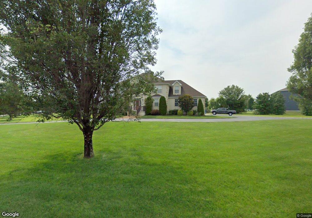
6 Crop St Woodbine, NJ 08270
Estimated Value: $651,000 - $840,000
--
Bed
--
Bath
2,962
Sq Ft
$245/Sq Ft
Est. Value
About This Home
This home is located at 6 Crop St, Woodbine, NJ 08270 and is currently estimated at $725,544, approximately $244 per square foot. 6 Crop St is a home located in Cape May County with nearby schools including Upper Township Primary School, Upper Township Elementary School, and Upper Township Middle School.
Ownership History
Date
Name
Owned For
Owner Type
Purchase Details
Closed on
Jun 18, 2010
Sold by
Murray Daniel O and Murray Wilma J
Bought by
Bondiskey John A
Current Estimated Value
Home Financials for this Owner
Home Financials are based on the most recent Mortgage that was taken out on this home.
Original Mortgage
$237,500
Outstanding Balance
$159,251
Interest Rate
4.98%
Mortgage Type
New Conventional
Estimated Equity
$566,293
Purchase Details
Closed on
Sep 15, 2008
Sold by
Murray Daniel O
Bought by
Murray Daniel O and Murray Wilma J
Purchase Details
Closed on
Jan 12, 2006
Sold by
Black Horse Land Llc
Bought by
Murray Daniel O
Purchase Details
Closed on
Jul 1, 2004
Sold by
Clayton Development Associates Llc
Bought by
Black Horse Land Llc
Create a Home Valuation Report for This Property
The Home Valuation Report is an in-depth analysis detailing your home's value as well as a comparison with similar homes in the area
Home Values in the Area
Average Home Value in this Area
Purchase History
| Date | Buyer | Sale Price | Title Company |
|---|---|---|---|
| Bondiskey John A | $475,000 | The Title Company Of Jersey | |
| Murray Daniel O | -- | None Available | |
| Murray Daniel O | $165,000 | The Title Company Of Jersey | |
| Black Horse Land Llc | $245,000 | The Title Company Of Jersey |
Source: Public Records
Mortgage History
| Date | Status | Borrower | Loan Amount |
|---|---|---|---|
| Open | Bondiskey John A | $237,500 |
Source: Public Records
Tax History Compared to Growth
Tax History
| Year | Tax Paid | Tax Assessment Tax Assessment Total Assessment is a certain percentage of the fair market value that is determined by local assessors to be the total taxable value of land and additions on the property. | Land | Improvement |
|---|---|---|---|---|
| 2025 | $10,821 | $459,500 | $99,400 | $360,100 |
| 2024 | $10,821 | $459,500 | $99,400 | $360,100 |
| 2023 | $10,307 | $459,500 | $99,400 | $360,100 |
| 2022 | $9,990 | $459,500 | $99,400 | $360,100 |
| 2021 | $9,400 | $459,500 | $99,400 | $360,100 |
| 2020 | $9,296 | $459,500 | $99,400 | $360,100 |
| 2019 | $9,084 | $459,500 | $99,400 | $360,100 |
| 2018 | $8,855 | $459,500 | $99,400 | $360,100 |
| 2017 | $9,024 | $474,200 | $99,400 | $374,800 |
| 2016 | $7,897 | $408,300 | $99,400 | $308,900 |
| 2015 | $7,664 | $408,300 | $99,400 | $308,900 |
| 2014 | $7,201 | $471,600 | $172,600 | $299,000 |
Source: Public Records
Map
Nearby Homes
- 1520 Route 50
- 9 Deerfield Trail
- 17 Deerfield Trail
- 781 Route 50
- 1981 Tuckahoe Rd
- 240 Dennisville-Petersburg Rd
- 50 School House Ln
- 27 Cedar Ave
- 115 Rte 50
- 78 Tyler Rd
- 000 New Jersey 49
- 104 Church Rd
- 10 New Jersey 50
- 104 Head of River Rd
- 127 Route 50
- 116 Head of River Rd
- 120 Head of River Rd
- 11 Laurel Ridge Rd
- 126 Buck Hill Rd
- 124 Butter Rd