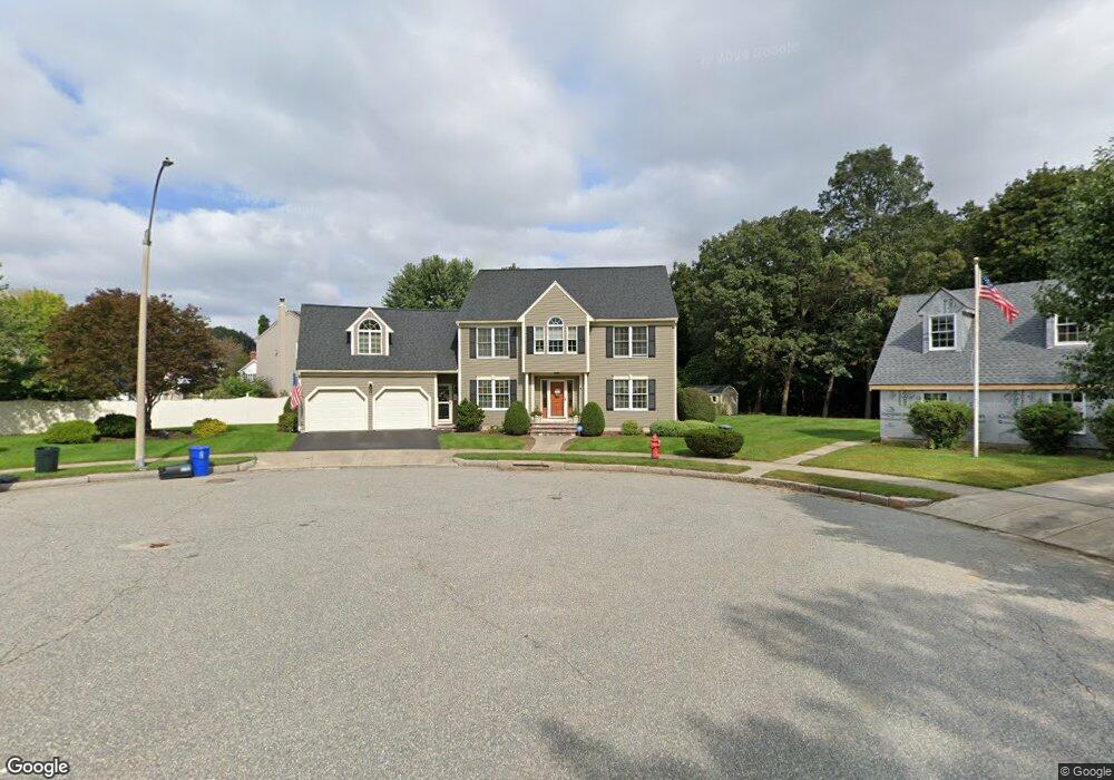
6 Daniel Dr Stoneham, MA 02180
Haywardville NeighborhoodEstimated Value: $1,172,538 - $1,374,000
4
Beds
2
Baths
2,917
Sq Ft
$432/Sq Ft
Est. Value
About This Home
This home is located at 6 Daniel Dr, Stoneham, MA 02180 and is currently estimated at $1,260,135, approximately $431 per square foot. 6 Daniel Dr is a home located in Middlesex County with nearby schools including Stoneham High School, Greater Boston Academy, and St. Patrick Elementary School.
Create a Home Valuation Report for This Property
The Home Valuation Report is an in-depth analysis detailing your home's value as well as a comparison with similar homes in the area
Home Values in the Area
Average Home Value in this Area
Tax History
| Year | Tax Paid | Tax Assessment Tax Assessment Total Assessment is a certain percentage of the fair market value that is determined by local assessors to be the total taxable value of land and additions on the property. | Land | Improvement |
|---|---|---|---|---|
| 2025 | $10,529 | $1,029,200 | $440,700 | $588,500 |
| 2024 | $9,767 | $922,300 | $400,700 | $521,600 |
| 2023 | $9,404 | $847,200 | $360,700 | $486,500 |
| 2022 | $8,403 | $807,200 | $350,700 | $456,500 |
| 2021 | $8,235 | $761,100 | $310,700 | $450,400 |
| 2020 | $8,152 | $755,500 | $310,700 | $444,800 |
| 2019 | $8,434 | $751,700 | $310,700 | $441,000 |
| 2018 | $8,241 | $703,800 | $290,700 | $413,100 |
| 2017 | $8,543 | $689,500 | $280,700 | $408,800 |
| 2016 | $8,265 | $650,800 | $280,700 | $370,100 |
| 2015 | $8,145 | $628,500 | $270,700 | $357,800 |
| 2014 | $7,785 | $577,100 | $235,700 | $341,400 |
Source: Public Records
Map
Nearby Homes
- 159 Franklin St Unit D2
- 159 Franklin St Unit C2
- 159 Franklin St Unit E6
- 137 Franklin St Unit 102
- 17 Franklin St
- 53 Perkins St
- 33 Lake Ave
- 6 Everett St
- 132 Walton Park
- 35 Wright St
- 51 Spring St
- 57 Park St
- 35 Maple Rd
- 8 Common St Unit 3
- 300 Park Terrace Dr Unit 354
- 10 Pomeworth St Unit A
- 601 Franklin St Unit 2
- 11 Ludlow Ave
- 4 Garfield Ave
- 15 Brookbridge Rd
- 8 Roberts Way
- 7 Daniel Dr
- 5 Daniel Dr
- 3 Roberts Way
- 6 Roberts Way
- 2 Daniel Dr
- 27 Dapper Darby Dr
- 25 Dapper Darby Dr
- 29 Dapper Darby Dr
- 4 Roberts Way
- 3 Daniel Dr
- 20 Dapper Darby Dr
- 31 Dapper Darby Dr
- 18 Dapper Darby Dr
- 23 Dapper Darby Dr
- 22 Dapper Darby Dr
- 26 Dapper Darby Dr
- 24 Dapper Darby Dr
- 33 Dapper Darby Dr
- 21 Dapper Darby Dr
Your Personal Tour Guide
Ask me questions while you tour the home.