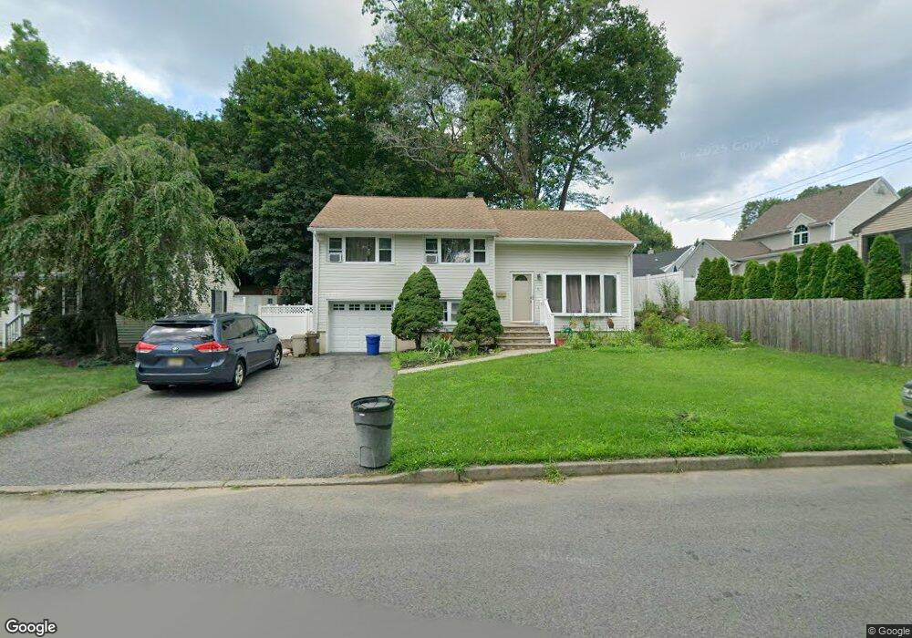
6 Devine Dr Mahwah, NJ 07430
Estimated Value: $585,188 - $651,000
--
Bed
--
Bath
1,639
Sq Ft
$377/Sq Ft
Est. Value
About This Home
This home is located at 6 Devine Dr, Mahwah, NJ 07430 and is currently estimated at $618,547, approximately $377 per square foot. 6 Devine Dr is a home located in Bergen County with nearby schools including Mahwah High School.
Ownership History
Date
Name
Owned For
Owner Type
Purchase Details
Closed on
Oct 26, 2015
Sold by
Morey Pamela
Bought by
Park Matthew and Park Jennifer
Current Estimated Value
Home Financials for this Owner
Home Financials are based on the most recent Mortgage that was taken out on this home.
Original Mortgage
$336,000
Outstanding Balance
$265,085
Interest Rate
3.88%
Mortgage Type
New Conventional
Estimated Equity
$353,462
Purchase Details
Closed on
Aug 8, 1996
Sold by
Schepisi John
Bought by
Morey Steven and Morey Pamela
Home Financials for this Owner
Home Financials are based on the most recent Mortgage that was taken out on this home.
Original Mortgage
$130,000
Interest Rate
8.08%
Create a Home Valuation Report for This Property
The Home Valuation Report is an in-depth analysis detailing your home's value as well as a comparison with similar homes in the area
Home Values in the Area
Average Home Value in this Area
Purchase History
| Date | Buyer | Sale Price | Title Company |
|---|---|---|---|
| Park Matthew | $420,000 | Professional Abstract | |
| Morey Steven | $130,000 | -- |
Source: Public Records
Mortgage History
| Date | Status | Borrower | Loan Amount |
|---|---|---|---|
| Open | Park Matthew | $336,000 | |
| Previous Owner | Morey Steven | $130,000 |
Source: Public Records
Tax History Compared to Growth
Tax History
| Year | Tax Paid | Tax Assessment Tax Assessment Total Assessment is a certain percentage of the fair market value that is determined by local assessors to be the total taxable value of land and additions on the property. | Land | Improvement |
|---|---|---|---|---|
| 2025 | $6,130 | $297,000 | $194,600 | $102,400 |
| 2024 | $6,050 | $297,000 | $194,600 | $102,400 |
| 2023 | $5,857 | $297,000 | $194,600 | $102,400 |
| 2022 | $5,857 | $297,000 | $194,600 | $102,400 |
| 2021 | $5,794 | $297,000 | $194,600 | $102,400 |
| 2020 | $5,655 | $297,000 | $194,600 | $102,400 |
| 2019 | $5,468 | $297,000 | $194,600 | $102,400 |
| 2018 | $5,391 | $297,000 | $194,600 | $102,400 |
| 2017 | $5,304 | $297,000 | $194,600 | $102,400 |
| 2016 | $5,189 | $297,000 | $194,600 | $102,400 |
| 2015 | $5,117 | $297,000 | $194,600 | $102,400 |
| 2014 | $5,031 | $297,000 | $194,600 | $102,400 |
Source: Public Records
Map
Nearby Homes
- 38 N Railroad Ave
- 17 Mountain Ave
- 34 N Railroad Ave
- 14 N Railroad Ave
- 13 Winter Terrace
- 128 Grove St
- 2054 Charles Ct
- 111 Moffatt Rd
- 2115 Henry Ct Unit 1
- 112 Moffatt Rd
- 37 Hillside Ave
- 2130 Isabelle Ct
- 136 Catherine Ave
- 2170 Kent Ct
- 7 Valley View Terrace
- 8 Valley View Terrace
- 19 Interstate St
- 199 Island Rd
- 29 Rockland Terrace
- 79 N Ramapo Ave