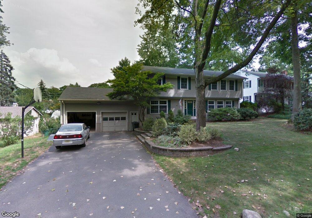
6 Drury Ln Demarest, NJ 07627
Estimated Value: $1,185,000 - $1,423,000
4
Beds
3
Baths
2,867
Sq Ft
$448/Sq Ft
Est. Value
About This Home
This home is located at 6 Drury Ln, Demarest, NJ 07627 and is currently estimated at $1,284,191, approximately $447 per square foot. 6 Drury Ln is a home located in Bergen County with nearby schools including County Road Elementary School, Luther Lee Emerson Elementary School, and Demarest Middle School.
Ownership History
Date
Name
Owned For
Owner Type
Purchase Details
Closed on
Aug 27, 2021
Sold by
Gioia Robert R and Gioia Karen L
Bought by
Xia Liangjie and Cao Xuanlu
Current Estimated Value
Home Financials for this Owner
Home Financials are based on the most recent Mortgage that was taken out on this home.
Original Mortgage
$799,000
Outstanding Balance
$727,031
Interest Rate
2.8%
Mortgage Type
New Conventional
Estimated Equity
$557,160
Purchase Details
Closed on
Nov 28, 1995
Sold by
Tomlinson Daniel
Bought by
Gioia Robert and Gioia Karen
Home Financials for this Owner
Home Financials are based on the most recent Mortgage that was taken out on this home.
Original Mortgage
$333,000
Interest Rate
7.44%
Create a Home Valuation Report for This Property
The Home Valuation Report is an in-depth analysis detailing your home's value as well as a comparison with similar homes in the area
Home Values in the Area
Average Home Value in this Area
Purchase History
| Date | Buyer | Sale Price | Title Company |
|---|---|---|---|
| Xia Liangjie | $940,000 | Old Republic Title Ins Co | |
| Gioia Robert | $370,000 | -- |
Source: Public Records
Mortgage History
| Date | Status | Borrower | Loan Amount |
|---|---|---|---|
| Open | Xia Liangjie | $799,000 | |
| Previous Owner | Gioia Robert | $333,000 |
Source: Public Records
Tax History
| Year | Tax Paid | Tax Assessment Tax Assessment Total Assessment is a certain percentage of the fair market value that is determined by local assessors to be the total taxable value of land and additions on the property. | Land | Improvement |
|---|---|---|---|---|
| 2025 | $18,639 | $1,122,700 | $562,400 | $560,300 |
| 2024 | $17,791 | $609,700 | $311,000 | $298,700 |
| 2023 | $17,309 | $609,700 | $311,000 | $298,700 |
| 2022 | $17,309 | $609,700 | $311,000 | $298,700 |
| 2021 | $16,044 | $579,400 | $311,000 | $268,400 |
| 2020 | $15,667 | $579,400 | $311,000 | $268,400 |
| 2019 | $15,215 | $579,400 | $311,000 | $268,400 |
| 2018 | $14,746 | $579,400 | $311,000 | $268,400 |
| 2017 | $14,392 | $579,400 | $311,000 | $268,400 |
| 2016 | $14,166 | $579,400 | $311,000 | $268,400 |
| 2015 | $13,975 | $579,400 | $311,000 | $268,400 |
| 2014 | $13,674 | $579,400 | $311,000 | $268,400 |
Source: Public Records
Map
Nearby Homes
Your Personal Tour Guide
Ask me questions while you tour the home.