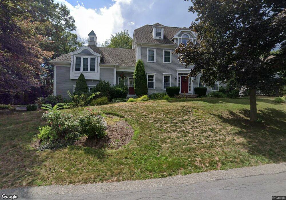
6 Dwiggins Path Hingham, MA 02043
Estimated Value: $1,732,000 - $2,349,000
4
Beds
5
Baths
3,116
Sq Ft
$632/Sq Ft
Est. Value
About This Home
This home is located at 6 Dwiggins Path, Hingham, MA 02043 and is currently estimated at $1,970,498, approximately $632 per square foot. 6 Dwiggins Path is a home located in Plymouth County with nearby schools including Plymouth River Elementary School, Hingham Middle School, and Hingham High School.
Ownership History
Date
Name
Owned For
Owner Type
Purchase Details
Closed on
Apr 26, 2013
Sold by
Doyle Michael P and Doyle Cynthia L
Bought by
Sloan John M and Sloan Karin A
Current Estimated Value
Home Financials for this Owner
Home Financials are based on the most recent Mortgage that was taken out on this home.
Original Mortgage
$724,000
Outstanding Balance
$516,702
Interest Rate
3.64%
Mortgage Type
Purchase Money Mortgage
Estimated Equity
$1,453,796
Purchase Details
Closed on
Apr 20, 2004
Sold by
Smith Peter F and Smith Sandra T
Bought by
Doyle Michael P and Doyle Cynthia L
Purchase Details
Closed on
Jun 4, 2001
Sold by
Wood Neil B and Wood Christine S
Bought by
Smith Peter F and Smith Sandra T
Purchase Details
Closed on
Sep 11, 1995
Sold by
Century Homes Rt and Bowering Daivd J
Bought by
Wood Christine S and Wood Neil B
Create a Home Valuation Report for This Property
The Home Valuation Report is an in-depth analysis detailing your home's value as well as a comparison with similar homes in the area
Purchase History
| Date | Buyer | Sale Price | Title Company |
|---|---|---|---|
| Sloan John M | $905,000 | -- | |
| Doyle Michael P | $1,024,900 | -- | |
| Doyle Michael P | $1,024,900 | -- | |
| Smith Peter F | $786,900 | -- | |
| Smith Peter F | $786,900 | -- | |
| Wood Christine S | $442,000 | -- |
Source: Public Records
Mortgage History
| Date | Status | Borrower | Loan Amount |
|---|---|---|---|
| Open | Sloan John M | $724,000 | |
| Previous Owner | Wood Christine S | $721,000 |
Source: Public Records
Tax History
| Year | Tax Paid | Tax Assessment Tax Assessment Total Assessment is a certain percentage of the fair market value that is determined by local assessors to be the total taxable value of land and additions on the property. | Land | Improvement |
|---|---|---|---|---|
| 2025 | $18,232 | $1,705,500 | $586,800 | $1,118,700 |
| 2024 | $17,451 | $1,608,400 | $586,800 | $1,021,600 |
| 2023 | $15,167 | $1,516,700 | $586,800 | $929,900 |
| 2022 | $14,815 | $1,281,600 | $529,700 | $751,900 |
| 2021 | $14,114 | $1,196,100 | $509,300 | $686,800 |
| 2020 | $13,882 | $1,204,000 | $509,300 | $694,700 |
| 2019 | $13,701 | $1,160,100 | $509,300 | $650,800 |
| 2018 | $13,654 | $1,160,100 | $509,300 | $650,800 |
| 2017 | $13,528 | $1,104,300 | $529,700 | $574,600 |
| 2016 | $13,478 | $1,079,100 | $504,500 | $574,600 |
| 2015 | $13,064 | $1,042,600 | $480,400 | $562,200 |
Source: Public Records
Map
Nearby Homes
- 156 Fort Hill St
- 6 Brewer Way
- 6 Adams Ct
- 7 Lewis Ct
- 225 South St Unit 1
- 1 Squirrel Hill Ln
- 425 East St
- 1206 Tuckers Ln Unit 1206
- 21 Hersey St
- 30 Puritan Rd
- 1 Hemlock Rd
- 19 Lantern Ln
- 5 Endicott St
- 11 Berkley Cir
- 43 Filomena St
- 428 Main St
- 92 Doris Dr
- 43 Park View Dr
- 109 Merryknoll Rd
- 168 Stayner Dr Unit 168
- 6 Dwiggins Pathe
- 8 Dwiggins Path
- 7 Sherman Way
- 4 Dwiggins Path
- 3 Dwiggins Path
- 5 Sherman Way
- 5 Dwiggins Path
- 7 Isaac Sprague Dr
- 161 Fort Hill St
- 5 Isaac Sprague Dr
- 7 Dwiggins Path
- 143 Fort Hill St
- 141 Fort Hill St
- 8 Sherman Way
- 165 Fort Hill St
- 165 Fort Hill St
- 3 Sherman Way
- 9 Isaac Sprague Dr
- 137 Fort Hill St
- 2 Isaac Sprague Dr
Your Personal Tour Guide
Ask me questions while you tour the home.