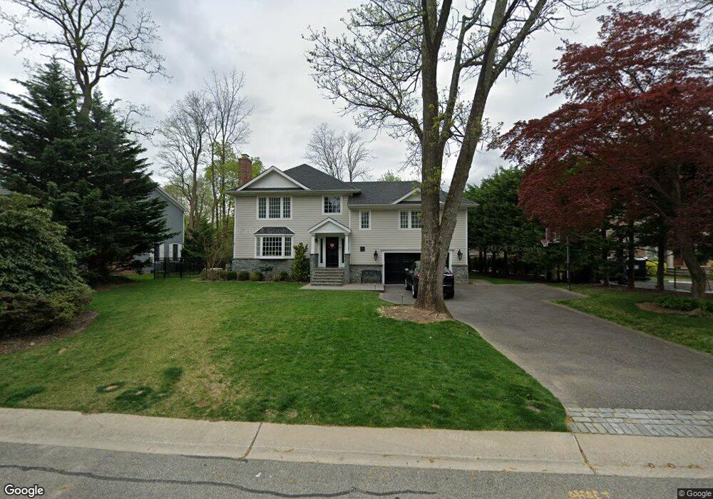
6 E High Rd Port Washington, NY 11050
Estimated Value: $1,794,000 - $2,575,038
3
Beds
3
Baths
3,709
Sq Ft
$589/Sq Ft
Est. Value
About This Home
This home is located at 6 E High Rd, Port Washington, NY 11050 and is currently estimated at $2,184,519, approximately $588 per square foot. 6 E High Rd is a home located in Nassau County with nearby schools including South Salem Elementary School, Carrie Palmer Weber Middle School, and Paul D. Schreiber Senior High School.
Ownership History
Date
Name
Owned For
Owner Type
Purchase Details
Closed on
Jul 1, 2010
Sold by
Flood Edward P and Flood Rebecca
Bought by
Marshall John and Marshall Allison
Current Estimated Value
Home Financials for this Owner
Home Financials are based on the most recent Mortgage that was taken out on this home.
Original Mortgage
$729,750
Outstanding Balance
$478,317
Interest Rate
4.76%
Mortgage Type
Purchase Money Mortgage
Estimated Equity
$1,706,202
Purchase Details
Closed on
Jun 15, 2001
Sold by
Dardashtian Forhad
Bought by
Flood Edward P
Create a Home Valuation Report for This Property
The Home Valuation Report is an in-depth analysis detailing your home's value as well as a comparison with similar homes in the area
Home Values in the Area
Average Home Value in this Area
Purchase History
| Date | Buyer | Sale Price | Title Company |
|---|---|---|---|
| Marshall John | $918,000 | -- | |
| Flood Edward P | $635,000 | George Prios |
Source: Public Records
Mortgage History
| Date | Status | Borrower | Loan Amount |
|---|---|---|---|
| Open | Marshall John | $729,750 |
Source: Public Records
Tax History
| Year | Tax Paid | Tax Assessment Tax Assessment Total Assessment is a certain percentage of the fair market value that is determined by local assessors to be the total taxable value of land and additions on the property. | Land | Improvement |
|---|---|---|---|---|
| 2025 | $21,874 | $1,382 | $664 | $718 |
| 2024 | $4,338 | $1,459 | $701 | $758 |
Source: Public Records
Map
Nearby Homes
- 225 Port Washington Blvd
- 97 Crabapple Rd
- 499 Stonytown Rd
- 38 Hewlett Ln
- 220 Elderfields Rd
- 265 Northwoods Rd
- 40 Hewlett Ln
- 126 Northwoods Rd
- 60 Wakefield Ave
- 191 Elderfields Rd
- 84 Middle Neck Rd
- 32 Barnard Place
- 448 Abbey Rd N
- 13 Chanticlare Dr
- 26 Birchdale Ln
- 30 Bonnie Heights Rd
- 12 Knollwood Rd
- 409 Abbey Rd
- 539 Manhasset Woods Rd
- 16 Cliff Way
Your Personal Tour Guide
Ask me questions while you tour the home.