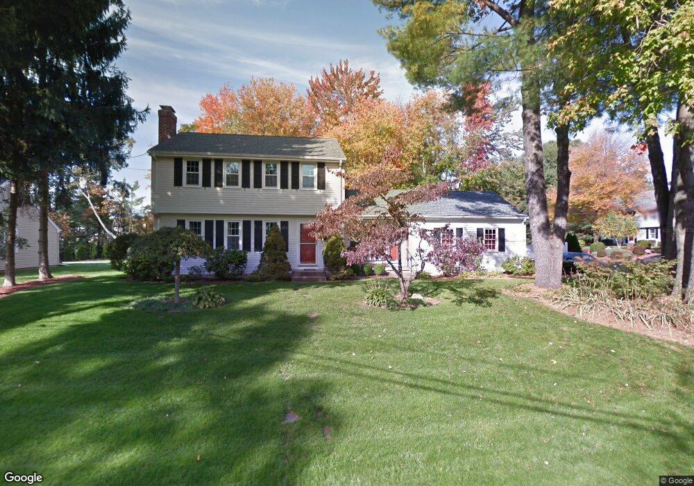
6 Fireside Ln Bristol, CT 06010
Forestville NeighborhoodEstimated Value: $359,000 - $464,000
3
Beds
2
Baths
1,588
Sq Ft
$257/Sq Ft
Est. Value
About This Home
This home is located at 6 Fireside Ln, Bristol, CT 06010 and is currently estimated at $407,897, approximately $256 per square foot. 6 Fireside Ln is a home located in Hartford County with nearby schools including Bristol Central High School, St Matthew School, and Great Beginnings.
Ownership History
Date
Name
Owned For
Owner Type
Purchase Details
Closed on
Aug 30, 2018
Sold by
Veronesi Maureen L
Bought by
Veronesi Michael A
Current Estimated Value
Create a Home Valuation Report for This Property
The Home Valuation Report is an in-depth analysis detailing your home's value as well as a comparison with similar homes in the area
Home Values in the Area
Average Home Value in this Area
Purchase History
| Date | Buyer | Sale Price | Title Company |
|---|---|---|---|
| Veronesi Michael A | -- | -- |
Source: Public Records
Mortgage History
| Date | Status | Borrower | Loan Amount |
|---|---|---|---|
| Previous Owner | Veronesi Michael A | $60,000 | |
| Previous Owner | Veronesi Michael A | $40,000 | |
| Previous Owner | Veronesi Michael A | $12,960 |
Source: Public Records
Tax History Compared to Growth
Tax History
| Year | Tax Paid | Tax Assessment Tax Assessment Total Assessment is a certain percentage of the fair market value that is determined by local assessors to be the total taxable value of land and additions on the property. | Land | Improvement |
|---|---|---|---|---|
| 2025 | $6,655 | $197,190 | $66,080 | $131,110 |
| 2024 | $6,281 | $197,190 | $66,080 | $131,110 |
| 2023 | $5,985 | $197,190 | $66,080 | $131,110 |
| 2022 | $5,380 | $140,280 | $51,660 | $88,620 |
| 2021 | $5,380 | $140,280 | $51,660 | $88,620 |
| 2020 | $5,380 | $140,280 | $51,660 | $88,620 |
| 2019 | $5,338 | $140,280 | $51,660 | $88,620 |
| 2018 | $5,174 | $140,280 | $51,660 | $88,620 |
| 2017 | $4,926 | $136,710 | $54,670 | $82,040 |
| 2016 | $4,926 | $136,710 | $54,670 | $82,040 |
| 2015 | $4,732 | $136,710 | $54,670 | $82,040 |
| 2014 | $4,732 | $136,710 | $54,670 | $82,040 |
Source: Public Records
Map
Nearby Homes
- 143 Redstone St
- 5 Cornell St
- 25 Leon Rd
- 245 W Main St
- 84 Dino Rd
- 25 Zack Ln
- 56 Bohemia St
- 132 Hollyberry Ln
- 26 Skyline Dr
- 28 Wilson St
- 683 Pine St
- 15 Charlies Way
- 49 Lincoln St
- 158 E Main St
- 2 Charlies Way
- 429 Redstone Hill Rd
- 63 Kenney St
- 14 Mckernan Dr
- 180 S Washington St Unit 12
- 279 Redstone Hill Rd Unit 75
- 14 Fireside Ln
- 86 Candlewood Dr
- 5 Fireside Ln
- 100 Candlewood Dr
- 24 Fireside Ln
- 21 Fireside Ln
- 24 Aloha Ln
- 76 Candlewood Dr
- 118 Candlewood Dr
- 121 Candlewood Dr
- 14 Aloha Ln
- 34 Fireside Ln
- 35 Fireside Ln
- 4 Aloha Ln
- 131 Candlewood Dr
- 27 Aloha Ln
- 32 Lantern Hill Rd
- 121 Harmony Rd
- 90 Rogers Rd
- 98 Rogers Rd