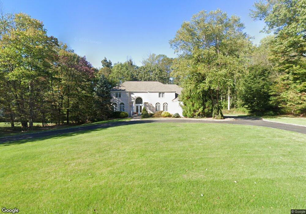
6 Firethorn Ct Warren, NJ 07059
Estimated Value: $1,894,000 - $2,174,000
--
Bed
--
Bath
5,713
Sq Ft
$346/Sq Ft
Est. Value
About This Home
This home is located at 6 Firethorn Ct, Warren, NJ 07059 and is currently estimated at $1,978,260, approximately $346 per square foot. 6 Firethorn Ct is a home located in Somerset County with nearby schools including Mt. Horeb School, Warren Middle School, and Watchung Hills Regional High School.
Ownership History
Date
Name
Owned For
Owner Type
Purchase Details
Closed on
Jul 2, 1998
Sold by
Paragano Evangeline
Bought by
Muthard David A and Muthard Deborah A
Current Estimated Value
Home Financials for this Owner
Home Financials are based on the most recent Mortgage that was taken out on this home.
Original Mortgage
$350,000
Outstanding Balance
$71,750
Interest Rate
7.02%
Estimated Equity
$1,906,510
Purchase Details
Closed on
Feb 21, 1997
Sold by
Paragano & And Dan Mar Asso
Bought by
Paragano Emil and Paragano Evangeline
Create a Home Valuation Report for This Property
The Home Valuation Report is an in-depth analysis detailing your home's value as well as a comparison with similar homes in the area
Home Values in the Area
Average Home Value in this Area
Purchase History
| Date | Buyer | Sale Price | Title Company |
|---|---|---|---|
| Muthard David A | $980,000 | -- | |
| Paragano Emil | $340,000 | -- |
Source: Public Records
Mortgage History
| Date | Status | Borrower | Loan Amount |
|---|---|---|---|
| Open | Muthard David A | $350,000 |
Source: Public Records
Tax History Compared to Growth
Tax History
| Year | Tax Paid | Tax Assessment Tax Assessment Total Assessment is a certain percentage of the fair market value that is determined by local assessors to be the total taxable value of land and additions on the property. | Land | Improvement |
|---|---|---|---|---|
| 2025 | $27,030 | $1,574,500 | $403,000 | $1,171,500 |
| 2024 | $27,030 | $1,470,600 | $376,700 | $1,093,900 |
| 2023 | $26,529 | $1,368,900 | $345,600 | $1,023,300 |
| 2022 | $26,030 | $1,310,000 | $329,100 | $980,900 |
| 2021 | $26,349 | $1,269,200 | $316,500 | $952,700 |
| 2020 | $26,421 | $1,276,400 | $316,500 | $959,900 |
| 2019 | $26,247 | $1,287,900 | $316,500 | $971,400 |
| 2018 | $25,348 | $1,275,700 | $326,300 | $949,400 |
| 2017 | $25,691 | $1,292,300 | $302,100 | $990,200 |
| 2016 | $25,593 | $1,273,900 | $302,100 | $971,800 |
| 2015 | $25,672 | $1,253,500 | $282,400 | $971,100 |
| 2014 | $24,169 | $1,186,500 | $268,900 | $917,600 |
Source: Public Records
Map
Nearby Homes
- 21 Angus Ln
- 50 Round Top Rd
- 19 Robin Rd
- 7 Nottingham Way
- 33 Skyline Dr
- 120-122 Mountainview Rd
- 21 Foxglove Dr
- 24 Old Forge Dr
- 27 Elm Ave
- 29 Elm Ave
- 14 Sunrise Dr
- 5 2nd St
- 6 Hardwood Ct
- 14 Downingtown Ct
- 6 Mount Horeb Rd
- 144 Liberty Corner Rd
- 24 Liberty Corner Rd
- 341 Penns Way Unit D2
- 2 Monmouth Rd
- 3 Brandywine Place
- 8 Firethorn Ct
- 4 Firethorn Ct
- 6 Fox Hill Dr W
- 6 Fox Hill Dr
- 8 Fox Hill Dr W
- 8 Fox Hill Dr
- 3 Firethorn Ct
- 2 Firethorn Ct
- 5 Black Oak Trail
- 4 Fox Hill Dr W
- 30 Nottingham Way
- 4 Fox Hill Dr
- 7 Fox Hill Dr
- 7 Fox Hill Dr W
- 6 Black Oak Trail
- 5 Fox Hill Dr W
- 61 Round Top Rd
- 9 Fox Hill Dr
- 9 Fox Hill Dr W
- 1 Angus Ln