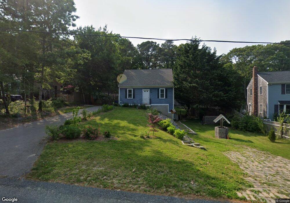
6 Flintlock Ln Sagamore Beach, MA 2562
Estimated Value: $356,000 - $497,000
3
Beds
2
Baths
1,372
Sq Ft
$305/Sq Ft
Est. Value
About This Home
This home is located at 6 Flintlock Ln, Sagamore Beach, MA 2562 and is currently estimated at $417,974, approximately $304 per square foot. 6 Flintlock Ln is a home located in Barnstable County with nearby schools including Bourne High School, Bridgeview Montessori School, and New Testament Christian School.
Ownership History
Date
Name
Owned For
Owner Type
Purchase Details
Closed on
Mar 5, 2013
Sold by
Cape Cod Town Of
Bought by
Campinha Amy
Current Estimated Value
Home Financials for this Owner
Home Financials are based on the most recent Mortgage that was taken out on this home.
Original Mortgage
$1
Outstanding Balance
$1
Interest Rate
3.43%
Mortgage Type
Purchase Money Mortgage
Purchase Details
Closed on
Dec 21, 2007
Sold by
Roberts Thomas
Bought by
Habitat For Humanity C
Create a Home Valuation Report for This Property
The Home Valuation Report is an in-depth analysis detailing your home's value as well as a comparison with similar homes in the area
Home Values in the Area
Average Home Value in this Area
Purchase History
| Date | Buyer | Sale Price | Title Company |
|---|---|---|---|
| Campinha Amy | $133,800 | -- | |
| Habitat For Humanity C | -- | -- | |
| Habitat For Humanity C | -- | -- |
Source: Public Records
Mortgage History
| Date | Status | Borrower | Loan Amount |
|---|---|---|---|
| Open | Habitat For Humanity C | $1 |
Source: Public Records
Tax History
| Year | Tax Paid | Tax Assessment Tax Assessment Total Assessment is a certain percentage of the fair market value that is determined by local assessors to be the total taxable value of land and additions on the property. | Land | Improvement |
|---|---|---|---|---|
| 2025 | $1,953 | $250,010 | $101,710 | $148,300 |
| 2024 | $1,922 | $0 | $0 | $0 |
| 2023 | $1,880 | $213,360 | $0 | $0 |
| 2022 | $1,788 | $177,170 | $0 | $0 |
| 2021 | $1,748 | $162,300 | $0 | $0 |
| 2020 | $8,411 | $153,870 | $0 | $0 |
| 2019 | $1,575 | $149,860 | $0 | $0 |
| 2018 | $6,909 | $143,580 | $0 | $0 |
| 2017 | $1,464 | $142,170 | $0 | $0 |
| 2016 | $1,415 | $139,250 | $0 | $0 |
| 2015 | $1,343 | $133,380 | $0 | $0 |
Source: Public Records
Map
Nearby Homes
- 38 Siasconset Dr
- 8 Driftwood Ln
- 133 Phillips Rd
- 10 Tecumseh Rd
- 17 Andrew Rd
- 16 Ocean Pines Dr Unit B
- 64 Hunters Brook Rd
- 18 Gibbs Rd
- 0 State Rd
- 896 Sandwich Rd
- 51 Commonwealth Ave
- 51 Commonwealth Ave
- 17 Ridgehill Ln
- 11 Village Green Dr Unit B
- 11 Marconi St
- 8 Jillian Dr
- 71 Tupper Rd
- 150 Herring Pond Rd
- 16 Town Neck Rd
- 6 Aspen Rd
- 4 Flintlock Ln
- 8 Flintlock Ln
- 10 Flintlock Ln
- 5 Flintlock Ln
- 4 Marsh Pond Rd
- 6 Marsh Pond Rd
- 7 Flintlock Ln
- 199 Phillips Rd
- 206-A Phillips Rd
- 186 Phillips Rd
- 208 Phillips Rd
- 196 Phillips Rd
- 200 Phillips Rd
- 12 Flintlock Ln
- 9 Flintlock Ln
- 5 Marsh Pond Rd
- 7 Marsh Pond Rd
- 236 Williston Rd
- 10 Marsh Pond Rd
- 4 Fox Run Rd
Your Personal Tour Guide
Ask me questions while you tour the home.