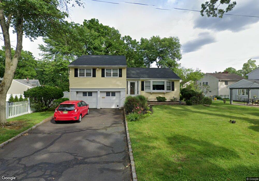
6 Glen Ave Cranford, NJ 07016
Estimated Value: $846,583 - $978,000
--
Bed
--
Bath
1,943
Sq Ft
$472/Sq Ft
Est. Value
About This Home
This home is located at 6 Glen Ave, Cranford, NJ 07016 and is currently estimated at $917,396, approximately $472 per square foot. 6 Glen Ave is a home located in Union County with nearby schools including Cranford Sr High School, St Michael School, and Mother Seton Regional High School.
Ownership History
Date
Name
Owned For
Owner Type
Purchase Details
Closed on
Aug 11, 2000
Sold by
Buchsbaum Adam L and Fernandez Maria F
Bought by
Mckinney William B and Mckinney Nicole S
Current Estimated Value
Home Financials for this Owner
Home Financials are based on the most recent Mortgage that was taken out on this home.
Original Mortgage
$274,000
Interest Rate
7.8%
Purchase Details
Closed on
Nov 16, 1994
Sold by
Yutsus Joseph and Yutsus Karen L
Bought by
Buchsbaum Adam L and Fernandez Maria F
Create a Home Valuation Report for This Property
The Home Valuation Report is an in-depth analysis detailing your home's value as well as a comparison with similar homes in the area
Home Values in the Area
Average Home Value in this Area
Purchase History
| Date | Buyer | Sale Price | Title Company |
|---|---|---|---|
| Mckinney William B | $342,500 | First American Title Ins Co | |
| Buchsbaum Adam L | $260,000 | -- |
Source: Public Records
Mortgage History
| Date | Status | Borrower | Loan Amount |
|---|---|---|---|
| Closed | Mckinney William B | $274,000 |
Source: Public Records
Tax History Compared to Growth
Tax History
| Year | Tax Paid | Tax Assessment Tax Assessment Total Assessment is a certain percentage of the fair market value that is determined by local assessors to be the total taxable value of land and additions on the property. | Land | Improvement |
|---|---|---|---|---|
| 2025 | $15,402 | $227,200 | $94,800 | $132,400 |
| 2024 | $15,147 | $227,200 | $94,800 | $132,400 |
| 2023 | $15,147 | $227,200 | $94,800 | $132,400 |
| 2022 | $15,022 | $227,200 | $94,800 | $132,400 |
| 2021 | $14,957 | $227,200 | $94,800 | $132,400 |
| 2020 | $14,909 | $227,200 | $94,800 | $132,400 |
| 2019 | $14,813 | $227,200 | $94,800 | $132,400 |
| 2018 | $14,545 | $227,200 | $94,800 | $132,400 |
| 2017 | $13,829 | $223,700 | $94,800 | $128,900 |
| 2016 | $13,326 | $223,700 | $94,800 | $128,900 |
| 2015 | $12,977 | $223,700 | $94,800 | $128,900 |
| 2014 | $12,711 | $223,700 | $94,800 | $128,900 |
Source: Public Records
Map
Nearby Homes
- 10 Alan O Kell Place
- 19 Hawthorne St
- 18 Colin Kelly St
- 45 Hillcrest Ave
- 113 Retford Ave
- 108 James Ave
- 11 Mendell Ave
- 1920 Boynton Ave
- 7 Iroquois Rd
- 5 Iroquois Rd
- 247 Walnut Ave
- 37 Broad St
- 29 Coldevin Rd
- 13 Sunset Dr
- 15 Sunset Dr
- 166 N Lehigh Ave
- 205 Locust Ave
- 1619 Raritan Rd
- 22 Sunset Dr
- 1 Broad St
- 524 Lexington Ave
- 9 Shetland Dr
- 7 Shetland Dr
- 522 Lexington Ave
- 526 Lexington Ave
- 528 Lexington Ave
- 5 Shetland Dr
- 20 Chester Lang Place
- 13 Shetland Dr
- 5 Glen Ave
- 3 Glen Ave
- 530 Lexington Ave
- 18 Chester Lang Place
- 1 Glen Ave
- 521 Lexington Ave
- 3 Shetland Dr
- 532 Lexington Ave
- 15 Shetland Dr
- 8 Shetland Dr
- 6 Shetland Dr