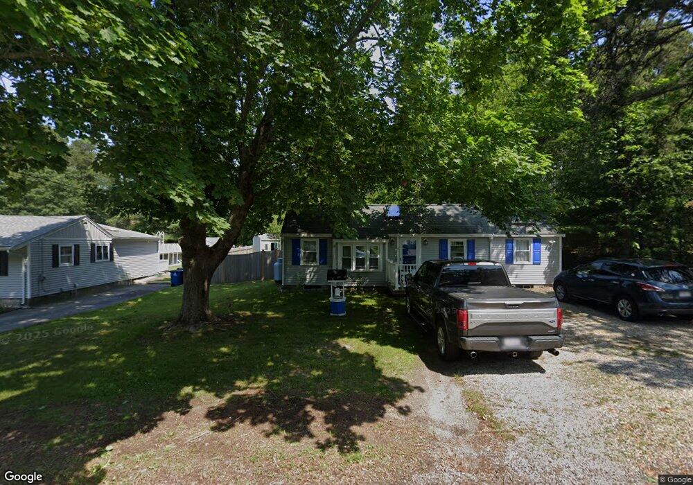
6 Great Wind Dr Plymouth, MA 02360
Estimated Value: $374,000 - $470,000
2
Beds
1
Bath
768
Sq Ft
$557/Sq Ft
Est. Value
About This Home
This home is located at 6 Great Wind Dr, Plymouth, MA 02360 and is currently estimated at $427,393, approximately $556 per square foot. 6 Great Wind Dr is a home located in Plymouth County with nearby schools including South Elementary School, Plymouth South Middle School, and Plymouth South High School.
Ownership History
Date
Name
Owned For
Owner Type
Purchase Details
Closed on
Sep 8, 2006
Sold by
Rowland Kimberly A
Bought by
Rowland Christopher and Rowland Kimberly A
Current Estimated Value
Home Financials for this Owner
Home Financials are based on the most recent Mortgage that was taken out on this home.
Original Mortgage
$261,000
Outstanding Balance
$157,763
Interest Rate
6.79%
Mortgage Type
Purchase Money Mortgage
Estimated Equity
$269,630
Purchase Details
Closed on
Jun 30, 2000
Sold by
Burch Clayton W and Burch Lisa M
Bought by
Rowland Kimberly A
Purchase Details
Closed on
Oct 2, 1992
Sold by
Lynch Michael P
Bought by
Burch Clayton W and Burch Lisa M
Create a Home Valuation Report for This Property
The Home Valuation Report is an in-depth analysis detailing your home's value as well as a comparison with similar homes in the area
Home Values in the Area
Average Home Value in this Area
Purchase History
| Date | Buyer | Sale Price | Title Company |
|---|---|---|---|
| Rowland Christopher | -- | -- | |
| Rowland Kimberly A | $144,400 | -- | |
| Burch Clayton W | $75,000 | -- | |
| Burch Clayton W | $75,000 | -- |
Source: Public Records
Mortgage History
| Date | Status | Borrower | Loan Amount |
|---|---|---|---|
| Open | Burch Clayton W | $261,000 | |
| Previous Owner | Burch Clayton W | $241,250 |
Source: Public Records
Tax History Compared to Growth
Tax History
| Year | Tax Paid | Tax Assessment Tax Assessment Total Assessment is a certain percentage of the fair market value that is determined by local assessors to be the total taxable value of land and additions on the property. | Land | Improvement |
|---|---|---|---|---|
| 2025 | $4,160 | $327,800 | $173,700 | $154,100 |
| 2024 | $4,035 | $313,500 | $170,100 | $143,400 |
| 2023 | $3,855 | $281,200 | $148,500 | $132,700 |
| 2022 | $3,598 | $233,200 | $135,000 | $98,200 |
| 2021 | $3,520 | $217,800 | $135,000 | $82,800 |
| 2020 | $3,144 | $192,300 | $131,400 | $60,900 |
| 2019 | $2,928 | $177,000 | $117,000 | $60,000 |
| 2018 | $2,765 | $168,000 | $108,000 | $60,000 |
| 2017 | $2,716 | $163,800 | $108,000 | $55,800 |
| 2016 | $2,519 | $154,800 | $99,000 | $55,800 |
| 2015 | $2,406 | $154,800 | $99,000 | $55,800 |
| 2014 | $2,415 | $159,600 | $99,000 | $60,600 |
Source: Public Records
Map
Nearby Homes
- 19 Great Wind Dr
- 15 S Wind Dr
- 2 Wind Rose Ln
- 28 Paulette Terrace
- 206R Bourne Rd
- 196 Bourne Rd
- 20 Towering Trees Rd
- 21 Daisy Ln
- 26 Daisy Ln
- 11 Trumpet Vine Ln
- 31 Sunflower Way
- 18 Scarlet Dr
- 97 Sunflower Way
- 464 Lunns Way
- 7 River Birch Way
- 455 Lunns Way
- 5 Bearberry Path Unit 5
- 5 Daylily Dr Unit 5
- 43 Freeman Dr
- 119 Nathan Ln
- 4 Great Wind Dr
- 2 Great Wind Dr
- 10 Great Wind Dr
- 2R Great Wind Dr
- 23 Mooring Cir
- 7 Great Wind Dr
- 9 Great Wind Dr
- 12 Great Wind Dr
- 1 Wallwind Dr
- 3 Wall Wind Dr
- 6 Wallwind Dr
- 3 Wallwind Dr
- 6 Tradewind Ln
- 24 Mooring Cir
- 7 Wallwind Dr
- 10 Tradewind Ln
- 12 Tradewind Ln
- 3 S Wind Dr
- 15 Mooring Cir
- 3 Tradewind Ln