Estimated Value: $541,000 - $581,000
4
Beds
2
Baths
1,177
Sq Ft
$472/Sq Ft
Est. Value
About This Home
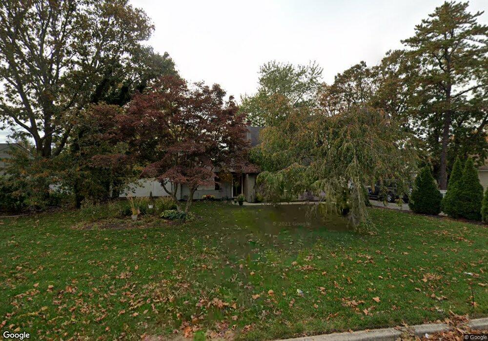
This home is located at 6 Groton Ln, Coram, NY 11727 and is currently estimated at $555,976, approximately $472 per square foot. 6 Groton Ln is a home located in Suffolk County with nearby schools including Longwood Middle School, Longwood Junior High School, and Longwood Senior High School.
Ownership History
Date
Name
Owned For
Owner Type
Purchase Details
Closed on
Apr 9, 2010
Sold by
Kam Development Inc
Bought by
Mastriano Nicholas J and Mastriano Danielle
Current Estimated Value
Home Financials for this Owner
Home Financials are based on the most recent Mortgage that was taken out on this home.
Original Mortgage
$268,400
Outstanding Balance
$183,134
Interest Rate
5.5%
Mortgage Type
FHA
Estimated Equity
$372,842
Purchase Details
Closed on
Feb 9, 2009
Sold by
Krum M Gabriela
Bought by
Minasion Kevin
Purchase Details
Closed on
Aug 29, 2006
Sold by
Marienson Rose Marie Fred
Bought by
Krumm Gabriela
Purchase Details
Closed on
Aug 21, 2002
Sold by
Consiglio Martensen Rosemarie
Bought by
Martensen Fred and Consiglio Martensen Rosemarie
Purchase Details
Closed on
Oct 29, 1993
Sold by
Miles John
Bought by
Busch Properties Inc
Create a Home Valuation Report for This Property
The Home Valuation Report is an in-depth analysis detailing your home's value as well as a comparison with similar homes in the area
Home Values in the Area
Average Home Value in this Area
Purchase History
| Date | Buyer | Sale Price | Title Company |
|---|---|---|---|
| Mastriano Nicholas J | $273,500 | -- | |
| Minasion Kevin | $150,000 | Dennis Masino | |
| Krumm Gabriela | $399,000 | Richard Zinn | |
| Martensen Fred | -- | -- | |
| Busch Properties Inc | $122,500 | Chicago Title Insurance Co |
Source: Public Records
Mortgage History
| Date | Status | Borrower | Loan Amount |
|---|---|---|---|
| Open | Mastriano Nicholas J | $268,400 |
Source: Public Records
Tax History Compared to Growth
Tax History
| Year | Tax Paid | Tax Assessment Tax Assessment Total Assessment is a certain percentage of the fair market value that is determined by local assessors to be the total taxable value of land and additions on the property. | Land | Improvement |
|---|---|---|---|---|
| 2024 | $10,147 | $2,350 | $300 | $2,050 |
| 2023 | $10,147 | $2,350 | $300 | $2,050 |
| 2022 | $8,945 | $2,350 | $300 | $2,050 |
| 2021 | $8,945 | $2,350 | $300 | $2,050 |
| 2020 | $9,199 | $2,350 | $300 | $2,050 |
| 2019 | $9,199 | $0 | $0 | $0 |
| 2018 | $8,716 | $2,350 | $300 | $2,050 |
| 2017 | $8,716 | $2,350 | $300 | $2,050 |
| 2016 | $8,207 | $2,250 | $300 | $1,950 |
| 2015 | -- | $2,250 | $300 | $1,950 |
| 2014 | -- | $2,250 | $300 | $1,950 |
Source: Public Records
Map
Nearby Homes
- 48 Walnut St
- 10 Royal Dr
- 42 Chestnut St
- 38 Glenmere Ln
- 64 Chestnut St
- 5 Wynville Ct
- 29 El Camino Ct
- 27 El Camino Ct Unit E27
- 70 Fairfax Dr
- 15 Denver Ct Unit 15
- 33 Whitfield Ln
- 98 Wedgewood Dr
- 52 Andover Dr
- 19 Redwood Ct Unit 19
- 41 Winside Ln
- 3538 Gibbs Rd
- 22 Howe Rd
- 9 Sierra Ct
- 15 Sierra Ct Unit S15
- 80 Pointe Cir S Unit 80 - Upper