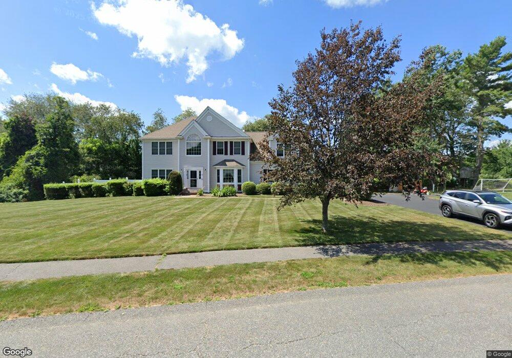
6 Harvest Ln Halifax, MA 02338
Estimated Value: $798,000 - $857,000
4
Beds
3
Baths
3,500
Sq Ft
$239/Sq Ft
Est. Value
About This Home
This home is located at 6 Harvest Ln, Halifax, MA 02338 and is currently estimated at $836,400, approximately $238 per square foot. 6 Harvest Ln is a home located in Plymouth County with nearby schools including Silver Lake Regional High School, Halifax Elementary School, and Silver Lake Regional Middle School.
Ownership History
Date
Name
Owned For
Owner Type
Purchase Details
Closed on
Apr 6, 2011
Sold by
Li Brian and Li Wendy
Bought by
Bryan Edward J and Bryan Vanessa R
Current Estimated Value
Home Financials for this Owner
Home Financials are based on the most recent Mortgage that was taken out on this home.
Original Mortgage
$452,237
Outstanding Balance
$318,482
Interest Rate
5.25%
Mortgage Type
FHA
Estimated Equity
$517,918
Purchase Details
Closed on
Apr 1, 2005
Sold by
Harvest Lane Bldrs Llc
Bought by
Li Brian and Li Wendy
Home Financials for this Owner
Home Financials are based on the most recent Mortgage that was taken out on this home.
Original Mortgage
$290,000
Interest Rate
5.61%
Mortgage Type
Purchase Money Mortgage
Create a Home Valuation Report for This Property
The Home Valuation Report is an in-depth analysis detailing your home's value as well as a comparison with similar homes in the area
Home Values in the Area
Average Home Value in this Area
Purchase History
| Date | Buyer | Sale Price | Title Company |
|---|---|---|---|
| Bryan Edward J | $464,000 | -- | |
| Li Brian | $569,000 | -- |
Source: Public Records
Mortgage History
| Date | Status | Borrower | Loan Amount |
|---|---|---|---|
| Open | Bryan Edward J | $452,237 | |
| Previous Owner | Li Brian | $384,000 | |
| Previous Owner | Li Brian | $188,900 | |
| Previous Owner | Li Brian | $290,000 |
Source: Public Records
Tax History Compared to Growth
Tax History
| Year | Tax Paid | Tax Assessment Tax Assessment Total Assessment is a certain percentage of the fair market value that is determined by local assessors to be the total taxable value of land and additions on the property. | Land | Improvement |
|---|---|---|---|---|
| 2025 | $10,506 | $736,200 | $200,400 | $535,800 |
| 2024 | $10,290 | $714,600 | $192,700 | $521,900 |
| 2023 | $9,874 | $663,600 | $187,000 | $476,600 |
| 2022 | $9,585 | $598,700 | $167,000 | $431,700 |
| 2021 | $9,251 | $532,000 | $160,600 | $371,400 |
| 2020 | $8,863 | $508,200 | $160,600 | $347,600 |
| 2019 | $8,679 | $496,800 | $155,900 | $340,900 |
| 2018 | $8,315 | $471,100 | $147,100 | $324,000 |
| 2017 | $8,261 | $445,800 | $147,100 | $298,700 |
| 2016 | $8,210 | $426,500 | $137,500 | $289,000 |
| 2015 | $8,158 | $429,600 | $137,500 | $292,100 |
Source: Public Records
Map
Nearby Homes
- 40 Old Summit St
- 26 Old Summit St
- 198 Thompson St
- 10 Old Summit St
- 34 Highland Cir
- 74 Magnolia Way
- 25 Dominique Dr
- 234 River St
- 904 Auburn St
- 20 Quail Run Rd
- 230 Cherry St
- 199 Cherry St
- 89 River St
- 163 Cherry St
- 55 Thompson St
- 61 Thompson St
- 67 Thompson St
- 0 Morse St Unit 73387111
- 0 Auburn St
- 2 Edgewood Cir