
Seller's Agent in 2014
Virginia Wrabel
KW Coastal and Lakes & Mountains Realty/Wolfeboro
(603) 828-6512
8 Total Sales
Estimated Value: $582,000 - $761,000
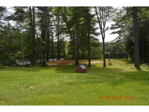
Recreational camping spot with 3 hook-ups for your family camping pleasure. Direct river front property with approximately 375 feet of river frontage on the Ossipee River in Freedom NH. Septic, well, underground electric,and phone all in place. Just hook up your RV's and start relaxing. Close to skiing, golf,snow mobile trails, Ossipee Lake and Province Lake. Also only about 45 minutes from the beautiful Presidential Range of the White Mountains, and tax free shopping. Lot is 1.95 acres +-
Last Agent to Sell the Property
KW Coastal and Lakes & Mountains Realty/Wolfeboro Brokerage Phone: 603-828-6512 License #068203 Listed on: 07/23/2013
Last Buyer's Agent
KW Coastal and Lakes & Mountains Realty/Wolfeboro Brokerage Phone: 603-828-6512 License #068203 Listed on: 07/23/2013
| Date | Buyer | Sale Price | Title Company |
|---|---|---|---|
| William & Mary Lord Ret | $100,000 | -- |
| Date | Event | Price | List to Sale | Price per Sq Ft |
|---|---|---|---|---|
| 12/22/2014 12/22/14 | Sold | $100,000 | -25.7% | -- |
| 09/17/2014 09/17/14 | Pending | -- | -- | -- |
| 07/23/2013 07/23/13 | For Sale | $134,499 | -- | -- |
| Year | Tax Paid | Tax Assessment Tax Assessment Total Assessment is a certain percentage of the fair market value that is determined by local assessors to be the total taxable value of land and additions on the property. | Land | Improvement |
|---|---|---|---|---|
| 2024 | $4,829 | $672,500 | $140,200 | $532,300 |
| 2023 | $4,408 | $401,500 | $65,800 | $335,700 |
| 2022 | $4,107 | $401,500 | $65,800 | $335,700 |
| 2021 | $4,145 | $382,000 | $65,800 | $316,200 |
| 2020 | $4,076 | $382,000 | $65,800 | $316,200 |
| 2019 | $4,067 | $299,900 | $70,800 | $229,100 |
| 2018 | $3,878 | $299,900 | $70,800 | $229,100 |
| 2016 | $3,313 | $262,900 | $70,800 | $192,100 |
| 2015 | $808 | $66,800 | $66,800 | $0 |
| 2014 | $815 | $66,800 | $66,800 | $0 |
| 2013 | $826 | $66,800 | $66,800 | $0 |
Seller's Agent in 2014
Virginia Wrabel
KW Coastal and Lakes & Mountains Realty/Wolfeboro
(603) 828-6512
8 Total Sales
Source: PrimeMLS
MLS Number: 4256580
APN: FRDM-000004-000000-000029
Disclaimer: Certain information contained herein is derived from information provided by parties other than Homes.com. All information provided is deemed reliable, but is not guaranteed to be accurate and should be independently verified.
![]() Copyright 2025 PrimeMLS, Inc. All rights reserved. This information is deemed reliable, but not guaranteed. The data relating to real estate displayed on this display comes in part from the IDX Program of PrimeMLS. The information being provided is for consumers’ personal, non-commercial use and may not be used for any purpose other than to identify prospective properties consumers may be interested in purchasing.
Copyright 2025 PrimeMLS, Inc. All rights reserved. This information is deemed reliable, but not guaranteed. The data relating to real estate displayed on this display comes in part from the IDX Program of PrimeMLS. The information being provided is for consumers’ personal, non-commercial use and may not be used for any purpose other than to identify prospective properties consumers may be interested in purchasing.