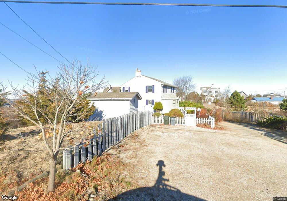
6 I St Newburyport, MA 01950
Estimated Value: $680,000 - $746,000
3
Beds
2
Baths
1,330
Sq Ft
$529/Sq Ft
Est. Value
About This Home
This home is located at 6 I St, Newburyport, MA 01950 and is currently estimated at $703,859, approximately $529 per square foot. 6 I St is a home located in Essex County with nearby schools including Francis T. Bresnahan Elementary School, Edward G. Molin Elementary School, and Rupert A. Nock Middle School.
Ownership History
Date
Name
Owned For
Owner Type
Purchase Details
Closed on
Jun 21, 2024
Sold by
Keslof Francis E and Keslof Susan M
Bought by
Escott Talisman
Current Estimated Value
Home Financials for this Owner
Home Financials are based on the most recent Mortgage that was taken out on this home.
Original Mortgage
$130,000
Outstanding Balance
$128,363
Interest Rate
7.09%
Mortgage Type
Purchase Money Mortgage
Estimated Equity
$575,496
Create a Home Valuation Report for This Property
The Home Valuation Report is an in-depth analysis detailing your home's value as well as a comparison with similar homes in the area
Home Values in the Area
Average Home Value in this Area
Purchase History
| Date | Buyer | Sale Price | Title Company |
|---|---|---|---|
| Escott Talisman | $650,000 | None Available | |
| Escott Talisman | $650,000 | None Available |
Source: Public Records
Mortgage History
| Date | Status | Borrower | Loan Amount |
|---|---|---|---|
| Open | Escott Talisman | $130,000 | |
| Closed | Escott Talisman | $130,000 |
Source: Public Records
Tax History Compared to Growth
Tax History
| Year | Tax Paid | Tax Assessment Tax Assessment Total Assessment is a certain percentage of the fair market value that is determined by local assessors to be the total taxable value of land and additions on the property. | Land | Improvement |
|---|---|---|---|---|
| 2025 | $4,952 | $516,900 | $0 | $516,900 |
| 2024 | $4,830 | $484,500 | $0 | $484,500 |
| 2023 | $4,807 | $447,600 | $0 | $447,600 |
| 2022 | $4,686 | $390,200 | $0 | $390,200 |
| 2021 | $4,767 | $377,100 | $0 | $377,100 |
| 2020 | $4,744 | $369,500 | $0 | $369,500 |
| 2019 | $4,577 | $349,900 | $0 | $349,900 |
| 2018 | $4,499 | $339,300 | $0 | $339,300 |
| 2017 | $4,362 | $324,300 | $0 | $324,300 |
| 2016 | $4,099 | $306,100 | $0 | $306,100 |
| 2015 | $3,995 | $299,500 | $0 | $299,500 |
Source: Public Records
Map
Nearby Homes
- 163 Old Point Rd
- 7 Davoli Way
- 5 Harbor St
- 11 Harbor St
- 4 54th St
- 10 61st St Unit 10
- 12 Barker St
- 12 53rd St
- 12 63rd St
- 11 71st St
- 11 Sunset Dr
- 28 & 30 Plum Island Turnpike
- 65 Plum Island Turnpike
- 2 Sunset Dr
- 10 Meadowview Ln Unit B
- 14 Fordham Way
- 3 Riverview Dr
- 42 Riverview Dr
- 4 Goodwin Ave
- 141 Atlantic Ave