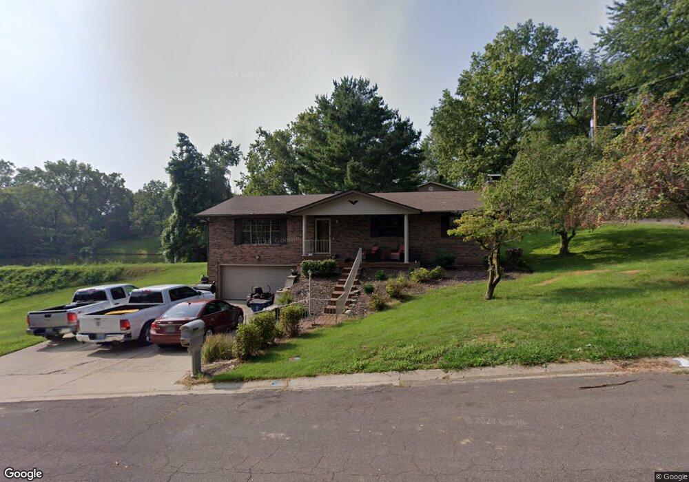
6 Lakeside Dr Collinsville, IL 62234
Estimated Value: $232,658 - $275,000
4
Beds
2
Baths
1,560
Sq Ft
$161/Sq Ft
Est. Value
About This Home
This home is located at 6 Lakeside Dr, Collinsville, IL 62234 and is currently estimated at $251,915, approximately $161 per square foot. 6 Lakeside Dr is a home located in Madison County with nearby schools including John A Renfro Elementary School, Dorris Intermediate School, and Collinsville Middle School.
Ownership History
Date
Name
Owned For
Owner Type
Purchase Details
Closed on
Dec 12, 2015
Sold by
Thompson David E and Thompson Laura
Bought by
Riddle Steven C
Current Estimated Value
Home Financials for this Owner
Home Financials are based on the most recent Mortgage that was taken out on this home.
Original Mortgage
$142,373
Outstanding Balance
$113,999
Interest Rate
4.25%
Mortgage Type
FHA
Estimated Equity
$137,916
Purchase Details
Closed on
Dec 2, 2004
Sold by
Thompson William M and Thompson Thelma I
Bought by
Thompson William M and Thompson Thelma I
Create a Home Valuation Report for This Property
The Home Valuation Report is an in-depth analysis detailing your home's value as well as a comparison with similar homes in the area
Home Values in the Area
Average Home Value in this Area
Purchase History
| Date | Buyer | Sale Price | Title Company |
|---|---|---|---|
| Riddle Steven C | $145,000 | Title Star Agency Llc | |
| Thompson William M | -- | -- |
Source: Public Records
Mortgage History
| Date | Status | Borrower | Loan Amount |
|---|---|---|---|
| Open | Riddle Steven C | $142,373 |
Source: Public Records
Tax History Compared to Growth
Tax History
| Year | Tax Paid | Tax Assessment Tax Assessment Total Assessment is a certain percentage of the fair market value that is determined by local assessors to be the total taxable value of land and additions on the property. | Land | Improvement |
|---|---|---|---|---|
| 2024 | $4,603 | $74,620 | $15,510 | $59,110 |
| 2023 | $4,603 | $69,070 | $14,360 | $54,710 |
| 2022 | $4,402 | $63,870 | $13,280 | $50,590 |
| 2021 | $3,921 | $58,830 | $12,220 | $46,610 |
| 2020 | $3,801 | $56,130 | $11,660 | $44,470 |
| 2019 | $3,716 | $54,210 | $11,260 | $42,950 |
| 2018 | $3,651 | $51,360 | $10,670 | $40,690 |
| 2017 | $3,661 | $50,220 | $10,470 | $39,750 |
| 2016 | $3,882 | $50,220 | $10,470 | $39,750 |
| 2015 | $2,791 | $48,920 | $10,200 | $38,720 |
| 2014 | $2,791 | $48,920 | $10,200 | $38,720 |
| 2013 | $2,791 | $48,920 | $10,200 | $38,720 |
Source: Public Records
Map
Nearby Homes
- 10 White Lily Dr
- 0 N Keebler Ave
- 625 W Country Ln
- 203 Greenfield Dr
- 414 Bunker Hill Dr
- 1224 Cedar Ridge Ct
- 22 Brookwood Dr
- 2 Chelsea Rd
- 102 Toni Ct
- 5 Brookwood Dr
- 1120 Williams St
- 1210 Constance St
- 706 Illinois Ave
- 2007 Belt Line Rd
- 308 Brown Ave
- 1227 Ridge Ave
- 300 Pine Lake Rd Unit 6
- 300 Pine Lake Rd Unit 7
- 54 Oak Leaf Dr
- 617 N Morrison Ave