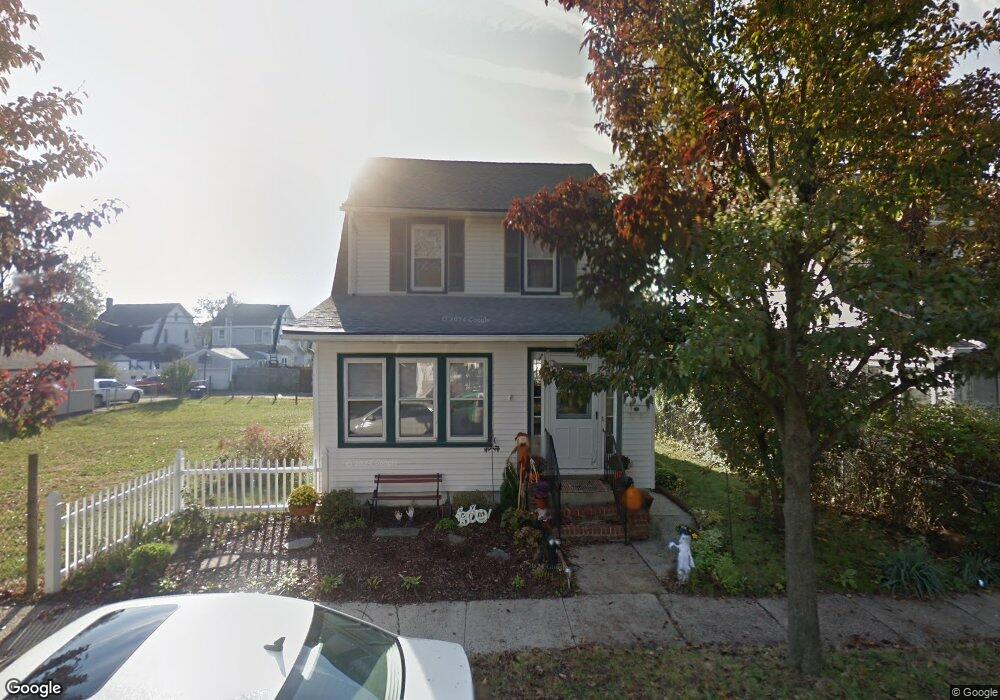
6 Laurel Rd Lindenhurst, NY 11757
Estimated Value: $530,031 - $657,000
Studio
--
Bath
1,284
Sq Ft
$458/Sq Ft
Est. Value
About This Home
This home is located at 6 Laurel Rd, Lindenhurst, NY 11757 and is currently estimated at $588,508, approximately $458 per square foot. 6 Laurel Rd is a home located in Suffolk County with nearby schools including William Rall School, Lindenhurst Middle School, and Lindenhurst Senior High School.
Ownership History
Date
Name
Owned For
Owner Type
Purchase Details
Closed on
Oct 29, 2020
Sold by
Ness Sean T
Bought by
Ness Sean T and Ness Kelly C
Current Estimated Value
Purchase Details
Closed on
Oct 28, 2010
Sold by
Taddeo Joseph and Taddeo Filomena
Bought by
Ness Sean T
Home Financials for this Owner
Home Financials are based on the most recent Mortgage that was taken out on this home.
Original Mortgage
$291,000
Interest Rate
4.41%
Mortgage Type
Purchase Money Mortgage
Create a Home Valuation Report for This Property
The Home Valuation Report is an in-depth analysis detailing your home's value as well as a comparison with similar homes in the area
Home Values in the Area
Average Home Value in this Area
Purchase History
| Date | Buyer | Sale Price | Title Company |
|---|---|---|---|
| Ness Sean T | -- | None Available | |
| Ness Sean T | $302,000 | -- |
Source: Public Records
Mortgage History
| Date | Status | Borrower | Loan Amount |
|---|---|---|---|
| Previous Owner | Ness Sean T | $291,000 |
Source: Public Records
Tax History
| Year | Tax Paid | Tax Assessment Tax Assessment Total Assessment is a certain percentage of the fair market value that is determined by local assessors to be the total taxable value of land and additions on the property. | Land | Improvement |
|---|---|---|---|---|
| 2024 | $6,609 | $1,950 | $200 | $1,750 |
| 2023 | $6,609 | $1,950 | $200 | $1,750 |
| 2022 | $5,432 | $1,950 | $200 | $1,750 |
| 2021 | $5,432 | $1,950 | $200 | $1,750 |
| 2020 | $5,784 | $1,950 | $200 | $1,750 |
| 2019 | $5,784 | $0 | $0 | $0 |
| 2018 | $5,370 | $1,950 | $200 | $1,750 |
| 2017 | $5,370 | $1,950 | $200 | $1,750 |
| 2016 | $5,391 | $1,950 | $200 | $1,750 |
| 2015 | -- | $1,950 | $200 | $1,750 |
| 2014 | -- | $1,950 | $200 | $1,750 |
Source: Public Records
Map
Nearby Homes
Your Personal Tour Guide
Ask me questions while you tour the home.