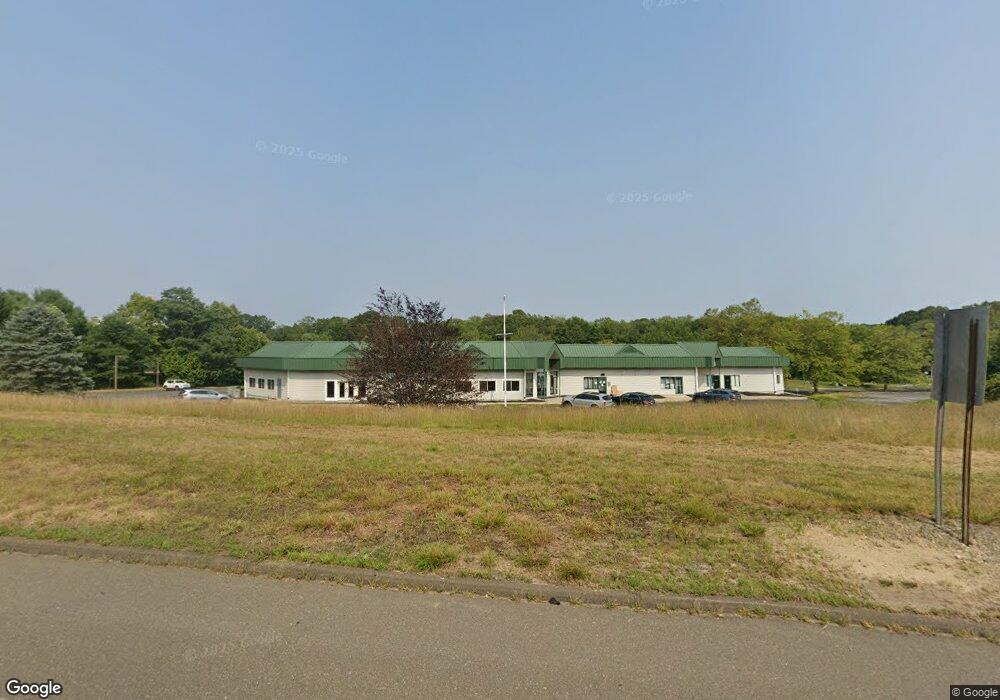
6 Liberty Way Niantic, CT 06357
Estimated Value: $2,567,438
--
Bed
2
Baths
20,488
Sq Ft
$125/Sq Ft
Est. Value
About This Home
This home is located at 6 Liberty Way, Niantic, CT 06357 and is currently estimated at $2,567,438, approximately $125 per square foot. 6 Liberty Way is a home located in New London County with nearby schools including East Lyme Middle School, East Lyme High School, and The Light House Voc-Ed Center.
Ownership History
Date
Name
Owned For
Owner Type
Purchase Details
Closed on
Jun 28, 2016
Sold by
Barrett Christopher M
Bought by
6 Libert Way Llc
Current Estimated Value
Home Financials for this Owner
Home Financials are based on the most recent Mortgage that was taken out on this home.
Original Mortgage
$1,244,268
Outstanding Balance
$992,981
Interest Rate
3.57%
Mortgage Type
Commercial
Estimated Equity
$1,574,457
Purchase Details
Closed on
Sep 16, 1992
Sold by
Barone Joseph and Barone Janice
Bought by
Suzio Leonard and Bruno Vincent
Create a Home Valuation Report for This Property
The Home Valuation Report is an in-depth analysis detailing your home's value as well as a comparison with similar homes in the area
Home Values in the Area
Average Home Value in this Area
Purchase History
| Date | Buyer | Sale Price | Title Company |
|---|---|---|---|
| 6 Libert Way Llc | $1,300,000 | -- | |
| 6 Libert Way Llc | $1,300,000 | -- | |
| Suzio Leonard | $75,000 | -- |
Source: Public Records
Mortgage History
| Date | Status | Borrower | Loan Amount |
|---|---|---|---|
| Open | Suzio Leonard | $568,000 | |
| Open | Suzio Leonard | $1,244,268 | |
| Closed | Suzio Leonard | $1,244,268 |
Source: Public Records
Tax History Compared to Growth
Tax History
| Year | Tax Paid | Tax Assessment Tax Assessment Total Assessment is a certain percentage of the fair market value that is determined by local assessors to be the total taxable value of land and additions on the property. | Land | Improvement |
|---|---|---|---|---|
| 2025 | $27,787 | $992,040 | $295,890 | $696,150 |
| 2024 | $26,140 | $992,040 | $295,890 | $696,150 |
| 2023 | $24,144 | $970,410 | $295,890 | $674,520 |
| 2022 | $23,135 | $970,410 | $295,890 | $674,520 |
| 2021 | $29,407 | $1,031,450 | $248,640 | $782,810 |
| 2020 | $29,252 | $1,031,450 | $248,640 | $782,810 |
| 2019 | $29,077 | $1,031,450 | $248,640 | $782,810 |
| 2018 | $28,210 | $1,031,450 | $248,640 | $782,810 |
| 2017 | $22,736 | $869,120 | $248,640 | $620,480 |
| 2016 | $23,500 | $926,660 | $267,750 | $658,910 |
| 2015 | $22,898 | $926,660 | $267,750 | $658,910 |
| 2014 | $22,268 | $926,660 | $267,750 | $658,910 |
Source: Public Records
Map
Nearby Homes
- 15 Freedom Way Unit 92
- 14 Colton Rd
- 4 Jean Dr
- 40 Spinnaker Dr
- 188 4 Mile River Rd
- 2 Riverdale Landing
- 22 Riverdale Landing
- 55 Corey Ln
- 78 Corey Ln Unit 9
- 18 Twin Valley Rd
- 3 Twin Valley Rd
- 16 Twin Valley Rd
- Waramaug Plan at Riverside Reserve
- Highland Plan at Riverside Reserve
- Hayward Plan at Riverside Reserve
- Ashford Plan at Riverside Reserve
- Lillinonah Plan at Riverside Reserve
- 23 Over Brook Rd
- 57 Spring Rock Rd
- 245 Giants Neck Rd
- 5 Liberty Way
- 7 Liberty Way
- 0 W Main St Unit 170036474
- 0 W Main and Rathbun Unit N353523
- 0 W Main and Rathbun Unit N10230411
- 00 W Main St
- 11 Liberty Way
- 22 Liberty Way
- 18 & 20 Liberty Way
- 10 Liberty Way
- 15 Liberty Way
- 15 Liberty Way Unit A
- 15 Liberty Way
- 5 Freedom Way Unit C3 & C4
- 266 W Main St
- 255 W Main St
- 1 Chadwick Place
- 4 Atwood Dr
- 2 Atwood Dr
- 253 W Main St