Estimated Value: $587,000 - $849,000
3
Beds
2
Baths
1,649
Sq Ft
$422/Sq Ft
Est. Value
About This Home
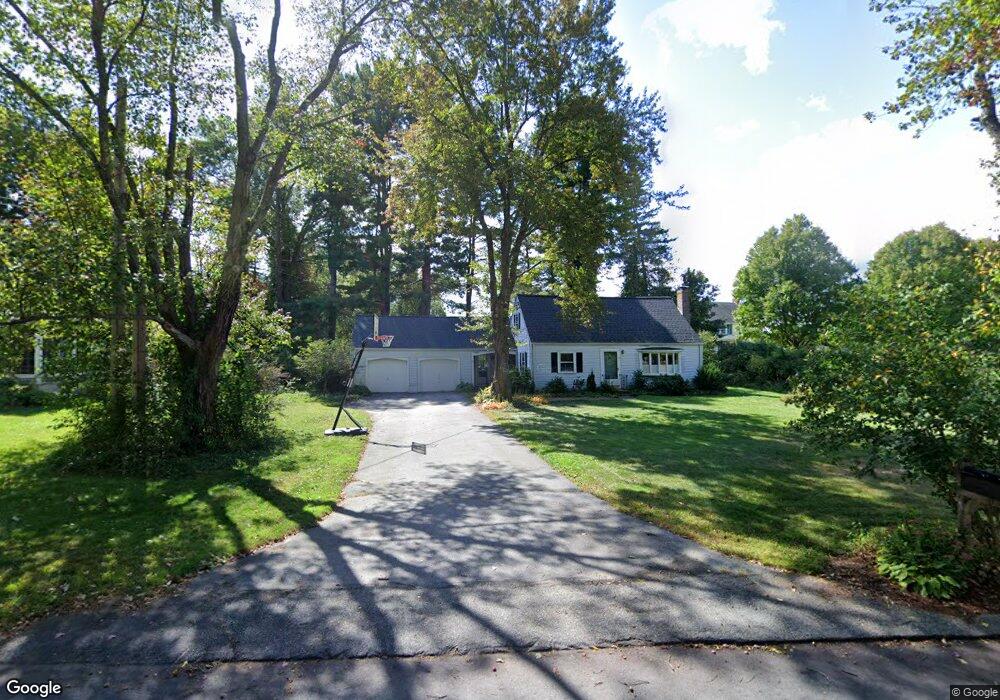
This home is located at 6 Littlefield Rd, Acton, MA 01720 and is currently estimated at $696,493, approximately $422 per square foot. 6 Littlefield Rd is a home located in Middlesex County with nearby schools including Acton-Boxborough Regional High School and Oak Meadow Montessori School.
Ownership History
Date
Name
Owned For
Owner Type
Purchase Details
Closed on
Aug 13, 1999
Sold by
Mooney Dorothy A and Litsas Diane
Bought by
Starr Christopher L and Starr Robin S
Current Estimated Value
Home Financials for this Owner
Home Financials are based on the most recent Mortgage that was taken out on this home.
Original Mortgage
$125,000
Interest Rate
7.65%
Mortgage Type
Purchase Money Mortgage
Purchase Details
Closed on
Jun 14, 1996
Sold by
Clark Dana F and Clark Jean B
Bought by
Mooney Dorothy A and Litsas Diane
Create a Home Valuation Report for This Property
The Home Valuation Report is an in-depth analysis detailing your home's value as well as a comparison with similar homes in the area
Home Values in the Area
Average Home Value in this Area
Purchase History
| Date | Buyer | Sale Price | Title Company |
|---|---|---|---|
| Starr Christopher L | $265,000 | -- | |
| Mooney Dorothy A | $220,000 | -- |
Source: Public Records
Mortgage History
| Date | Status | Borrower | Loan Amount |
|---|---|---|---|
| Open | Mooney Dorothy A | $307,000 | |
| Closed | Mooney Dorothy A | $70,000 | |
| Closed | Mooney Dorothy A | $125,000 |
Source: Public Records
Tax History
| Year | Tax Paid | Tax Assessment Tax Assessment Total Assessment is a certain percentage of the fair market value that is determined by local assessors to be the total taxable value of land and additions on the property. | Land | Improvement |
|---|---|---|---|---|
| 2025 | $10,199 | $594,700 | $278,900 | $315,800 |
| 2024 | $9,804 | $588,100 | $278,900 | $309,200 |
| 2023 | $9,881 | $562,700 | $253,500 | $309,200 |
| 2022 | $8,945 | $459,900 | $220,500 | $239,400 |
| 2021 | $8,636 | $426,900 | $204,100 | $222,800 |
| 2020 | $8,392 | $436,200 | $204,100 | $232,100 |
| 2019 | $7,980 | $412,000 | $204,100 | $207,900 |
| 2018 | $7,967 | $411,100 | $204,100 | $207,000 |
| 2017 | $7,836 | $411,100 | $204,100 | $207,000 |
| 2016 | $7,444 | $387,100 | $204,100 | $183,000 |
| 2015 | $7,115 | $373,500 | $204,100 | $169,400 |
| 2014 | $6,965 | $358,100 | $204,100 | $154,000 |
Source: Public Records
Map
Nearby Homes
- 4 Littlefield Rd
- 8 Algonquin Rd
- 60 Nashoba Rd
- 5 Perkins Ln
- 235 Arlington St
- 20 Joseph Reed Ln
- 285 Central St Unit 285
- 79 Charter Rd
- 4 Omega Way
- 92 Willow St Unit 3
- 92 Willow St Unit 2
- 90 Willow St Unit 1
- 246 Main St Unit 2
- 18 Hayward Rd
- 7 Kelley Rd
- 11 Braebrook
- 305 Harwood Ave
- 79 Old Orchard Ln
- 36 Leonard Rd
- 184 Main St Unit 3
- 3 Littlefield Rd
- 5 Littlefield Rd
- 8 Littlefield Rd
- 2 Littlefield Rd
- 430 Central St
- 422 Central St
- 436 Central St
- 418 Central St
- 22 Littlefield Rd
- 4 Nashoba Rd
- 421 Central St
- 416 Central St
- 416 Central St Unit 1
- 440 Central St
- 5 Nashoba Rd
- 427 Central St
- 412 Central St
- 2 Nashoba Rd
- 6 Nashoba Rd
- 14 Nashoba Rd
Your Personal Tour Guide
Ask me questions while you tour the home.