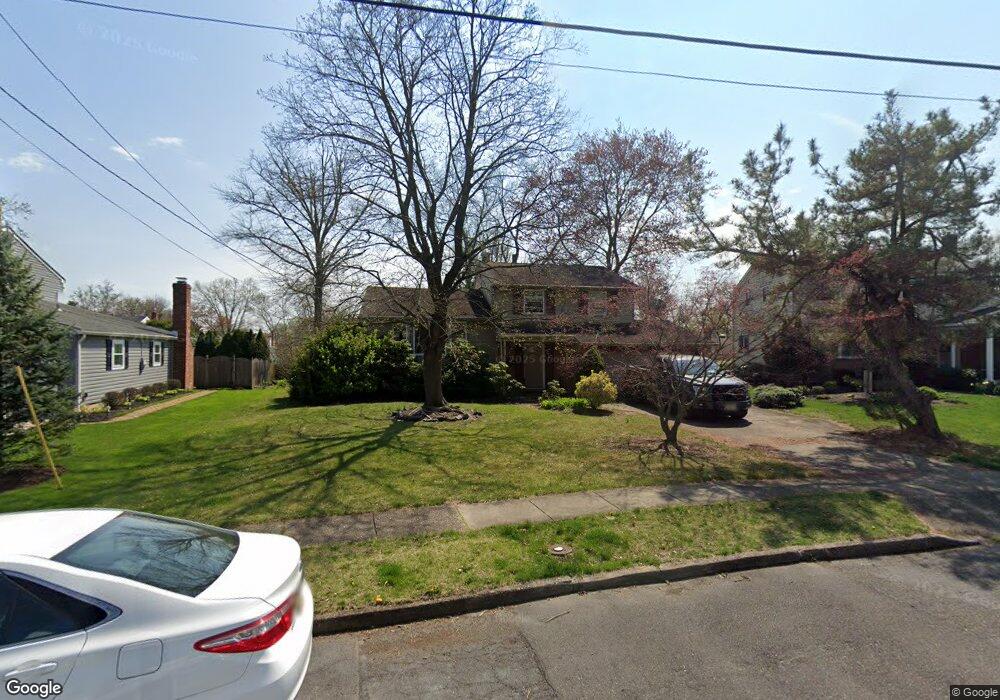
6 Locust Grove Rd Cherry Hill, NJ 08003
Estimated Value: $476,000 - $504,000
--
Bed
--
Bath
1,712
Sq Ft
$286/Sq Ft
Est. Value
About This Home
This home is located at 6 Locust Grove Rd, Cherry Hill, NJ 08003 and is currently estimated at $489,337, approximately $285 per square foot. 6 Locust Grove Rd is a home located in Camden County with nearby schools including Joseph D. Sharp Elementary School, Henry C. Beck Middle School, and Cherry Hill High-East High School.
Ownership History
Date
Name
Owned For
Owner Type
Purchase Details
Closed on
Jan 3, 2008
Sold by
Seminara Lynda
Bought by
Dick Dwight
Current Estimated Value
Home Financials for this Owner
Home Financials are based on the most recent Mortgage that was taken out on this home.
Original Mortgage
$182,000
Outstanding Balance
$114,041
Interest Rate
6.02%
Mortgage Type
New Conventional
Estimated Equity
$375,296
Purchase Details
Closed on
Jun 16, 2000
Sold by
Essex Enterprises Llc
Bought by
Seminara Lynda
Home Financials for this Owner
Home Financials are based on the most recent Mortgage that was taken out on this home.
Original Mortgage
$38,000
Interest Rate
8.59%
Purchase Details
Closed on
Feb 15, 2000
Sold by
Peter S Tocco Bldg & Remodel
Bought by
Essex Enterprises Inc
Create a Home Valuation Report for This Property
The Home Valuation Report is an in-depth analysis detailing your home's value as well as a comparison with similar homes in the area
Home Values in the Area
Average Home Value in this Area
Purchase History
| Date | Buyer | Sale Price | Title Company |
|---|---|---|---|
| Dick Dwight | $282,000 | -- | |
| Seminara Lynda | $165,000 | -- | |
| Essex Enterprises Inc | $75,000 | -- | |
| Peter S Tocco Bldg & Remodel | $47,000 | -- |
Source: Public Records
Mortgage History
| Date | Status | Borrower | Loan Amount |
|---|---|---|---|
| Open | Dick Dwight | $182,000 | |
| Previous Owner | Seminara Lynda | $38,000 |
Source: Public Records
Tax History Compared to Growth
Tax History
| Year | Tax Paid | Tax Assessment Tax Assessment Total Assessment is a certain percentage of the fair market value that is determined by local assessors to be the total taxable value of land and additions on the property. | Land | Improvement |
|---|---|---|---|---|
| 2025 | $9,110 | $204,300 | $66,600 | $137,700 |
| 2024 | $8,585 | $204,300 | $66,600 | $137,700 |
| 2023 | $8,585 | $204,300 | $66,600 | $137,700 |
| 2022 | $8,348 | $204,300 | $66,600 | $137,700 |
| 2021 | $8,374 | $204,300 | $66,600 | $137,700 |
| 2020 | $8,272 | $204,300 | $66,600 | $137,700 |
| 2019 | $8,268 | $204,300 | $66,600 | $137,700 |
| 2018 | $8,246 | $204,300 | $66,600 | $137,700 |
| 2017 | $8,133 | $204,300 | $66,600 | $137,700 |
| 2016 | $8,025 | $204,300 | $66,600 | $137,700 |
| 2015 | $7,898 | $204,300 | $66,600 | $137,700 |
| 2014 | $7,810 | $204,300 | $66,600 | $137,700 |
Source: Public Records
Map
Nearby Homes
- 16 Gatehouse Ln
- 8 Elbow Ln
- 100 E Eagle Ln
- 309 Highgate Ln
- 26 Regent Rd
- 103 Aspen Ct
- 220 Deerpark Ct
- 360 Juniper St
- 145 Kilburn Dr
- 100 Old Colony Ln
- 213 Balfield Terrace
- 112 Champlain Rd
- 800 Marlowe Rd
- 219 Conestoga Dr
- 209 Henfield Ave
- 22 Hawk Ln
- 2 W High Ridge Rd
- 63 Banner Ct Unit 63
- 102 Partree Rd
- 110 Partree Rd
- 8 Locust Grove Rd
- 4 Locust Grove Rd
- 5 Waverly Rd
- 7 Waverly Rd
- 10 Locust Grove Dr
- 10 Locust Grove Rd
- 3 Waverly Rd
- 9 Waverly Rd
- 102 Roanoke Rd
- 3 Locust Grove Rd
- 200 Roanoke Rd
- 11 Waverly Rd
- 100 Roanoke Rd
- 12 Locust Grove Rd
- 5 Locust Grove Rd
- 202 Roanoke Rd
- 15 Waverly Rd
- 7 Locust Grove Rd
- 8 Waverly Rd
- 14 Locust Grove Rd