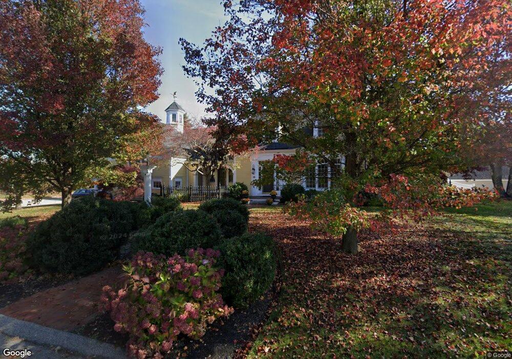
6 Lorum St Newburyport, MA 01950
Estimated Value: $2,340,000 - $2,499,525
4
Beds
4
Baths
3,473
Sq Ft
$701/Sq Ft
Est. Value
About This Home
This home is located at 6 Lorum St, Newburyport, MA 01950 and is currently estimated at $2,435,381, approximately $701 per square foot. 6 Lorum St is a home located in Essex County with nearby schools including Francis T. Bresnahan Elementary School, Edward G. Molin Elementary School, and Rupert A. Nock Middle School.
Ownership History
Date
Name
Owned For
Owner Type
Purchase Details
Closed on
May 31, 2007
Sold by
Hirsch Denise R and Hirsch Gerald S
Bought by
Mack Kathryn K
Current Estimated Value
Home Financials for this Owner
Home Financials are based on the most recent Mortgage that was taken out on this home.
Original Mortgage
$1,330,000
Outstanding Balance
$805,412
Interest Rate
6%
Mortgage Type
Purchase Money Mortgage
Estimated Equity
$1,629,969
Purchase Details
Closed on
Mar 31, 1998
Sold by
Mcdougall Michael J and Mcdougall Irene M
Bought by
Hirsch Gerald S and Hirsch Denise R
Create a Home Valuation Report for This Property
The Home Valuation Report is an in-depth analysis detailing your home's value as well as a comparison with similar homes in the area
Home Values in the Area
Average Home Value in this Area
Purchase History
| Date | Buyer | Sale Price | Title Company |
|---|---|---|---|
| Mack Kathryn K | $1,100,000 | -- | |
| Hirsch Gerald S | $595,000 | -- |
Source: Public Records
Mortgage History
| Date | Status | Borrower | Loan Amount |
|---|---|---|---|
| Open | Hirsch Gerald S | $1,330,000 | |
| Previous Owner | Hirsch Gerald S | $675,000 | |
| Previous Owner | Hirsch Gerald S | $93,000 | |
| Previous Owner | Hirsch Gerald S | $545,000 |
Source: Public Records
Tax History Compared to Growth
Tax History
| Year | Tax Paid | Tax Assessment Tax Assessment Total Assessment is a certain percentage of the fair market value that is determined by local assessors to be the total taxable value of land and additions on the property. | Land | Improvement |
|---|---|---|---|---|
| 2025 | $22,399 | $2,338,100 | $516,600 | $1,821,500 |
| 2024 | $21,460 | $2,152,500 | $469,600 | $1,682,900 |
| 2023 | $20,301 | $1,890,200 | $408,400 | $1,481,800 |
| 2022 | $18,951 | $1,577,900 | $340,300 | $1,237,600 |
| 2021 | $19,227 | $1,521,100 | $309,400 | $1,211,700 |
| 2020 | $18,537 | $1,443,700 | $309,400 | $1,134,300 |
| 2019 | $17,760 | $1,357,800 | $309,400 | $1,048,400 |
| 2018 | $17,543 | $1,323,000 | $294,700 | $1,028,300 |
| 2017 | $17,016 | $1,265,100 | $280,800 | $984,300 |
| 2016 | $16,760 | $1,251,700 | $267,400 | $984,300 |
| 2015 | $15,408 | $1,155,000 | $267,400 | $887,600 |
Source: Public Records
Map
Nearby Homes
- 1 Lancaster Rd
- 3 Riverview Dr
- 4 Goodwin Ave
- 11 High Rd
- 65 Bromfield St
- 1 Littles Ln
- 164 Water St
- 164 Water St Unit A
- 166 Water St Unit B
- 111 Prospect St Unit A
- 113 Prospect St Unit B
- 7 Parsons St
- 12 Parsons St Unit 2
- 4 Hanover St
- 58 Lime St Unit 5
- 42 Riverview Dr
- 78 High St
- 42 Federal St Unit B
- 11 Orange St Unit 2
- 9 Orange St Unit 1