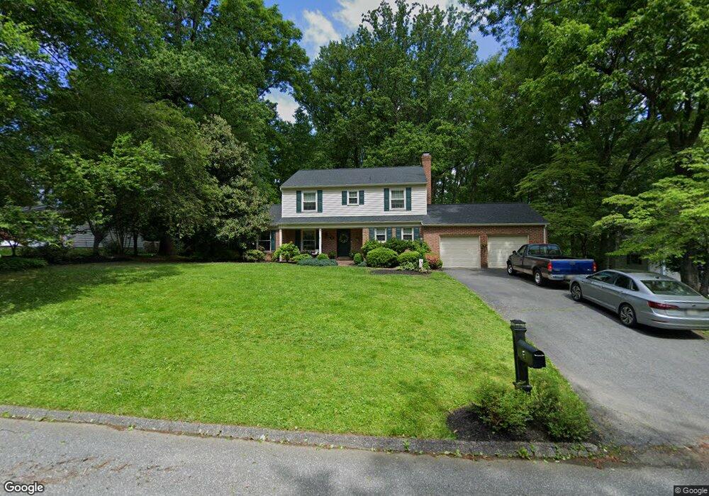
6 Mcgregor Way Bel Air, MD 21014
Estimated Value: $565,638 - $643,000
Studio
3
Baths
2,404
Sq Ft
$257/Sq Ft
Est. Value
About This Home
This home is located at 6 Mcgregor Way, Bel Air, MD 21014 and is currently estimated at $617,160, approximately $256 per square foot. 6 Mcgregor Way is a home located in Harford County with nearby schools including Ring Factory Elementary School, Patterson Mill Middle School, and Patterson Mill High School.
Ownership History
Date
Name
Owned For
Owner Type
Purchase Details
Closed on
Feb 1, 1999
Sold by
Pearce John Michael
Bought by
Hedrick Robert H and Hedrick Kathryn E
Current Estimated Value
Purchase Details
Closed on
Sep 29, 1997
Sold by
Torsner Lars E
Bought by
Pearce John Michael
Purchase Details
Closed on
Jun 15, 1995
Sold by
Powers Doris H
Bought by
Torsner Lars E
Home Financials for this Owner
Home Financials are based on the most recent Mortgage that was taken out on this home.
Original Mortgage
$149,250
Interest Rate
8.24%
Create a Home Valuation Report for This Property
The Home Valuation Report is an in-depth analysis detailing your home's value as well as a comparison with similar homes in the area
Home Values in the Area
Average Home Value in this Area
Purchase History
| Date | Buyer | Sale Price | Title Company |
|---|---|---|---|
| Hedrick Robert H | $225,500 | -- | |
| Pearce John Michael | $215,900 | -- | |
| Torsner Lars E | $199,000 | -- |
Source: Public Records
Mortgage History
| Date | Status | Borrower | Loan Amount |
|---|---|---|---|
| Previous Owner | Torsner Lars E | $149,250 | |
| Closed | Pearce John Michael | -- |
Source: Public Records
Tax History
| Year | Tax Paid | Tax Assessment Tax Assessment Total Assessment is a certain percentage of the fair market value that is determined by local assessors to be the total taxable value of land and additions on the property. | Land | Improvement |
|---|---|---|---|---|
| 2025 | $4,573 | $433,900 | $116,400 | $317,500 |
| 2024 | $4,573 | $414,433 | $0 | $0 |
| 2023 | $4,358 | $394,967 | $0 | $0 |
| 2022 | $4,153 | $375,500 | $116,400 | $259,100 |
| 2021 | $4,307 | $371,767 | $0 | $0 |
| 2020 | $4,307 | $368,033 | $0 | $0 |
| 2019 | $4,264 | $364,300 | $128,300 | $236,000 |
| 2018 | $4,170 | $359,433 | $0 | $0 |
| 2017 | $4,115 | $364,300 | $0 | $0 |
| 2016 | -- | $349,700 | $0 | $0 |
| 2015 | $3,909 | $346,200 | $0 | $0 |
| 2014 | $3,909 | $342,700 | $0 | $0 |
Source: Public Records
Map
Nearby Homes
- 1611 Lynndale Ct
- 1411 Valley Stream Rd
- 127 Briarcliff Ln
- 0 Bonnie Ave
- 508 Woodring Dr
- 1327 Saratoga Dr
- 1601 Westwood Dr
- 1613 Rolling Rd
- 536 David Dr
- 1202 Vermont Rd
- 400 Hazelnut Ct Unit D
- 140 Royal Oak Dr Unit 140-C
- 102 Brandywine Place
- 1406 Tayside Way
- 1408 Tayside Way
- 116 Hibiscus Ct
- 43 Oak Crest Ct
- 1604 S Tollgate Rd
- 201 Victory Ln
- 1610 S Tollgate Rd
- 4 Mcgregor Way
- 8 Mcgregor Way
- 1509 Balmoral Dr
- 7 Mcgregor Way
- 1511 Balmoral Dr
- 9 Mcgregor Way
- 10 Mcgregor Way
- 5 Mcgregor Way
- 7 Inverness Way
- 3 Mcgregor Way
- 1507 Balmoral Dr
- 12 Mcgregor Way
- 5 Inverness Way
- 1 Mcgregor Way
- 11 Mcgregor Way
- 3 Inverness Way
- 1512 Balmoral Dr
- 9 Inverness Way
- 1508 Balmoral Dr
- 1 Inverness Way
Your Personal Tour Guide
Ask me questions while you tour the home.