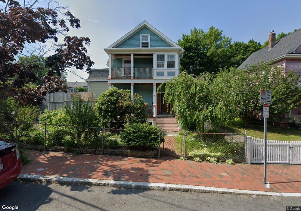
6 Mead St Cambridge, MA 02140
North Cambridge NeighborhoodEstimated Value: $1,667,000 - $1,911,000
3
Beds
2
Baths
1,750
Sq Ft
$1,013/Sq Ft
Est. Value
About This Home
This home is located at 6 Mead St, Cambridge, MA 02140 and is currently estimated at $1,773,180, approximately $1,013 per square foot. 6 Mead St is a home located in Middlesex County with nearby schools including Cambridge Montessori School, Cambridge Friends School, and Wild Rose Montessori School.
Ownership History
Date
Name
Owned For
Owner Type
Purchase Details
Closed on
Nov 26, 2025
Sold by
Kimbrough Laurance and Kimbrough Derrick
Bought by
6 Mead Street Llc
Current Estimated Value
Home Financials for this Owner
Home Financials are based on the most recent Mortgage that was taken out on this home.
Original Mortgage
$1,350,000
Outstanding Balance
$1,347,441
Interest Rate
6.27%
Mortgage Type
Purchase Money Mortgage
Estimated Equity
$425,739
Purchase Details
Closed on
Nov 14, 2024
Sold by
Kimbrough Shirley W Est and Kimbrough
Bought by
Kimbrough Laurance and Kimbrough Derrick
Purchase Details
Closed on
Aug 5, 1977
Bought by
Kimbrough Leslie H
Create a Home Valuation Report for This Property
The Home Valuation Report is an in-depth analysis detailing your home's value as well as a comparison with similar homes in the area
Home Values in the Area
Average Home Value in this Area
Purchase History
| Date | Buyer | Sale Price | Title Company |
|---|---|---|---|
| 6 Mead Street Llc | -- | -- | |
| Kimbrough Laurance | -- | None Available | |
| Kimbrough Laurance | -- | None Available | |
| Kimbrough Leslie H | $31,500 | -- |
Source: Public Records
Mortgage History
| Date | Status | Borrower | Loan Amount |
|---|---|---|---|
| Open | 6 Mead Street Llc | $1,350,000 | |
| Previous Owner | Kimbrough Leslie H | $250,500 | |
| Previous Owner | Kimbrough Leslie H | $21,500 | |
| Previous Owner | Kimbrough Leslie H | $60,000 |
Source: Public Records
Tax History
| Year | Tax Paid | Tax Assessment Tax Assessment Total Assessment is a certain percentage of the fair market value that is determined by local assessors to be the total taxable value of land and additions on the property. | Land | Improvement |
|---|---|---|---|---|
| 2025 | $9,411 | $1,482,000 | $781,300 | $700,700 |
| 2024 | $8,791 | $1,485,000 | $814,400 | $670,600 |
| 2023 | $8,276 | $1,412,300 | $832,800 | $579,500 |
| 2022 | $7,827 | $1,322,100 | $809,500 | $512,600 |
| 2021 | $7,421 | $1,268,500 | $792,300 | $476,200 |
| 2020 | $7,103 | $1,235,300 | $784,400 | $450,900 |
| 2019 | $6,514 | $1,096,600 | $680,600 | $416,000 |
| 2018 | $6,377 | $1,013,800 | $630,400 | $383,400 |
| 2017 | $6,272 | $966,400 | $601,800 | $364,600 |
| 2016 | $6,072 | $868,600 | $519,400 | $349,200 |
| 2015 | $5,627 | $719,600 | $408,300 | $311,300 |
| 2014 | $5,424 | $647,300 | $340,300 | $307,000 |
Source: Public Records
Map
Nearby Homes
- 11 Cogswell Ave Unit 15
- 11 Cogswell Ave Unit 13
- 3 Warwick Park Unit 2
- 40 Mount Pleasant St Unit 4
- 178 Richdale Ave
- 7 Russell St Unit 1
- 24 Cambridge Terrace Unit 2
- 7 Beech St Unit 319
- 7 Beech St Unit 317
- 80 Upland Rd Unit B
- 10 Beech St Unit 4
- 10 Beech St Unit 1
- 10 Beech St Unit 3
- 18 Upland Rd Unit 1
- 46 Mount Vernon St Unit 1
- 3 Arlington St Unit 44
- 32-40 White St
- 353 Summer St Unit 310
- 6 Washington Ave Unit 11
- 151 Sherman St
- 45 Walden St
- 12 Mead St
- 16 Mead St
- 44 Walden St Unit 46
- 35 Walden St Unit 3B
- 33 Walden St Unit 41
- 33 Walden St Unit 41
- 33 Walden St Unit 41
- 33 Walden St Unit 41
- 33 Walden St Unit 41
- 33 Walden St Unit 41
- 33 Walden St Unit 41
- 33 Walden St Unit 41
- 33 Walden St Unit 41
- 33 Walden St Unit 41
- 33 Walden St Unit 41
- 33 Walden St Unit 41
- 33 Walden St Unit 41
- 33 Walden St Unit 41
- 33 Walden St Unit 41
Your Personal Tour Guide
Ask me questions while you tour the home.