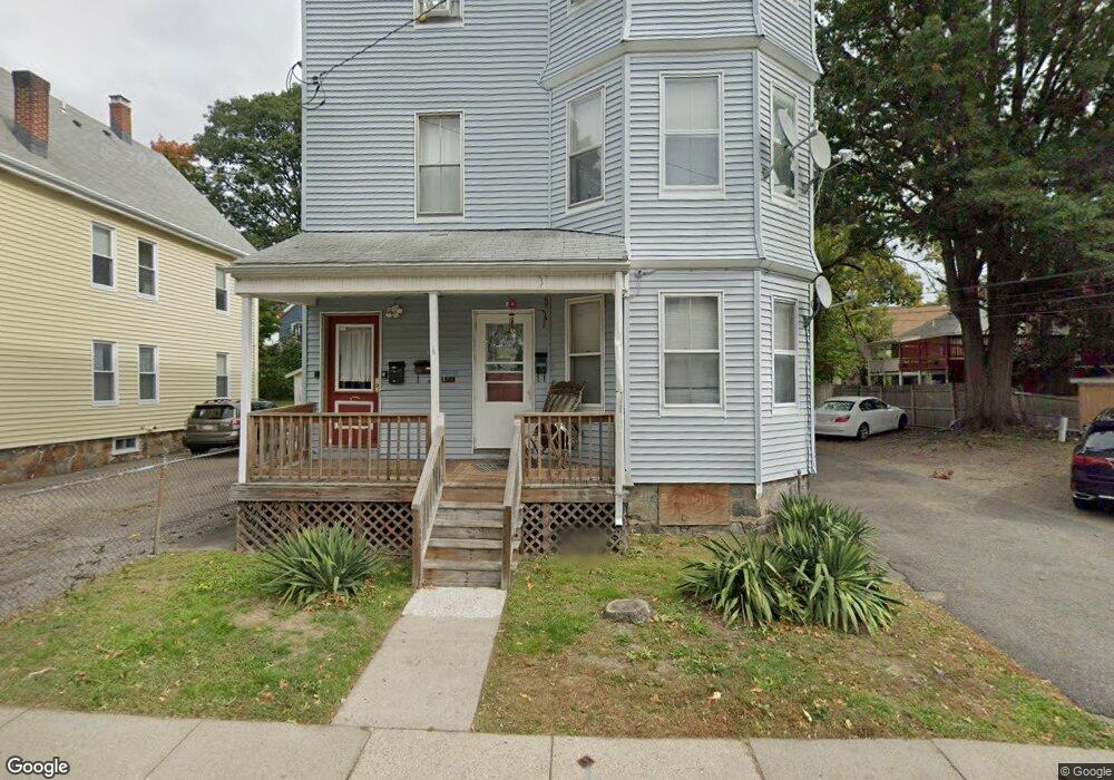
6 Meyer St Roslindale, MA 02131
Jamaica Plain NeighborhoodEstimated Value: $772,000 - $1,299,663
9
Beds
4
Baths
3,894
Sq Ft
$286/Sq Ft
Est. Value
About This Home
This home is located at 6 Meyer St, Roslindale, MA 02131 and is currently estimated at $1,115,166, approximately $286 per square foot. 6 Meyer St is a home located in Suffolk County with nearby schools including Brooke Charter School Roslindale, The Croft School - Jamaica Plain, and St. Clare High School.
Ownership History
Date
Name
Owned For
Owner Type
Purchase Details
Closed on
Sep 20, 2024
Sold by
J Stone Enterprises Llc
Bought by
Piedra Jonathan D and Vokes Janet M
Current Estimated Value
Purchase Details
Closed on
Aug 3, 2024
Sold by
Peidra Jonathan D and Vokes Janet M
Bought by
J Stone Enterprises Llc
Purchase Details
Closed on
Sep 29, 2023
Sold by
Meyer Street Nt and Gangemi
Bought by
Piedra Jonathan D and Vokes Janet M
Home Financials for this Owner
Home Financials are based on the most recent Mortgage that was taken out on this home.
Original Mortgage
$909,000
Interest Rate
6.75%
Mortgage Type
Purchase Money Mortgage
Create a Home Valuation Report for This Property
The Home Valuation Report is an in-depth analysis detailing your home's value as well as a comparison with similar homes in the area
Home Values in the Area
Average Home Value in this Area
Purchase History
| Date | Buyer | Sale Price | Title Company |
|---|---|---|---|
| Piedra Jonathan D | -- | None Available | |
| Piedra Jonathan D | -- | None Available | |
| J Stone Enterprises Llc | -- | None Available | |
| J Stone Enterprises Llc | -- | None Available | |
| Piedra Jonathan D | $1,212,000 | None Available |
Source: Public Records
Mortgage History
| Date | Status | Borrower | Loan Amount |
|---|---|---|---|
| Previous Owner | Piedra Jonathan D | $909,000 |
Source: Public Records
Tax History Compared to Growth
Tax History
| Year | Tax Paid | Tax Assessment Tax Assessment Total Assessment is a certain percentage of the fair market value that is determined by local assessors to be the total taxable value of land and additions on the property. | Land | Improvement |
|---|---|---|---|---|
| 2025 | $14,513 | $1,253,300 | $367,200 | $886,100 |
| 2024 | $14,550 | $1,334,900 | $297,100 | $1,037,800 |
| 2023 | $13,654 | $1,271,300 | $282,900 | $988,400 |
| 2022 | $13,167 | $1,210,200 | $269,300 | $940,900 |
| 2021 | $12,537 | $1,175,000 | $261,500 | $913,500 |
| 2020 | $9,751 | $923,400 | $295,600 | $627,800 |
| 2019 | $8,845 | $839,200 | $205,700 | $633,500 |
| 2018 | $8,068 | $769,800 | $205,700 | $564,100 |
| 2017 | $7,622 | $719,700 | $205,700 | $514,000 |
| 2016 | $7,069 | $642,600 | $205,700 | $436,900 |
| 2015 | $6,857 | $566,200 | $222,700 | $343,500 |
| 2014 | $6,296 | $500,500 | $222,700 | $277,800 |
Source: Public Records
Map
Nearby Homes
- 50 Southbourne Rd
- 24 Waterman Rd
- 71 Wyvern St
- 348-350 Hyde Park Ave Unit 2
- 105 Neponset Ave Unit 105
- 103 Neponset Ave Unit 103A
- 103-105 Neponset Ave
- 36 Neponset Ave Unit 1
- 18-20 Northbourne Rd Unit 18
- 31 Rodman St Unit 2
- 31 Rodman St Unit 1
- 602 Canterbury St Unit 14
- 602 Canterbury St Unit 4
- 602 Canterbury St Unit 5
- 602 Canterbury St Unit 2
- 602 Canterbury St Unit 9
- 32 Jewett St
- 579 American Legion Hwy
- 577-579 American Legion Hwy
- 158 Wachusett St Unit 3
- 6 Meyer St
- 6 Meyer St Unit 1
- 6 Meyer St Unit 2
- 2 Meyer St
- 2 Meyer St Unit 1
- 10 Meyer St
- 7 Meyer St Unit 1
- 7 Meyer St
- 7 Meyer St Unit 7
- 29 Catherine St
- 29 Catherine St Unit 1
- 1 Meyer St
- 1A Meyer St
- 1B Meyer St
- 25 Catherine St Unit 27
- 43 Catherine St Unit 2
- 68 Wallace Park
- 8 Wallace Park
- 6 Wallace Park
- 27 Catherine St