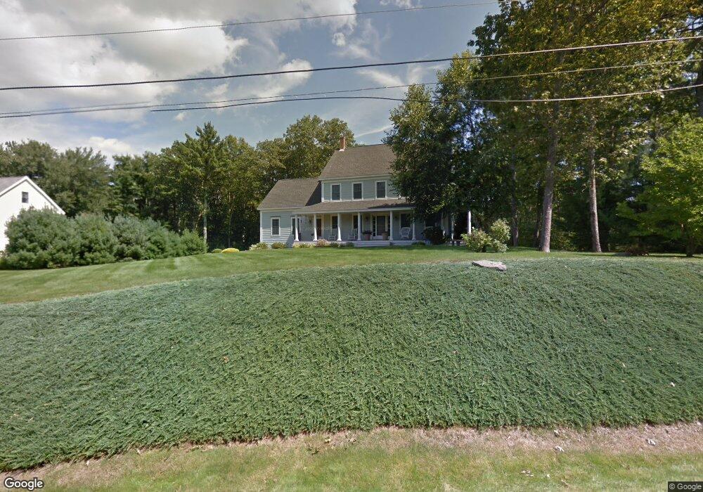
6 Michael Dr York, ME 03909
York NeighborhoodEstimated Value: $1,055,000 - $1,171,000
4
Beds
4
Baths
4,172
Sq Ft
$268/Sq Ft
Est. Value
About This Home
This home is located at 6 Michael Dr, York, ME 03909 and is currently estimated at $1,119,090, approximately $268 per square foot. 6 Michael Dr is a home located in York County with nearby schools including Village Elementary School, Coastal Ridge Elementary School, and York Middle School.
Create a Home Valuation Report for This Property
The Home Valuation Report is an in-depth analysis detailing your home's value as well as a comparison with similar homes in the area
Home Values in the Area
Average Home Value in this Area
Tax History
| Year | Tax Paid | Tax Assessment Tax Assessment Total Assessment is a certain percentage of the fair market value that is determined by local assessors to be the total taxable value of land and additions on the property. | Land | Improvement |
|---|---|---|---|---|
| 2024 | $7,935 | $944,600 | $195,800 | $748,800 |
| 2023 | $7,621 | $901,900 | $153,100 | $748,800 |
| 2022 | $7,206 | $842,800 | $153,100 | $689,700 |
| 2021 | $7,010 | $704,500 | $124,600 | $579,900 |
| 2020 | $7,000 | $630,600 | $159,700 | $470,900 |
| 2019 | $7,031 | $630,600 | $159,700 | $470,900 |
| 2018 | $6,913 | $620,000 | $149,100 | $470,900 |
| 2017 | $6,363 | $581,100 | $143,700 | $437,400 |
| 2016 | $6,420 | $575,800 | $138,400 | $437,400 |
| 2015 | $6,607 | $600,600 | $138,400 | $462,200 |
| 2014 | $6,426 | $600,600 | $138,400 | $462,200 |
| 2013 | $6,264 | $600,600 | $138,400 | $462,200 |
Source: Public Records
Map
Nearby Homes
- 52 Hooper Shores Rd
- 4 Fall Mill Rd
- 2 Woods Run
- 744 U S 1 Unit 12
- 801 Us Rt 1 Yorke Woods Unit K-3
- 801 US Route 1 Unit B3
- 801 US Route 1 Unit D2
- 7 Winterbrook Dr
- 16 Orchard Farm Rd
- 32 Bluestone Ln
- 8 Ash Ln
- 2 Lils Aly
- 1 Field Ave
- 1 River Farm Rd
- 190 York St
- 21 Fernald Ave Unit C
- 5 Mckenna Ln
- 12 Cardinal Ln
- 281 York St
- 294 York St Unit 1
Your Personal Tour Guide
Ask me questions while you tour the home.