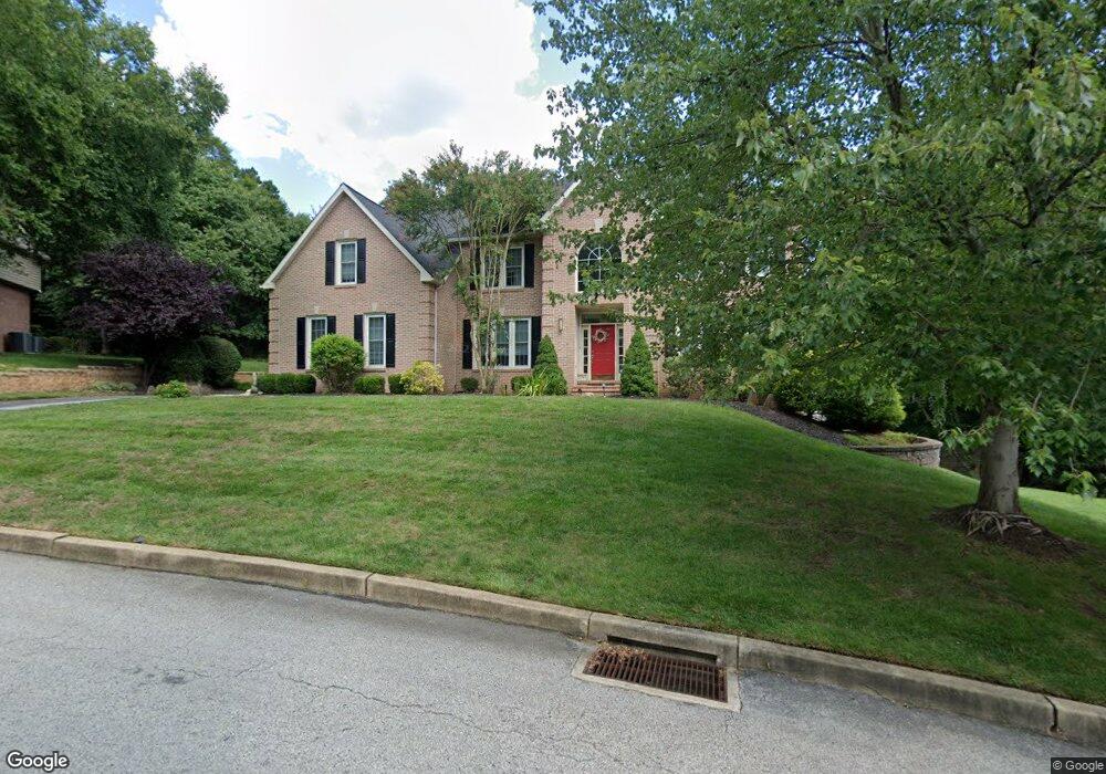
6 Michaels Way Broomall, PA 19008
Marple Township Delaware NeighborhoodEstimated Value: $996,000 - $1,119,000
4
Beds
5
Baths
4,167
Sq Ft
$251/Sq Ft
Est. Value
About This Home
This home is located at 6 Michaels Way, Broomall, PA 19008 and is currently estimated at $1,046,077, approximately $251 per square foot. 6 Michaels Way is a home located in Delaware County with nearby schools including Worrall Elementary School, Paxon Hollow Middle School, and Marple Newtown Senior High School.
Ownership History
Date
Name
Owned For
Owner Type
Purchase Details
Closed on
Jan 7, 2003
Sold by
Torbert Michael E and Torbert Michele P
Bought by
Naab Michael J and Naab Gail M
Current Estimated Value
Home Financials for this Owner
Home Financials are based on the most recent Mortgage that was taken out on this home.
Original Mortgage
$419,000
Outstanding Balance
$179,922
Interest Rate
6.11%
Mortgage Type
Purchase Money Mortgage
Estimated Equity
$866,155
Purchase Details
Closed on
Jan 27, 1994
Sold by
Preferred Homes Inc
Bought by
Schnall Mitchell D and Schnall Rosemary R
Home Financials for this Owner
Home Financials are based on the most recent Mortgage that was taken out on this home.
Original Mortgage
$273,000
Interest Rate
7.11%
Create a Home Valuation Report for This Property
The Home Valuation Report is an in-depth analysis detailing your home's value as well as a comparison with similar homes in the area
Home Values in the Area
Average Home Value in this Area
Purchase History
| Date | Buyer | Sale Price | Title Company |
|---|---|---|---|
| Naab Michael J | $549,000 | Commonwealth Land Title Ins | |
| Schnall Mitchell D | $427,000 | -- |
Source: Public Records
Mortgage History
| Date | Status | Borrower | Loan Amount |
|---|---|---|---|
| Open | Naab Michael J | $419,000 | |
| Previous Owner | Schnall Mitchell D | $273,000 |
Source: Public Records
Tax History Compared to Growth
Tax History
| Year | Tax Paid | Tax Assessment Tax Assessment Total Assessment is a certain percentage of the fair market value that is determined by local assessors to be the total taxable value of land and additions on the property. | Land | Improvement |
|---|---|---|---|---|
| 2025 | $9,957 | $576,180 | $168,520 | $407,660 |
| 2024 | $9,957 | $576,180 | $168,520 | $407,660 |
| 2023 | $9,641 | $576,180 | $168,520 | $407,660 |
| 2022 | $9,459 | $576,180 | $168,520 | $407,660 |
| 2021 | $14,274 | $576,180 | $168,520 | $407,660 |
| 2020 | $9,946 | $345,620 | $96,150 | $249,470 |
| 2019 | $9,826 | $345,620 | $96,150 | $249,470 |
| 2018 | $9,724 | $345,620 | $0 | $0 |
| 2017 | $9,729 | $345,620 | $0 | $0 |
| 2016 | $1,897 | $345,620 | $0 | $0 |
| 2015 | $1,897 | $345,620 | $0 | $0 |
| 2014 | $1,897 | $345,620 | $0 | $0 |
Source: Public Records
Map
Nearby Homes
- 102 Gibson Ct
- 104 Gibson Ct
- 106 Gibson Ct
- 2734 Old Cedar Grove Rd
- 101 Eagle Dr
- 113 Eagle Dr
- 105 Eagle Dr
- 103 Eagle Dr
- 107 Eagle Dr
- 106 Eagle Dr
- 104 Eagle Dr
- 2613 Caranel Rd
- 2500 Grant Rd
- 3607 Gradyville Rd
- 3609 Gradyville Rd
- 11 Linden Dr
- 2611 Woodberry Rd
- 204 Media Line Rd
- 1038 Palmers Mill Rd
- 402 S Newtown Street Rd
- 4 Michaels Way
- 8 Michaels Way
- 1 Michaels Way
- 320 Beechtree Dr
- 2 Michaels Way
- 3 Michaels Way
- 7 Michaels Way
- 5 Michaels Way
- 2687 Old Cedar Grove Rd
- 6 Sunan Rd
- 21 Michaels Way
- 318 Beechtree Dr
- 2651 Old Cedar Grove Rd
- 313 Beechtree Dr
- 4 Sunan Rd
- 316 Beechtree Dr
- 3 Stoney End Rd
- 5 Sunan Rd
- 2691 Old Cedar Grove Rd
- 2662 Old Cedar Grove Rd