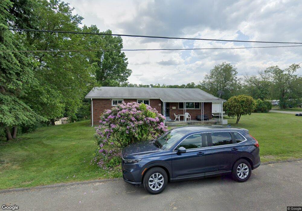
6 Milton St Uniontown, PA 15401
North Union Township NeighborhoodEstimated Value: $68,757 - $104,000
3
Beds
1
Bath
1,380
Sq Ft
$60/Sq Ft
Est. Value
About This Home
This home is located at 6 Milton St, Uniontown, PA 15401 and is currently estimated at $82,689, approximately $59 per square foot. 6 Milton St is a home located in Fayette County with nearby schools including Laurel Highlands Senior High School, St. John the Evangelist School, and Chestnut Ridge Christian Academy.
Ownership History
Date
Name
Owned For
Owner Type
Purchase Details
Closed on
Oct 30, 2024
Sold by
Murray William Earl and Murray Jeffrey
Bought by
Murray Derek
Current Estimated Value
Home Financials for this Owner
Home Financials are based on the most recent Mortgage that was taken out on this home.
Original Mortgage
$61,750
Outstanding Balance
$61,132
Interest Rate
6.09%
Mortgage Type
New Conventional
Estimated Equity
$21,557
Purchase Details
Closed on
Jan 1, 1968
Bought by
Murray William E
Create a Home Valuation Report for This Property
The Home Valuation Report is an in-depth analysis detailing your home's value as well as a comparison with similar homes in the area
Home Values in the Area
Average Home Value in this Area
Purchase History
| Date | Buyer | Sale Price | Title Company |
|---|---|---|---|
| Murray Derek | $65,000 | None Listed On Document | |
| Murray William E | -- | -- |
Source: Public Records
Mortgage History
| Date | Status | Borrower | Loan Amount |
|---|---|---|---|
| Open | Murray Derek | $61,750 |
Source: Public Records
Tax History Compared to Growth
Tax History
| Year | Tax Paid | Tax Assessment Tax Assessment Total Assessment is a certain percentage of the fair market value that is determined by local assessors to be the total taxable value of land and additions on the property. | Land | Improvement |
|---|---|---|---|---|
| 2025 | $779 | $27,435 | $6,385 | $21,050 |
| 2024 | $757 | $27,435 | $6,385 | $21,050 |
| 2023 | $1,455 | $27,435 | $6,385 | $21,050 |
| 2022 | $1,441 | $27,435 | $6,385 | $21,050 |
| 2021 | $1,401 | $27,435 | $6,385 | $21,050 |
| 2020 | $1,401 | $27,435 | $6,385 | $21,050 |
| 2019 | $1,286 | $27,435 | $6,385 | $21,050 |
| 2018 | $1,247 | $27,435 | $6,385 | $21,050 |
| 2017 | $1,247 | $27,435 | $6,385 | $21,050 |
| 2016 | -- | $27,435 | $6,385 | $21,050 |
| 2015 | -- | $27,435 | $6,385 | $21,050 |
| 2014 | -- | $54,870 | $12,770 | $42,100 |
Source: Public Records
Map
Nearby Homes
- 223 Emerson Ln
- 53 Braddock St
- 0 Taft Ave Unit 1714640
- 39 Murphy St
- 75 Cycle Ave
- 15 Reppert Blvd
- 246 Coolspring St
- 8 1/2 Apple St
- 192 Searight Ave
- 32 Coolspring St
- 1210 Connellsville Rd
- 30 Collins Ave
- 24 Herman St
- 149 Coolspring St
- 23 Thomas St
- 200 Evans St
- 349 Hopwood Coolspring Rd
- 142 Madison Ave
- 199 Lenox St
- 58 North Ave
- 619 Coolspring St
- 12 Milton St
- 625 Coolspring St
- 3 Milton St
- 7 Milton St
- 23 Atlantic Ave
- 16 Milton St
- 633 Coolspring St
- 11 Milton St
- 15 Atlantic Ave
- 15 Milton St
- 24 Milton St
- 626 Coolspring St
- 635 Coolspring St
- 25 Milton St
- 640 Coolspring St
- 640 Coolspring St Unit A
- 640 Coolspring St Unit B
- 636 Coolspring St
- 643 Coolspring St