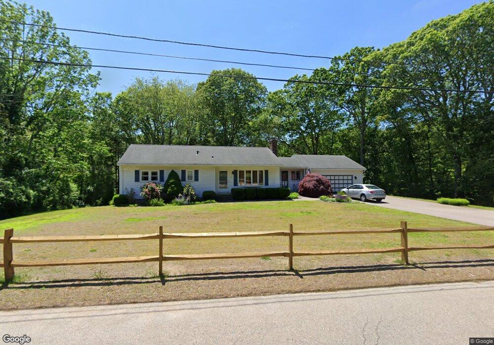
6 Moriah Dr Westerly, RI 02891
Estimated Value: $542,000 - $608,000
3
Beds
2
Baths
2,126
Sq Ft
$268/Sq Ft
Est. Value
About This Home
This home is located at 6 Moriah Dr, Westerly, RI 02891 and is currently estimated at $568,900, approximately $267 per square foot. 6 Moriah Dr is a home located in Washington County with nearby schools including Westerly High School, North Stonington Christian Academy, and St. Michael School.
Ownership History
Date
Name
Owned For
Owner Type
Purchase Details
Closed on
Oct 22, 2012
Sold by
Terranova Sarah W and Terranova Jospeh A
Bought by
Gregory Deborah R and Toscano Timothy J
Current Estimated Value
Home Financials for this Owner
Home Financials are based on the most recent Mortgage that was taken out on this home.
Original Mortgage
$60,000
Outstanding Balance
$8,761
Interest Rate
3.57%
Mortgage Type
New Conventional
Estimated Equity
$560,139
Create a Home Valuation Report for This Property
The Home Valuation Report is an in-depth analysis detailing your home's value as well as a comparison with similar homes in the area
Home Values in the Area
Average Home Value in this Area
Purchase History
| Date | Buyer | Sale Price | Title Company |
|---|---|---|---|
| Gregory Deborah R | $290,000 | -- |
Source: Public Records
Mortgage History
| Date | Status | Borrower | Loan Amount |
|---|---|---|---|
| Open | Gregory Deborah R | $60,000 | |
| Previous Owner | Gregory Deborah R | $125,000 | |
| Previous Owner | Gregory Deborah R | $65,000 |
Source: Public Records
Tax History
| Year | Tax Paid | Tax Assessment Tax Assessment Total Assessment is a certain percentage of the fair market value that is determined by local assessors to be the total taxable value of land and additions on the property. | Land | Improvement |
|---|---|---|---|---|
| 2025 | $3,385 | $476,100 | $199,900 | $276,200 |
| 2024 | $3,503 | $357,100 | $144,100 | $213,000 |
| 2023 | $3,435 | $357,100 | $144,100 | $213,000 |
| 2022 | $3,414 | $357,100 | $144,100 | $213,000 |
| 2021 | $3,355 | $291,200 | $125,900 | $165,300 |
| 2020 | $3,293 | $291,200 | $125,900 | $165,300 |
| 2019 | $3,261 | $291,200 | $125,900 | $165,300 |
| 2018 | $3,222 | $271,200 | $125,900 | $145,300 |
| 2017 | $3,143 | $271,200 | $125,900 | $145,300 |
| 2016 | $3,168 | $271,200 | $125,900 | $145,300 |
| 2015 | $3,245 | $299,900 | $134,400 | $165,500 |
| 2014 | $3,191 | $299,900 | $134,400 | $165,500 |
Source: Public Records
Map
Nearby Homes
Your Personal Tour Guide
Ask me questions while you tour the home.