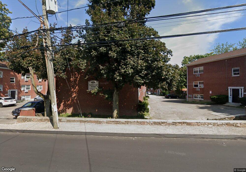
6 N Taylor Ave Unit D Norwalk, CT 06854
Spring Hill NeighborhoodEstimated Value: $275,654 - $335,000
1
Bed
1
Bath
1,013
Sq Ft
$295/Sq Ft
Est. Value
About This Home
This home is located at 6 N Taylor Ave Unit D, Norwalk, CT 06854 and is currently estimated at $299,164, approximately $295 per square foot. 6 N Taylor Ave Unit D is a home located in Fairfield County with nearby schools including Kendall Elementary School, Ponus Ridge Middle School, and Brien Mcmahon High School.
Ownership History
Date
Name
Owned For
Owner Type
Purchase Details
Closed on
Feb 1, 2007
Sold by
4 & 6 Taylor Avenue Llc
Bought by
Betancur Myriam
Current Estimated Value
Home Financials for this Owner
Home Financials are based on the most recent Mortgage that was taken out on this home.
Original Mortgage
$161,600
Interest Rate
6.16%
Create a Home Valuation Report for This Property
The Home Valuation Report is an in-depth analysis detailing your home's value as well as a comparison with similar homes in the area
Home Values in the Area
Average Home Value in this Area
Purchase History
| Date | Buyer | Sale Price | Title Company |
|---|---|---|---|
| Betancur Myriam | $202,000 | -- | |
| Betancur Myriam | $202,000 | -- |
Source: Public Records
Mortgage History
| Date | Status | Borrower | Loan Amount |
|---|---|---|---|
| Open | Betancur Myriam | $45,310 | |
| Open | Betancur Myriam | $207,263 | |
| Closed | Betancur Myriam | $209,113 | |
| Closed | Betancur Myriam | $161,600 |
Source: Public Records
Tax History Compared to Growth
Tax History
| Year | Tax Paid | Tax Assessment Tax Assessment Total Assessment is a certain percentage of the fair market value that is determined by local assessors to be the total taxable value of land and additions on the property. | Land | Improvement |
|---|---|---|---|---|
| 2025 | $3,509 | $146,810 | $0 | $146,810 |
| 2024 | $3,457 | $146,810 | $0 | $146,810 |
| 2023 | $2,770 | $110,430 | $0 | $110,430 |
| 2022 | $2,711 | $110,430 | $0 | $110,430 |
| 2021 | $2,647 | $110,430 | $0 | $110,430 |
| 2020 | $2,645 | $110,430 | $0 | $110,430 |
| 2019 | $2,575 | $110,430 | $0 | $110,430 |
| 2018 | $3,175 | $119,320 | $0 | $119,320 |
| 2017 | $3,064 | $119,320 | $0 | $119,320 |
| 2016 | $3,036 | $119,320 | $0 | $119,320 |
| 2015 | $3,027 | $119,320 | $0 | $119,320 |
| 2014 | $2,988 | $119,320 | $0 | $119,320 |
Source: Public Records
Map
Nearby Homes
- 14 Ferris Ave Unit 9
- 34 Ferris Ave Unit A2
- 8 Crown Ave
- 1 Horizon Dr Unit 2
- 59 Taylor Ave
- 42 Stuart Ave Unit A1
- 6 W Couch St
- 47 Taylor Ave
- 146 Gillies Ln Unit 146
- 39 Chatham Dr
- 2 Finley St
- 14 Windward Rd
- 187 Flax Hill Rd Unit D5
- 50 Fairview Ave Unit 4J
- 50 Fairview Ave Unit 1C
- 3 Wynne Rd
- 46 Prospect Ave Unit 2H
- 46 Prospect Ave Unit 1C
- 17 Woodlawn Ave
- 32 Pine St Unit 27
- 6 N Taylor Ave Unit C
- 4 N Taylor Ave Unit B
- 4 N Taylor Ave Unit A
- 4 N Taylor Ave
- 4 N Taylor Ave Unit E
- 10 N Taylor Ave
- 5 N Taylor Ave
- 3 N Taylor Ave
- 7 N Taylor Ave
- 118 W Cedar St Unit 5
- 118 W Cedar St Unit 4
- 118 W Cedar St Unit 3
- 118 W Cedar St Unit 2
- 118 W Cedar St Unit 1
- 118 W Cedar St
- 120 W Cedar St
- 9 N Taylor Ave
- 12 N Taylor Ave Unit 31
- 12 N Taylor Ave Unit 28
- 12 N Taylor Ave Unit 35