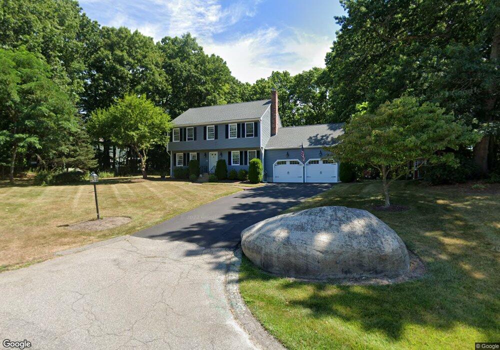
6 Nobscott Rd Medway, MA 02053
Estimated Value: $765,000 - $886,000
4
Beds
3
Baths
1,962
Sq Ft
$411/Sq Ft
Est. Value
About This Home
This home is located at 6 Nobscott Rd, Medway, MA 02053 and is currently estimated at $806,698, approximately $411 per square foot. 6 Nobscott Rd is a home located in Norfolk County with nearby schools including John D. McGovern Elementary School, Burke-Memorial Elementary, and Medway Middle School.
Ownership History
Date
Name
Owned For
Owner Type
Purchase Details
Closed on
Apr 2, 2025
Sold by
Bevilacqua Steven
Bought by
Bevilacqua Anthony J
Current Estimated Value
Purchase Details
Closed on
Jan 12, 2024
Sold by
Peduto Beth B
Bought by
Bevilacqua Steven
Create a Home Valuation Report for This Property
The Home Valuation Report is an in-depth analysis detailing your home's value as well as a comparison with similar homes in the area
Home Values in the Area
Average Home Value in this Area
Purchase History
| Date | Buyer | Sale Price | Title Company |
|---|---|---|---|
| Bevilacqua Anthony J | -- | None Available | |
| Bevilacqua Anthony J | -- | None Available | |
| Bevilacqua Steven | $680,000 | None Available | |
| Bevilacqua Steven | $680,000 | None Available |
Source: Public Records
Tax History Compared to Growth
Tax History
| Year | Tax Paid | Tax Assessment Tax Assessment Total Assessment is a certain percentage of the fair market value that is determined by local assessors to be the total taxable value of land and additions on the property. | Land | Improvement |
|---|---|---|---|---|
| 2025 | $9,156 | $642,500 | $339,900 | $302,600 |
| 2024 | $9,252 | $642,500 | $339,900 | $302,600 |
| 2023 | $8,931 | $560,300 | $309,400 | $250,900 |
| 2022 | $7,893 | $466,200 | $228,800 | $237,400 |
| 2021 | $7,880 | $451,300 | $213,500 | $237,800 |
| 2020 | $7,740 | $442,300 | $213,500 | $228,800 |
| 2019 | $7,297 | $430,000 | $204,800 | $225,200 |
| 2018 | $7,345 | $415,900 | $196,100 | $219,800 |
| 2017 | $7,311 | $408,000 | $191,800 | $216,200 |
| 2016 | $7,112 | $392,700 | $176,500 | $216,200 |
| 2015 | $7,059 | $387,000 | $174,300 | $212,700 |
| 2014 | $6,873 | $364,800 | $174,300 | $190,500 |
Source: Public Records
Map
Nearby Homes
- 15 Broad Acres Farm Rd
- 12 Longmeadow Ln
- 78 Fisher St
- 4 Deerfield Rd
- 85 Fisher St
- 56 Paul Rd
- 6 Rainbow Dr
- 6 Freedom Trail
- 116 Winthrop St
- 19 Sycamore Way Unit L40
- 5 Fales St
- 39 West St
- 176 Main St Unit 3
- 220 Main St Unit 220
- 7 Hill St
- 14 Heritage Dr
- 22 Granite St
- 28 Wellington St
- 36 Lovering St
- 9 Tulip Way
- 21 Broad Acres Farm Rd
- 23 Broad Acres Farm Rd
- 4 Nobscott Rd
- 2 Wildwood Dr
- 1 Wildwood Dr
- 1 Newton Ln
- 24 Broad Acres Farm Rd
- 3 Nobscott Rd
- 22 Broad Acres Farm Rd
- 25 Broad Acres Farm Rd
- 19 Broad Acres Farm Rd
- 2 Newton Ln
- 2 Nobscott Rd
- 1 Nobscott Rd
- 26 Broad Acres Farm Rd
- 27 Broad Acres Farm Rd
- 20 Broad Acres Farm Rd
- 13 Stable Way
- 4 Newton Ln
- 15 Stable Way