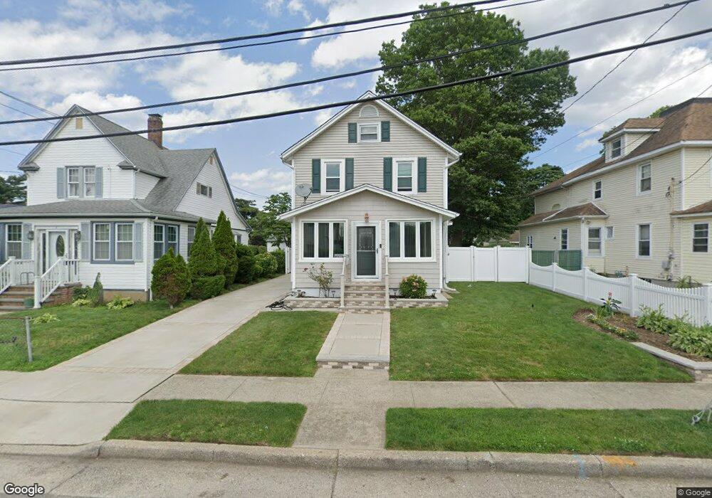
6 Nostrand Place Hempstead, NY 11550
Estimated Value: $616,036 - $647,000
--
Bed
3
Baths
1,566
Sq Ft
$403/Sq Ft
Est. Value
About This Home
This home is located at 6 Nostrand Place, Hempstead, NY 11550 and is currently estimated at $631,518, approximately $403 per square foot. 6 Nostrand Place is a home located in Nassau County with nearby schools including Crescent School.
Ownership History
Date
Name
Owned For
Owner Type
Purchase Details
Closed on
Aug 3, 1999
Sold by
N D N Enterprises Ltd
Bought by
Mitchell Christine and Bush Benjamin T
Current Estimated Value
Home Financials for this Owner
Home Financials are based on the most recent Mortgage that was taken out on this home.
Original Mortgage
$163,650
Outstanding Balance
$46,844
Interest Rate
7.6%
Mortgage Type
Purchase Money Mortgage
Estimated Equity
$584,674
Purchase Details
Closed on
Jan 29, 1999
Purchase Details
Closed on
Jan 28, 1999
Purchase Details
Closed on
Jun 16, 1998
Create a Home Valuation Report for This Property
The Home Valuation Report is an in-depth analysis detailing your home's value as well as a comparison with similar homes in the area
Home Values in the Area
Average Home Value in this Area
Purchase History
| Date | Buyer | Sale Price | Title Company |
|---|---|---|---|
| Mitchell Christine | $165,000 | Fidelity National Title Ins | |
| -- | -- | -- | |
| -- | $70,000 | -- | |
| -- | $85,000 | -- |
Source: Public Records
Mortgage History
| Date | Status | Borrower | Loan Amount |
|---|---|---|---|
| Open | Mitchell Christine | $163,650 |
Source: Public Records
Tax History Compared to Growth
Tax History
| Year | Tax Paid | Tax Assessment Tax Assessment Total Assessment is a certain percentage of the fair market value that is determined by local assessors to be the total taxable value of land and additions on the property. | Land | Improvement |
|---|---|---|---|---|
| 2025 | $7,927 | $362 | $159 | $203 |
| 2024 | $950 | $362 | $159 | $203 |
| 2023 | $7,770 | $362 | $159 | $203 |
| 2022 | $7,770 | $354 | $142 | $212 |
| 2021 | $11,683 | $343 | $138 | $205 |
| 2020 | $8,649 | $604 | $329 | $275 |
| 2019 | $8,686 | $604 | $329 | $275 |
| 2018 | $8,291 | $604 | $0 | $0 |
| 2017 | $6,446 | $604 | $329 | $275 |
| 2016 | $7,503 | $604 | $329 | $275 |
| 2015 | $1,011 | $604 | $329 | $275 |
| 2014 | $1,011 | $604 | $329 | $275 |
| 2013 | $936 | $604 | $329 | $275 |
Source: Public Records
Map
Nearby Homes
- 47 Gladys Ave
- 4 Duryea Place
- 27 Hoff Ct
- 66 Henry St Unit 4
- 66 Henry St Unit 1
- 142 Henry St
- 72 Ingraham Blvd
- 11 Hoff Ct
- 199 William St
- 59 Ingraham Blvd
- 43 Peninsula Blvd
- 7 Stanley Place
- 109 Leverich St
- 110 Powell Place
- 78 Spencer Place
- 106 Spencer Place
- 75 Baldwin Rd
- 81 Baldwin Rd
- 27 Elizabeth Ct
- 23 Elizabeth Ct
- 10 Nostrand Place
- 2 Nostrand Place
- 2 N Norstrand Place
- 116 Gladys Ave
- 14 Nostrand Place
- 120 Gladys Ave
- 94 Gladys Ave
- 18 Nostrand Place
- 105 Gladys Ave
- 111 Gladys Ave
- 103 Gladys Ave
- 115 Gladys Ave
- 7 Nostrand Place
- 126 Gladys Ave
- 11 Nostrand Place
- 117 Gladys Ave
- 22 Nostrand Place
- 88 Gladys Ave
- 95 Gladys Ave
- 17 Nostrand Place