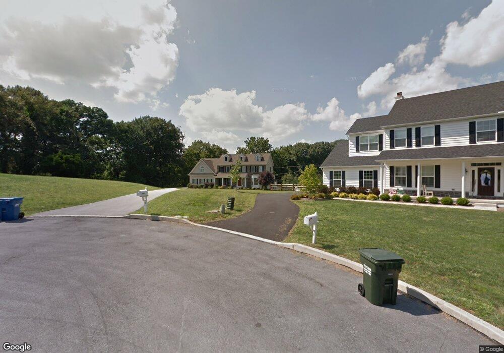
6 Overlook Cir West Chester, PA 19382
Estimated Value: $1,075,076 - $1,147,000
5
Beds
3
Baths
4,683
Sq Ft
$238/Sq Ft
Est. Value
About This Home
This home is located at 6 Overlook Cir, West Chester, PA 19382 and is currently estimated at $1,114,269, approximately $237 per square foot. 6 Overlook Cir is a home located in Chester County with nearby schools including Pocopson Elementary School, Charles F. Patton Middle School, and Unionville High School.
Ownership History
Date
Name
Owned For
Owner Type
Purchase Details
Closed on
Oct 27, 2010
Sold by
Cornell Pocopson Llc
Bought by
Willey David and Willey Catherine
Current Estimated Value
Purchase Details
Closed on
Apr 8, 2008
Sold by
Town & Country Of West Chester Inc
Bought by
Cornell Pocopson Llc
Home Financials for this Owner
Home Financials are based on the most recent Mortgage that was taken out on this home.
Original Mortgage
$560,000
Interest Rate
6.1%
Mortgage Type
Construction
Create a Home Valuation Report for This Property
The Home Valuation Report is an in-depth analysis detailing your home's value as well as a comparison with similar homes in the area
Home Values in the Area
Average Home Value in this Area
Purchase History
| Date | Buyer | Sale Price | Title Company |
|---|---|---|---|
| Willey David | $585,000 | None Available | |
| Cornell Pocopson Llc | $240,000 | None Available |
Source: Public Records
Mortgage History
| Date | Status | Borrower | Loan Amount |
|---|---|---|---|
| Previous Owner | Cornell Pocopson Llc | $560,000 |
Source: Public Records
Tax History Compared to Growth
Tax History
| Year | Tax Paid | Tax Assessment Tax Assessment Total Assessment is a certain percentage of the fair market value that is determined by local assessors to be the total taxable value of land and additions on the property. | Land | Improvement |
|---|---|---|---|---|
| 2025 | $13,644 | $352,540 | $71,440 | $281,100 |
| 2024 | $13,644 | $352,540 | $71,440 | $281,100 |
| 2023 | $13,214 | $352,540 | $71,440 | $281,100 |
| 2022 | $12,942 | $352,540 | $71,440 | $281,100 |
| 2021 | $12,628 | $352,540 | $71,440 | $281,100 |
| 2020 | $12,596 | $352,540 | $71,440 | $281,100 |
| 2019 | $12,367 | $352,540 | $71,440 | $281,100 |
| 2018 | $12,332 | $352,540 | $71,440 | $281,100 |
| 2017 | $12,078 | $352,540 | $71,440 | $281,100 |
| 2016 | $1,329 | $352,540 | $71,440 | $281,100 |
| 2015 | $1,329 | $352,540 | $71,440 | $281,100 |
| 2014 | $1,329 | $352,540 | $71,440 | $281,100 |
Source: Public Records
Map
Nearby Homes
- 7 Bittersweet Dr
- 1435 Lenape Rd
- 4 Sloan Rd
- 2005 W Street Rd
- 1740 Lenape Rd
- 30 Penn Dr
- 523 Radek Ct
- 275 S Creek Rd
- 1315 Lenape Rd
- 1303 Lenape Rd
- 1936 Lenape Rd
- 1125 Mews Ln Unit 16
- 741 Haines Mill Rd
- 1107 Mews Ln Unit 7
- 0 Haines Mill Rd
- 1185 W Street Rd
- 361 Quail Run Ln
- 1202 Turks Head Ln
- 2039-2035 Lenape Unionville Rd
- 1342 Carolannes Way
- 7 Overlook Cir
- 699 W Lafayette Dr
- 5 Overlook Cir
- 698 W Lafayette Dr
- 1550 Lenape Rd
- 665 W Lafayette Dr
- 4 Overlook Cir
- 1553 Lenape Rd
- 650 W Lafayette Dr
- 1609 Lenape Rd
- 1617 Lenape Rd
- 3 Overlook Cir
- 690 E Lafayette Dr
- 1566 Wayne Dr
- 1621 Lenape Rd
- 600 W Lafayette Dr
- 2 Overlook Cir
- 680 E Lafayette Dr
- 1601 Lenni Dr
- 1564 Wayne Dr