
Seller's Agent in 2025
Gregory Rice
Coldwell Banker Realty
(732) 449-2777
23 in this area
111 Total Sales
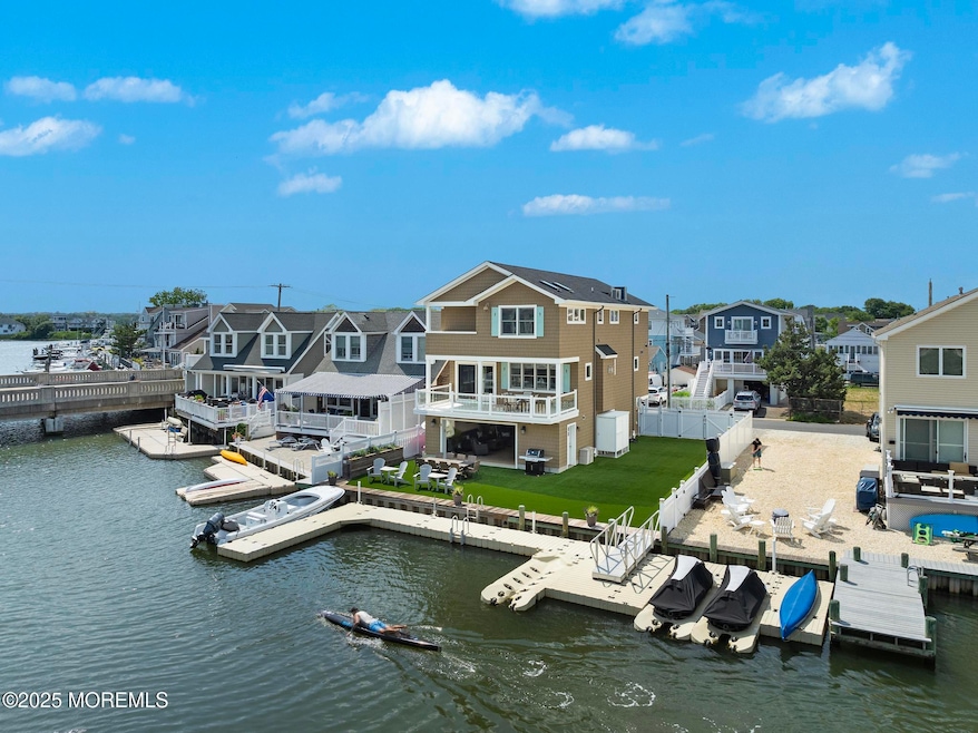
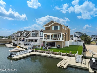
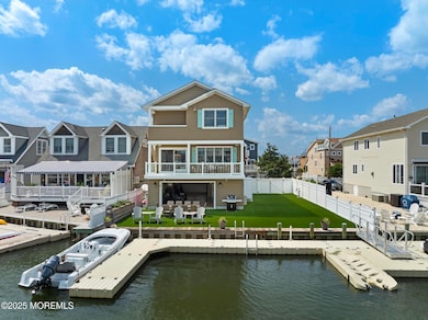
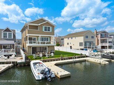
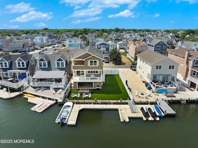
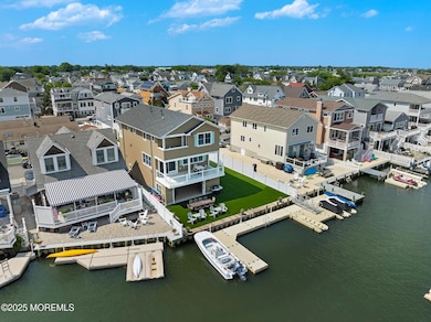
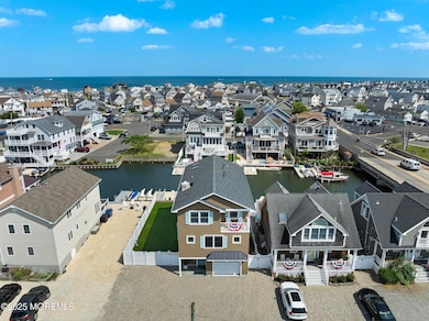
Here is that opportunity for a turn-key Shore House on the water and only steps from Manasquan Beach! Just 10 years old, this modern, custom-built beauty sits just 2 blocks from the beach and on the lagoon between Stockton Lake and Glimmer Glass Harbor! Enjoy boating, jet skiing, kayaking, paddleboarding, swimming and fishing all from your backyard! This is a very private one-way street, and the property is a rare 52.5' wide lot for privacy and extra parking! Inside you'll find a 3-stop ELEVATOR, ground level garage/cabana space, open floor plan, radiant floor heating, luxurious kitchen, custom tile and built-ins, multiple balconies, an ocean view, and much more! Just move right in immediately and start living the ultimate coastal lifestyle!
Last Agent to Sell the Property
Coldwell Banker Realty License #0571288 Listed on: 06/26/2025
| Date | Type | Sale Price | Title Company |
|---|---|---|---|
| Deed | $3,180,000 | Commonwealth Title | |
| Deed | -- | None Listed On Document | |
| Deed | -- | None Listed On Document | |
| Deed | -- | None Listed On Document | |
| Deed | -- | None Listed On Document | |
| Deed | $670,000 | Old Republic National Title | |
| Deed | $232,000 | -- |
| Date | Status | Loan Amount | Loan Type |
|---|---|---|---|
| Open | $2,160,000 | New Conventional | |
| Previous Owner | $167,000 | No Value Available |
| Date | Event | Price | List to Sale | Price per Sq Ft |
|---|---|---|---|---|
| 08/15/2025 08/15/25 | Sold | $3,180,000 | +6.0% | $1,380 / Sq Ft |
| 07/08/2025 07/08/25 | Pending | -- | -- | -- |
| 06/26/2025 06/26/25 | For Sale | $2,999,995 | -- | $1,302 / Sq Ft |
| Year | Tax Paid | Tax Assessment Tax Assessment Total Assessment is a certain percentage of the fair market value that is determined by local assessors to be the total taxable value of land and additions on the property. | Land | Improvement |
|---|---|---|---|---|
| 2025 | $15,726 | $884,500 | $436,300 | $448,200 |
| 2024 | $14,723 | $884,500 | $436,300 | $448,200 |
| 2023 | $14,723 | $860,500 | $429,100 | $431,400 |
| 2022 | $14,172 | $860,500 | $429,100 | $431,400 |
| 2021 | $13,450 | $860,500 | $429,100 | $431,400 |
| 2020 | $13,975 | $860,500 | $429,100 | $431,400 |
| 2019 | $13,450 | $860,500 | $429,100 | $431,400 |
| 2018 | $13,148 | $860,500 | $429,100 | $431,400 |
| 2017 | $12,649 | $860,500 | $429,100 | $431,400 |
| 2016 | $6,284 | $439,100 | $429,100 | $10,000 |
| 2015 | $5,701 | $333,600 | $322,000 | $11,600 |
| 2014 | $7,839 | $459,200 | $338,700 | $120,500 |
Seller's Agent in 2025
Gregory Rice
Coldwell Banker Realty
(732) 449-2777
23 in this area
111 Total Sales
Buyer's Agent in 2025
Danielle Coyle
RE/MAX
(732) 598-0428
3 in this area
206 Total Sales
Source: MOREMLS (Monmouth Ocean Regional REALTORS®)
MLS Number: 22518498
APN: 29-00155-0000-00002
Disclaimer: Certain information contained herein is derived from information provided by parties other than Homes.com. All information provided is deemed reliable, but is not guaranteed to be accurate and should be independently verified.
![]() IDX information is provided exclusively for personal, non-commercial use, and may not be used for any purpose other than to identify prospective properties consumers may be interested in purchasing.
IDX information is provided exclusively for personal, non-commercial use, and may not be used for any purpose other than to identify prospective properties consumers may be interested in purchasing.
Information is deemed reliable but not guaranteed.