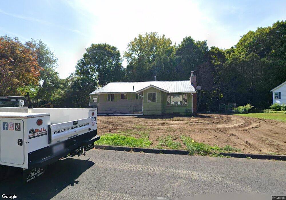
6 Phillips Dr Holyoke, MA 01040
Estimated Value: $221,000 - $363,000
3
Beds
2
Baths
1,876
Sq Ft
$158/Sq Ft
Est. Value
About This Home
This home is located at 6 Phillips Dr, Holyoke, MA 01040 and is currently estimated at $296,552, approximately $158 per square foot. 6 Phillips Dr is a home located in Hampden County with nearby schools including Lt. Elmer J. McMahon Elementary School, Holyoke High School, and First Lutheran Christian School.
Ownership History
Date
Name
Owned For
Owner Type
Purchase Details
Closed on
Aug 28, 2025
Sold by
Curtis Randall J and Curtis Linda M
Bought by
Rivera-Otero Wilma and Otero-Cintron Sammy
Current Estimated Value
Purchase Details
Closed on
Nov 30, 1999
Sold by
Julin David T
Bought by
Curtis Randall J and Curtis Linda M
Home Financials for this Owner
Home Financials are based on the most recent Mortgage that was taken out on this home.
Original Mortgage
$106,084
Interest Rate
7.77%
Mortgage Type
Purchase Money Mortgage
Create a Home Valuation Report for This Property
The Home Valuation Report is an in-depth analysis detailing your home's value as well as a comparison with similar homes in the area
Home Values in the Area
Average Home Value in this Area
Purchase History
| Date | Buyer | Sale Price | Title Company |
|---|---|---|---|
| Rivera-Otero Wilma | $193,000 | -- | |
| Rivera-Otero Wilma | $193,000 | -- | |
| Curtis Randall J | $107,000 | -- | |
| Curtis Randall J | $107,000 | -- |
Source: Public Records
Mortgage History
| Date | Status | Borrower | Loan Amount |
|---|---|---|---|
| Previous Owner | Curtis Randall J | $106,084 |
Source: Public Records
Tax History Compared to Growth
Tax History
| Year | Tax Paid | Tax Assessment Tax Assessment Total Assessment is a certain percentage of the fair market value that is determined by local assessors to be the total taxable value of land and additions on the property. | Land | Improvement |
|---|---|---|---|---|
| 2025 | $4,086 | $234,000 | $63,400 | $170,600 |
| 2024 | $3,835 | $202,400 | $60,400 | $142,000 |
| 2023 | $3,681 | $196,200 | $60,400 | $135,800 |
| 2022 | $3,565 | $185,100 | $60,400 | $124,700 |
| 2021 | $3,412 | $175,900 | $57,800 | $118,100 |
| 2020 | $3,639 | $167,300 | $57,800 | $109,500 |
| 2019 | $3,096 | $160,500 | $57,800 | $102,700 |
| 2018 | $5,061 | $155,200 | $57,800 | $97,400 |
| 2017 | $2,975 | $155,200 | $57,800 | $97,400 |
| 2016 | $2,967 | $155,200 | $59,700 | $95,500 |
| 2015 | $2,955 | $155,200 | $59,700 | $95,500 |
Source: Public Records
Map
Nearby Homes
- 34 Maple Crest Cir Unit D
- 33 Maple Crest Cir Unit D
- 15 Maple Crest Cir Unit D
- 16 Maple Crest Cir Unit B
- 128 Ontario Ave
- 155 Huron Ave
- 244 Ontario Ave
- 43 King St
- 286 Westfield Rd
- 46 Cherry Hill
- 78 Hitchcock St
- 7 Vermont St
- 70-72 Westfield Rd
- 85 Woodland St
- 53 Calumet Rd
- 84 Woodland St
- 1793 Northampton St
- 25 W Glen St
- Lot A Homestead Ave
- 56 Laurel St
- 10 Phillips Dr
- 7 Phillips Dr
- 155 Homestead Ave
- 159 Homestead Ave
- 11 Phillips Dr
- 14 Phillips Dr
- 145 Homestead Ave
- 4 Timber Ln
- 1 Humeston Slope
- 3 Humeston Slope
- 17 Phillips Dr
- 17 Phillips Dr
- 6 Timber Ln
- 6 Timber Ln
- 3 Humested Slope
- 8 Timber Ln
- 5 Humeston Slope
- 172 Homestead Ave
- 172 Homestead Ave Unit 172
- 172 Homestead Ave Unit 1