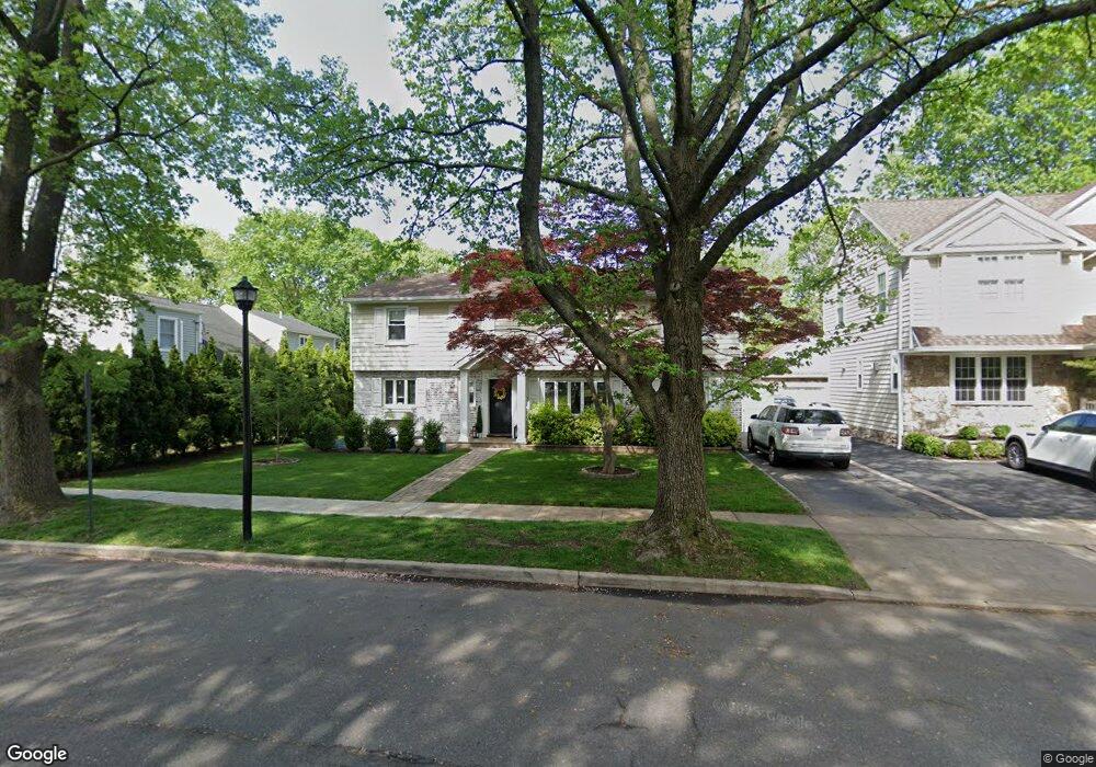
6 Plattsdale Rd Garden City, NY 11530
Estimated Value: $1,138,586 - $1,294,000
3
Beds
2
Baths
1,900
Sq Ft
$640/Sq Ft
Est. Value
About This Home
This home is located at 6 Plattsdale Rd, Garden City, NY 11530 and is currently estimated at $1,216,293, approximately $640 per square foot. 6 Plattsdale Rd is a home located in Nassau County with nearby schools including Homestead School, Stratford Avenue School, and Garden City Middle School.
Ownership History
Date
Name
Owned For
Owner Type
Purchase Details
Closed on
Jun 30, 2016
Sold by
Power Brendan and Quinn Erin P
Bought by
Themelis John and Themelis Sotira
Current Estimated Value
Home Financials for this Owner
Home Financials are based on the most recent Mortgage that was taken out on this home.
Original Mortgage
$663,200
Outstanding Balance
$530,795
Interest Rate
3.66%
Mortgage Type
New Conventional
Estimated Equity
$685,498
Purchase Details
Closed on
Jun 30, 2008
Sold by
Ketigian George
Bought by
Power Brendan
Purchase Details
Closed on
Sep 11, 1998
Create a Home Valuation Report for This Property
The Home Valuation Report is an in-depth analysis detailing your home's value as well as a comparison with similar homes in the area
Home Values in the Area
Average Home Value in this Area
Purchase History
| Date | Buyer | Sale Price | Title Company |
|---|---|---|---|
| Themelis John | $829,000 | None Available | |
| Power Brendan | $637,000 | -- | |
| -- | -- | -- |
Source: Public Records
Mortgage History
| Date | Status | Borrower | Loan Amount |
|---|---|---|---|
| Open | Themelis John | $663,200 |
Source: Public Records
Tax History Compared to Growth
Tax History
| Year | Tax Paid | Tax Assessment Tax Assessment Total Assessment is a certain percentage of the fair market value that is determined by local assessors to be the total taxable value of land and additions on the property. | Land | Improvement |
|---|---|---|---|---|
| 2025 | $11,188 | $696 | $263 | $433 |
| 2024 | $1,836 | $843 | $319 | $524 |
| 2023 | $12,428 | $855 | $323 | $532 |
| 2022 | $12,428 | $843 | $319 | $524 |
| 2021 | $16,912 | $837 | $316 | $521 |
| 2020 | $11,930 | $1,146 | $1,082 | $64 |
| 2019 | $11,375 | $1,228 | $978 | $250 |
| 2018 | $11,430 | $1,456 | $0 | $0 |
| 2017 | $9,066 | $1,456 | $1,159 | $297 |
| 2016 | $11,251 | $1,456 | $1,159 | $297 |
| 2015 | $2,103 | $1,456 | $1,159 | $297 |
| 2014 | $2,103 | $1,456 | $1,159 | $297 |
| 2013 | $1,987 | $1,456 | $1,159 | $297 |
Source: Public Records
Map
Nearby Homes
- 71 Chester Ave
- 1045 Cathedral Ave
- 261 Fernwood Terrace
- 217 Elton Rd
- 700 Tulip Ave
- 67 Fernwood Terrace
- 7 Yale St
- 58 Dartmouth St
- 182 Lexington Ave
- 31 Chester Ave
- 163 Herman Blvd
- 178 Farnum Blvd
- 112 Bromleigh Rd
- 143 Bromleigh Rd
- 120 Barrymore Blvd
- 888 Court Rd
- 72 Harrison St
- 5 Wilson St
- 235 Lincoln Place
- 501 Tulip Ave Unit A