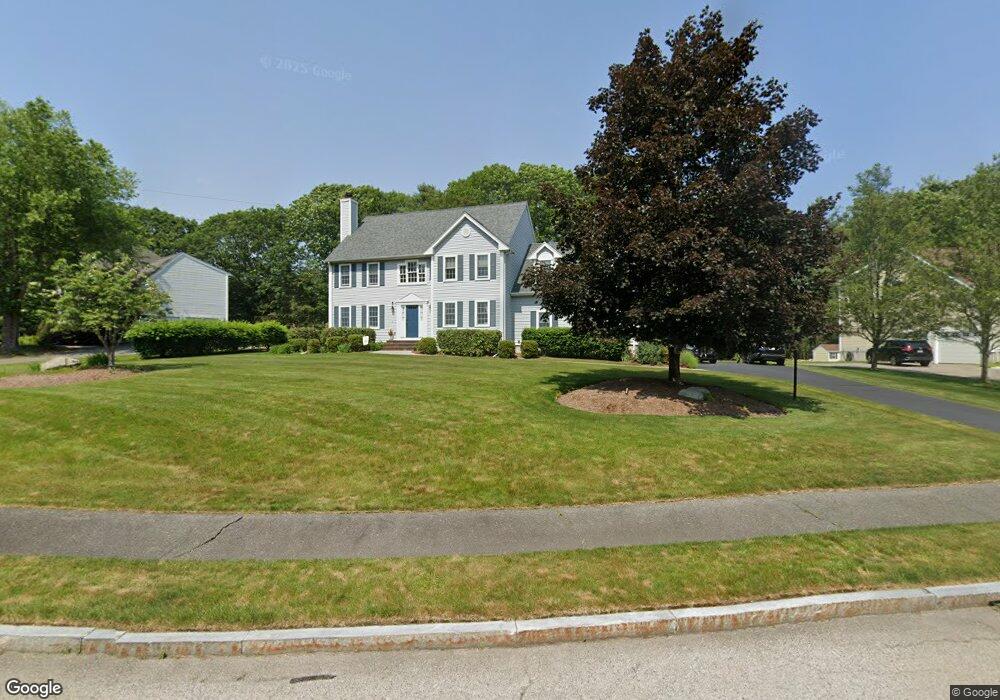
6 Possum Run Rd North Easton, MA 02356
Estimated Value: $981,000 - $1,030,000
4
Beds
3
Baths
2,710
Sq Ft
$373/Sq Ft
Est. Value
About This Home
This home is located at 6 Possum Run Rd, North Easton, MA 02356 and is currently estimated at $1,010,677, approximately $372 per square foot. 6 Possum Run Rd is a home located in Bristol County with nearby schools including Easton Middle School and Oliver Ames High School.
Ownership History
Date
Name
Owned For
Owner Type
Purchase Details
Closed on
Feb 23, 2023
Sold by
Timbone Chris M and Timbone Stephanie J
Bought by
Timbone Ft
Current Estimated Value
Purchase Details
Closed on
Jun 29, 2000
Sold by
Erpol Constr Llc
Bought by
Timbone Chris M and Timbone Stephanie J
Home Financials for this Owner
Home Financials are based on the most recent Mortgage that was taken out on this home.
Original Mortgage
$230,000
Interest Rate
8.59%
Mortgage Type
Purchase Money Mortgage
Create a Home Valuation Report for This Property
The Home Valuation Report is an in-depth analysis detailing your home's value as well as a comparison with similar homes in the area
Home Values in the Area
Average Home Value in this Area
Purchase History
| Date | Buyer | Sale Price | Title Company |
|---|---|---|---|
| Timbone Ft | -- | None Available | |
| Timbone Ft | -- | None Available | |
| Timbone Chris M | $397,115 | -- | |
| Timbone Chris M | $397,115 | -- |
Source: Public Records
Mortgage History
| Date | Status | Borrower | Loan Amount |
|---|---|---|---|
| Previous Owner | Timbone Chris M | $164,000 | |
| Previous Owner | Timbone Chris M | $230,000 | |
| Previous Owner | Timbone Chris M | $230,000 |
Source: Public Records
Tax History Compared to Growth
Tax History
| Year | Tax Paid | Tax Assessment Tax Assessment Total Assessment is a certain percentage of the fair market value that is determined by local assessors to be the total taxable value of land and additions on the property. | Land | Improvement |
|---|---|---|---|---|
| 2025 | $11,090 | $888,600 | $415,900 | $472,700 |
| 2024 | $11,191 | $838,300 | $366,700 | $471,600 |
| 2023 | $10,824 | $741,900 | $357,000 | $384,900 |
| 2022 | $10,187 | $661,900 | $291,300 | $370,600 |
| 2021 | $9,850 | $636,300 | $265,700 | $370,600 |
| 2020 | $9,543 | $620,500 | $260,700 | $359,800 |
| 2019 | $9,748 | $610,800 | $260,700 | $350,100 |
| 2018 | $9,546 | $588,600 | $260,700 | $327,900 |
| 2017 | $9,187 | $566,400 | $260,700 | $305,700 |
| 2016 | $8,930 | $551,600 | $260,700 | $290,900 |
| 2015 | $8,434 | $502,600 | $211,700 | $290,900 |
| 2014 | $8,463 | $508,300 | $221,100 | $287,200 |
Source: Public Records
Map
Nearby Homes
- 89 Massapoag Ave
- 98 Massapoag Ave
- 81 Rockland St
- 29 Owl Ridge Rd
- 218 Massapoag Ave
- 3 Nicole Rd
- 260 Massapoag Ave
- 20 Quarry Ln
- 25 Andrews Farm Rd
- 46 Kerry Dr
- 43 Kathleen Grant Rd
- 96 Kevins Way
- 11 Kathleen Grant Rd
- 34 Kevins Way
- 295 Lincoln St
- 4 Plantation Rd
- 66 Poquanticut Ave
- 15 Victory Ln
- 23 Estelle Marsan Dr
- 32 Heritage Dr
- 2 Possum Run Rd
- 10 Possum Run Rd
- 14 Possum Run Rd
- 140 Rockland St
- 3 Possum Run Rd
- 11 Possum Run Rd
- 18 Possum Run Rd
- 15 Possum Run Rd
- 144 Rockland St
- 7 Possum Run Rd
- 126 Rockland St
- 22 Possum Run Rd
- 14 Mill St
- 22 Mill St
- 18 Mill St
- 9 Mill St
- 154 Rockland St
- 19 Possum Run Rd
- 13 Mill St
- 157 Rockland St