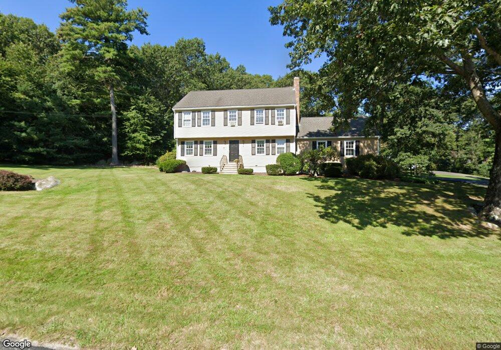
6 Richard Rd Hopedale, MA 01747
Estimated Value: $627,000 - $734,000
4
Beds
3
Baths
2,580
Sq Ft
$269/Sq Ft
Est. Value
About This Home
This home is located at 6 Richard Rd, Hopedale, MA 01747 and is currently estimated at $694,192, approximately $269 per square foot. 6 Richard Rd is a home located in Worcester County with nearby schools including Memorial Elementary School, Hopedale Jr Sr High School, and Bethany Christian Academy.
Ownership History
Date
Name
Owned For
Owner Type
Purchase Details
Closed on
May 24, 2001
Sold by
Luckraft Kenneth V and Luckraft Linda K
Bought by
Romano Jonathan L and Romano Ann M
Current Estimated Value
Create a Home Valuation Report for This Property
The Home Valuation Report is an in-depth analysis detailing your home's value as well as a comparison with similar homes in the area
Home Values in the Area
Average Home Value in this Area
Purchase History
| Date | Buyer | Sale Price | Title Company |
|---|---|---|---|
| Romano Jonathan L | $307,000 | -- |
Source: Public Records
Mortgage History
| Date | Status | Borrower | Loan Amount |
|---|---|---|---|
| Open | Romano Jonathan L | $280,000 | |
| Closed | Romano Jonathan L | $281,500 |
Source: Public Records
Tax History Compared to Growth
Tax History
| Year | Tax Paid | Tax Assessment Tax Assessment Total Assessment is a certain percentage of the fair market value that is determined by local assessors to be the total taxable value of land and additions on the property. | Land | Improvement |
|---|---|---|---|---|
| 2025 | $9,551 | $575,000 | $209,000 | $366,000 |
| 2024 | $8,893 | $535,700 | $199,000 | $336,700 |
| 2023 | $8,107 | $502,000 | $196,000 | $306,000 |
| 2022 | $7,910 | $462,300 | $179,700 | $282,600 |
| 2021 | $7,582 | $424,300 | $163,400 | $260,900 |
| 2020 | $7,387 | $424,300 | $163,400 | $260,900 |
| 2019 | $2,246 | $399,700 | $163,400 | $236,300 |
| 2018 | $6,788 | $386,100 | $155,800 | $230,300 |
| 2017 | $6,344 | $366,900 | $148,600 | $218,300 |
| 2016 | $5,966 | $354,500 | $148,600 | $205,900 |
| 2015 | $5,599 | $337,700 | $138,600 | $199,100 |
Source: Public Records
Map
Nearby Homes