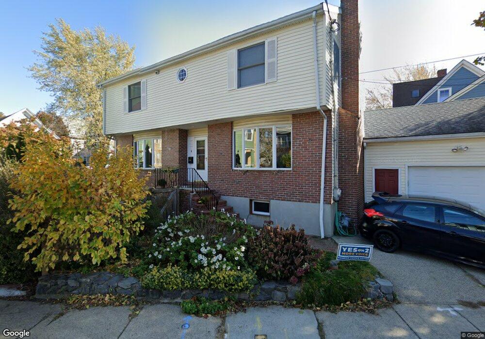
6 Rindgefield St Cambridge, MA 02140
North Cambridge NeighborhoodEstimated Value: $1,399,000 - $1,828,930
4
Beds
4
Baths
1,692
Sq Ft
$1,001/Sq Ft
Est. Value
About This Home
This home is located at 6 Rindgefield St, Cambridge, MA 02140 and is currently estimated at $1,694,483, approximately $1,001 per square foot. 6 Rindgefield St is a home located in Middlesex County with nearby schools including Benjamin Banneker Charter Public School, Cambridge Friends School, and Cambridge Montessori School.
Ownership History
Date
Name
Owned For
Owner Type
Purchase Details
Closed on
Aug 31, 2010
Sold by
Thorp Joseph F
Bought by
Zurn Christopher F and Saunders Michelle
Current Estimated Value
Home Financials for this Owner
Home Financials are based on the most recent Mortgage that was taken out on this home.
Original Mortgage
$523,750
Outstanding Balance
$348,124
Interest Rate
4.57%
Mortgage Type
Purchase Money Mortgage
Estimated Equity
$1,346,359
Create a Home Valuation Report for This Property
The Home Valuation Report is an in-depth analysis detailing your home's value as well as a comparison with similar homes in the area
Home Values in the Area
Average Home Value in this Area
Purchase History
| Date | Buyer | Sale Price | Title Company |
|---|---|---|---|
| Zurn Christopher F | $785,000 | -- |
Source: Public Records
Mortgage History
| Date | Status | Borrower | Loan Amount |
|---|---|---|---|
| Open | Zurn Christopher F | $523,750 |
Source: Public Records
Tax History Compared to Growth
Tax History
| Year | Tax Paid | Tax Assessment Tax Assessment Total Assessment is a certain percentage of the fair market value that is determined by local assessors to be the total taxable value of land and additions on the property. | Land | Improvement |
|---|---|---|---|---|
| 2025 | $10,945 | $1,723,600 | $558,400 | $1,165,200 |
| 2024 | $10,058 | $1,699,000 | $583,300 | $1,115,700 |
| 2023 | $9,135 | $1,558,900 | $593,900 | $965,000 |
| 2022 | $8,462 | $1,429,400 | $584,300 | $845,100 |
| 2021 | $7,790 | $1,331,700 | $572,500 | $759,200 |
| 2020 | $7,358 | $1,279,700 | $559,800 | $719,900 |
| 2019 | $6,671 | $1,123,000 | $465,300 | $657,700 |
| 2018 | $6,414 | $1,019,700 | $391,900 | $627,800 |
| 2017 | $6,241 | $961,700 | $367,400 | $594,300 |
| 2016 | $6,067 | $868,000 | $318,400 | $549,600 |
| 2015 | $5,842 | $747,100 | $279,900 | $467,200 |
| 2014 | $5,915 | $705,900 | $244,900 | $461,000 |
Source: Public Records
Map
Nearby Homes
- 12 Rindge Ave Unit 1
- 179 Rindge Ave Unit 1
- 183 Rindge Ave Unit 1
- 30 Dudley St
- 17 Shea Rd
- 34 Day St
- 8 Cogswell Ave
- 22 Harrington Rd
- 50 Howard St Unit 5
- 110 Reed St
- 61 Bolton St Unit 304
- 32 Cameron Ave
- 147 Sherman St Unit 201
- 2456 Massachusetts Ave Unit 402
- 70 Walden St Unit 1
- 70 Walden St Unit 7
- 70 Walden St Unit 11
- 69 Harvey St Unit 1
- 39 Bellis Cir Unit E
- 67-69 Cameron Ave
- 13 Rindgefield St Unit 13
- 25 Haskell St Unit 1
- 25 Haskell St Unit 3
- 27 Haskell St Unit 2
- 27 Haskell St Unit 1
- 8 Rindgefield St
- 2 Rindgefield St
- 15 Rindgefield St
- 15 Rindgefield St Unit 2
- 15 Rindgefield St Unit 15
- 19 Haskell St
- 19 Haskell St Unit rear
- 19 Haskell St
- 19 Haskell St Unit 3
- 23 Haskell St Unit 25
- 11 Rindgefield St Unit 2
- 9 Rindgefield St
- 11 Rindgefield St Unit 3
- 9 Rindgefield St Unit 1
- 11 Rindgefield St