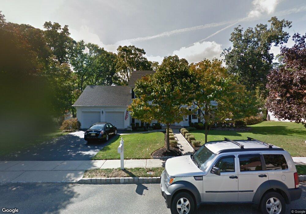
6 Robby Dr Oakhurst, NJ 07755
Estimated Value: $1,100,020 - $1,355,000
4
Beds
2
Baths
2,406
Sq Ft
$502/Sq Ft
Est. Value
About This Home
This home is located at 6 Robby Dr, Oakhurst, NJ 07755 and is currently estimated at $1,208,255, approximately $502 per square foot. 6 Robby Dr is a home located in Monmouth County with nearby schools including Ocean Township High School, Bet Yaakov of the Jersey Shore, and Ma'or Yeshiva High School for Boys.
Ownership History
Date
Name
Owned For
Owner Type
Purchase Details
Closed on
Apr 21, 1999
Sold by
S & K Inc
Bought by
Rogers Anthony and Rogers Eileen
Current Estimated Value
Home Financials for this Owner
Home Financials are based on the most recent Mortgage that was taken out on this home.
Original Mortgage
$225,000
Outstanding Balance
$56,216
Interest Rate
6.88%
Estimated Equity
$1,152,039
Create a Home Valuation Report for This Property
The Home Valuation Report is an in-depth analysis detailing your home's value as well as a comparison with similar homes in the area
Home Values in the Area
Average Home Value in this Area
Purchase History
| Date | Buyer | Sale Price | Title Company |
|---|---|---|---|
| Rogers Anthony | $281,750 | -- |
Source: Public Records
Mortgage History
| Date | Status | Borrower | Loan Amount |
|---|---|---|---|
| Open | Rogers Anthony | $225,000 |
Source: Public Records
Tax History Compared to Growth
Tax History
| Year | Tax Paid | Tax Assessment Tax Assessment Total Assessment is a certain percentage of the fair market value that is determined by local assessors to be the total taxable value of land and additions on the property. | Land | Improvement |
|---|---|---|---|---|
| 2025 | $13,665 | $1,072,400 | $550,500 | $521,900 |
| 2024 | $11,865 | $958,300 | $521,600 | $436,700 |
| 2023 | $11,865 | $776,000 | $351,500 | $424,500 |
| 2022 | $10,587 | $613,200 | $209,000 | $404,200 |
| 2021 | $10,587 | $538,800 | $209,000 | $329,800 |
| 2020 | $10,580 | $531,400 | $209,000 | $322,400 |
| 2019 | $10,880 | $533,600 | $209,000 | $324,600 |
| 2018 | $11,569 | $552,500 | $209,000 | $343,500 |
| 2017 | $11,499 | $546,800 | $218,500 | $328,300 |
| 2016 | $11,634 | $497,600 | $240,000 | $257,600 |
| 2015 | $11,522 | $499,000 | $245,000 | $254,000 |
| 2014 | $11,149 | $489,400 | $245,000 | $244,400 |
Source: Public Records
Map
Nearby Homes
- 8 Corey Dr
- 459 Harnell Ave
- 185 Pinecrest Rd
- 185 Elmwood Rd
- 156 Belmar Ave
- 197 Delaware Ave
- 421 W Lincoln Ave
- 82 Larkin Place
- 216 Chatham Ave
- 243 Woodcrest Rd
- 227 Chatham Ave
- 120 Whalepond Rd
- 221 Harrison Ave
- 6 Arlington St
- 406 W Park Ave
- 71 Monmouth Rd
- 311 Park Ave
- 0 Adams Ave
- 35 Shadow Lawn Dr
- 100 Adams Ave
- 8 Robby Dr
- 4 Robby Dr
- 4 Robby Dr Unit SUMMER
- 155 Delaware Ave
- 153 Delaware Ave
- 5 Robby Dr
- 5 Robby Dr Unit SUMMER
- 157 Delaware Ave
- 9 Robby Dr
- 10 Robby Dr
- 151 Delaware Ave
- 161 Delaware Ave
- 3 Robby Dr
- 6 Chris Place
- 150 Delaware Ave
- 154 Delaware Ave
- 3 Chris Place
- 158 Delaware Ave
- 146 Delaware Ave
- 12 Robby Dr